RAF Hornby Hall
RAF Hornby Hall No. 9 SLG | |||||||||||
|---|---|---|---|---|---|---|---|---|---|---|---|
| Summary | |||||||||||
| Airport type | Military | ||||||||||
| Owner | Air Ministry | ||||||||||
| Operator | Royal Air Force | ||||||||||
| Location | Penrith, Cumbria | ||||||||||
| Built | 1941 | ||||||||||
| In use | 1941-1945 | ||||||||||
| Elevation AMSL | 443 ft / 135 m | ||||||||||
| Coordinates | 54°39′26″N 002°39′51″W / 54.65722°N 2.66417°WCoordinates: 54°39′26″N 002°39′51″W / 54.65722°N 2.66417°W | ||||||||||
| Map | |||||||||||
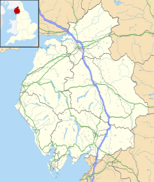 RAF Hornby Hall Location in Cumbria | |||||||||||
| Runways | |||||||||||
| |||||||||||
RAF Hornby Hall was a Royal Air Force satellite landing ground located near Brougham, 4 miles (6.4 km) east of Penrith, Cumbria and 8.8 miles (14.2 km) north west of Appleby-in-Westmorland, Cumbria, England.
History[]
The airfield was used by No. 22 Maintenance Unit RAF (MU) at RAF Silloth but changed to No. 12 MU at .[1]
The landing ground was also temporarily operated by No. 18 MU at RAF Dumfries sometime between July and September 1940.[2]
Aircraft operated[]
See also[]
References[]
- ^ "Hornby Hall - Satellite Landing Ground". Russell W. Barnes. Retrieved 8 September 2012.
- ^ "History of RAF Dumfries". Dumfries and Galloway Aviation Museum. Retrieved 8 September 2012.
| Formations and units |
|  | ||||||
|---|---|---|---|---|---|---|---|---|
| Branches and components | ||||||||
| Reserve forces | ||||||||
| Associated civil organisations | ||||||||
| Equipment | ||||||||
| Personnel |
| |||||||
| Appointments | ||||||||
| Symbols and uniform | ||||||||
Categories:
- Royal Air Force stations in Cumbria
- Royal Air Force satellite landing grounds