Raša (river)
| Raša | |
|---|---|
 Raška Inlet | |
| Location | |
| Country | Croatia |
| Physical characteristics | |
| Source | |
| • location | Near Pićan |
| Mouth | |
• location | Adriatic Sea |
• coordinates | 45°01′59″N 14°02′50″E / 45.0330°N 14.0471°ECoordinates: 45°01′59″N 14°02′50″E / 45.0330°N 14.0471°E |
| Length | 23 km (14 mi)[1] |
| Basin size | 279 km2 (108 sq mi)[1] |
| Basin features | |
| Tributaries | |
| • left | Krapanski Potok |
| • right | Karbuna |

The Raša (Latin: Arsia, Italian: Arsa) in Croatian Istria is a major river of Croatia's Istria County. It is 23 kilometres (14 mi) long, and its basin covers an area of 279 km2 (108 sq mi).[1] Its mouth is in the long ria of Raški zaljev/Porto d'Arsia, which is a drowned river valley scoured out when world sea levels were lowered, then drowned by the rising waters of the post glacial era. The Raša rises in springs near Pićan and flows south through a steep-sided valley before opening into the head of the Adriatic Sea.[2] The river, although short in length, has an ancient history as a border.[3]
Border river[]
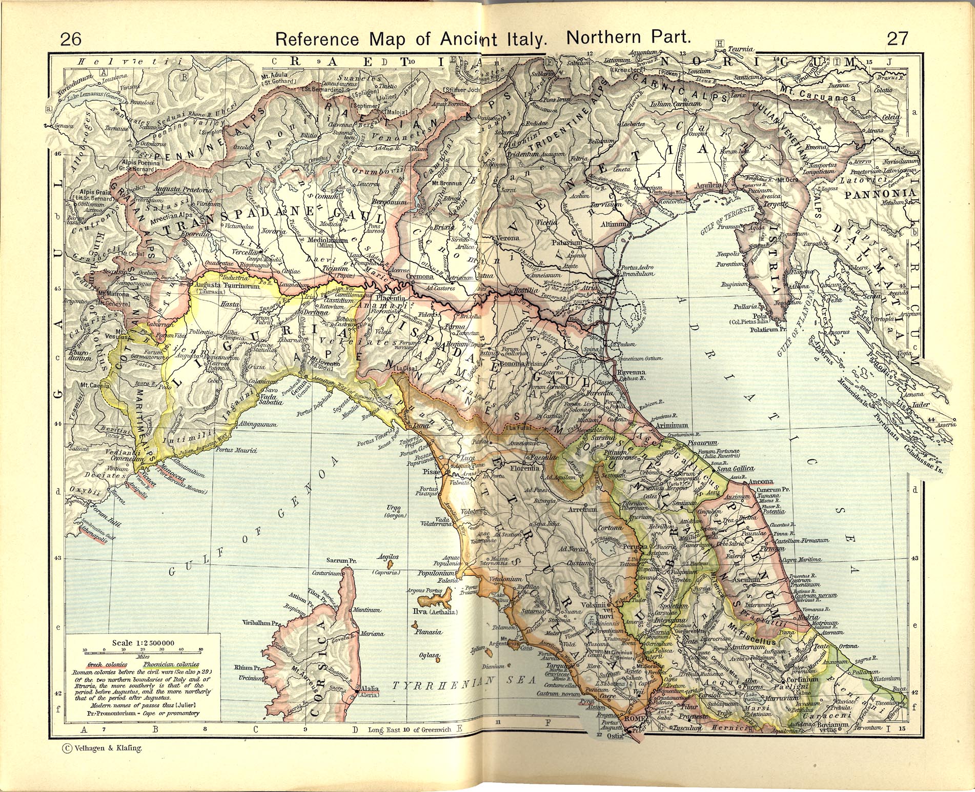
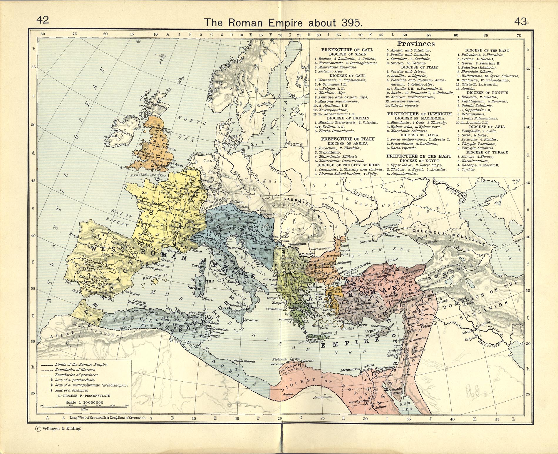
By Roman times, the Arsia, as it was called in Latin, constituted the border between the Histri, who lived west of its banks, and the Liburni on the coast to the east,[4] with the Iapydes in the upcountry valley behind them.[5] After the Romans conquered the fierce and piratical Histri in 177 BC, the Arsia formed the limes of Roman territory in coastal Istria for a generation, until the gap between the Arsia and the northernmost Roman outposts in illyria was closed in 129;[6] for long afterwards it divided Italia and its regio X, from Illyricum, according to the divisions ratified by Augustus.[7] The 8th-century Irish monk and geographer Dicuil, following his late Latin sources for the geographical summary De mensura Orbis terrae, gives the northeastern boundary of Italia as flumen Arsia.[8]
The Roman road Via Flavia, reaching from Tergeste (Trieste) into Istria came to an end at the crossing of the Arsia; beyond, it continued into Dalmatia as a local road that linked to Via Gemina.
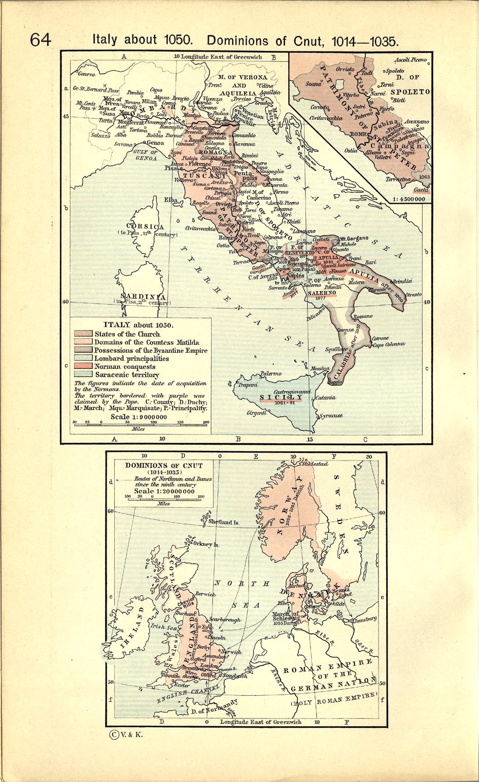
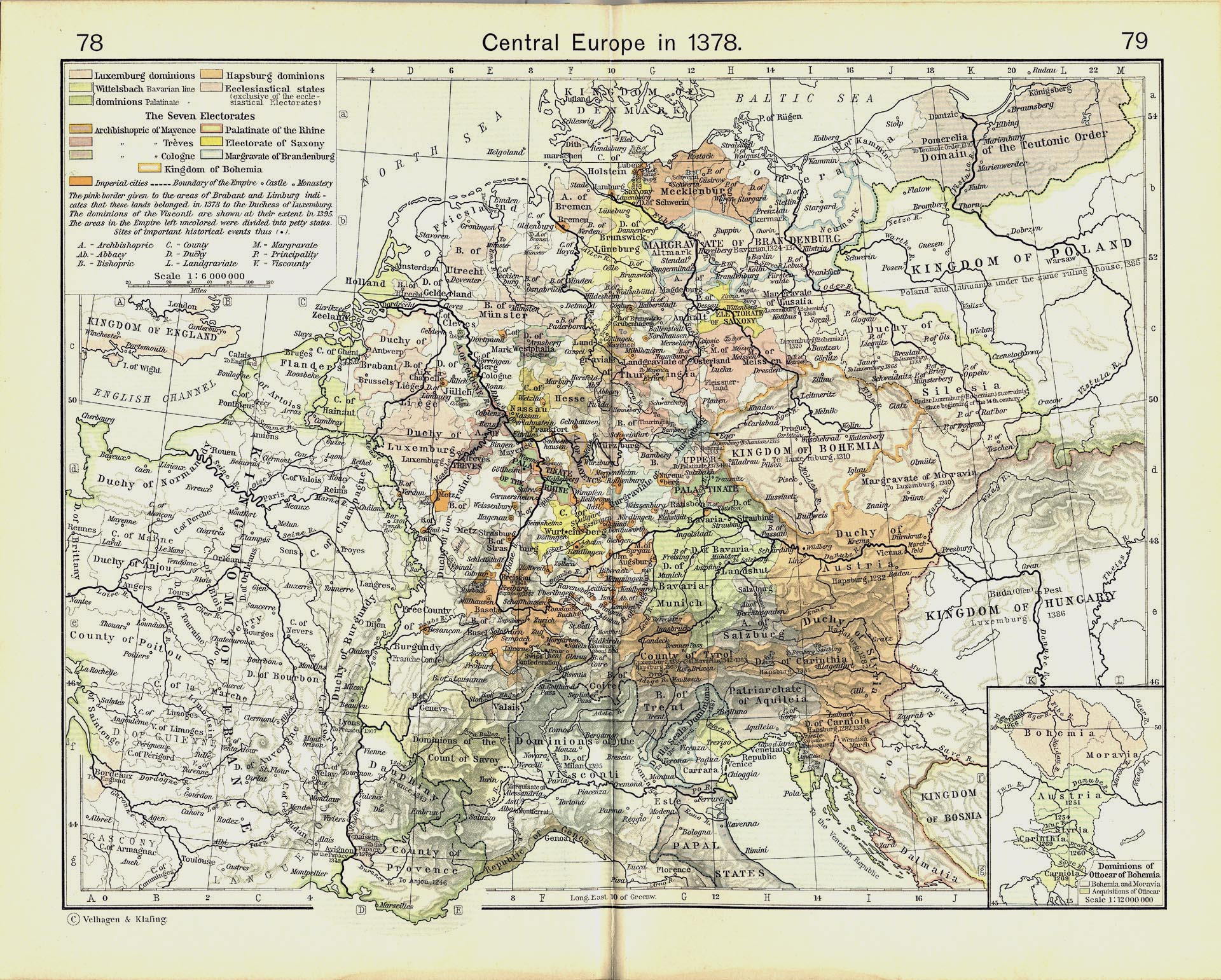
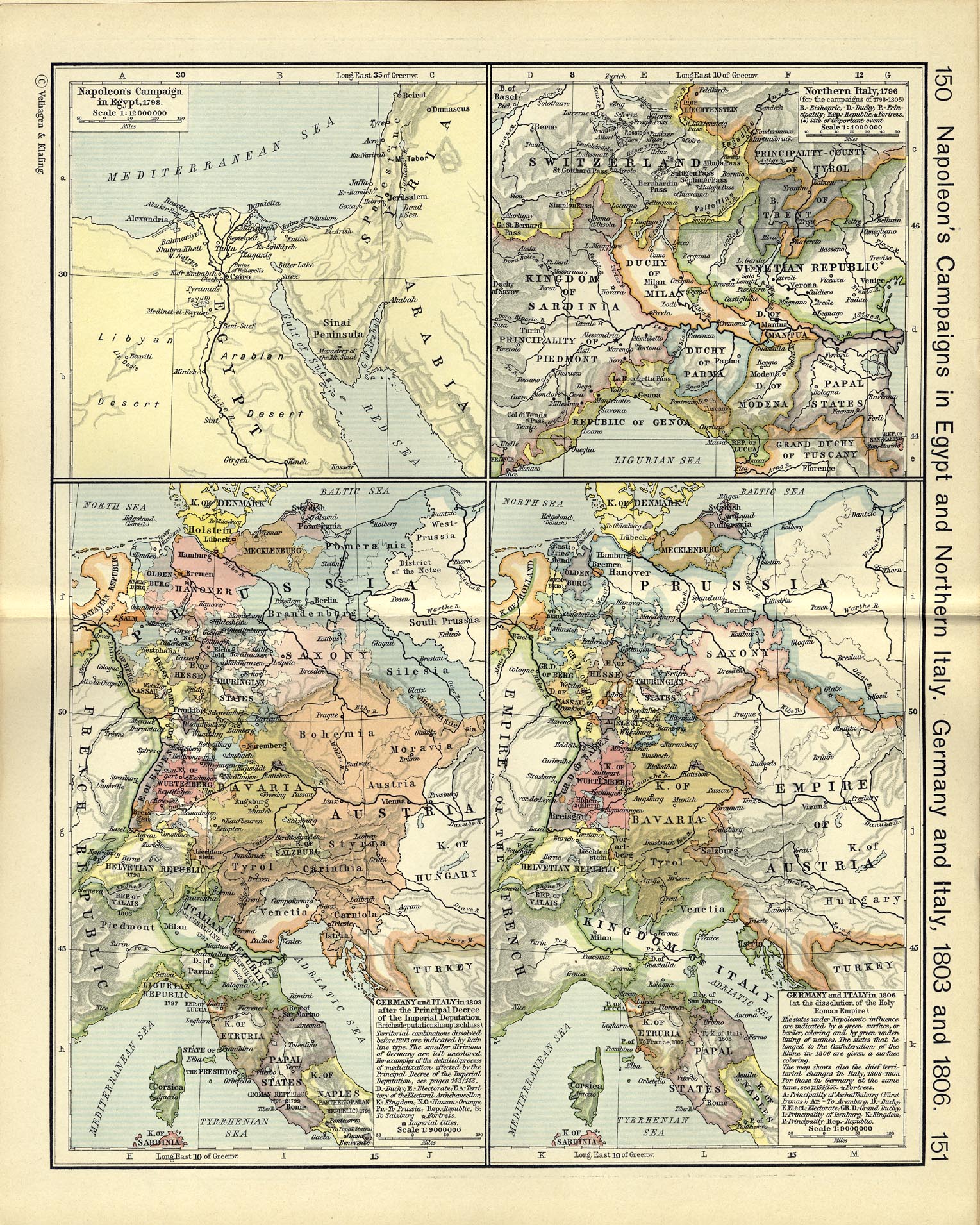
In the early 10th century Tomislav of Croatia ruled a state that ran from the Adriatic to the Drava, and from the Raša, as it was now being called, to the Drina.[4][9] In the 13th century, the territory on the east bank was administered by the counts of Gorizia, while that on the west was ruled by the patriarchs of Aquileia.[4] After centuries of Venetian rule over all of Istria to the Raša,[10] the Raša became the border between Napoleon's Kingdom of Italy and the Austrian Empire;[4][11] following Napoleon's downfall, Austria gained all of Istria and the river became the border between two Austrian provinces.
The planned city of Raša (Italian: Arsia), on the tributary Krapanski Potok of the river in the inner part of the Raška Inlet, was constructed in 1936–1937 as Arsia on drained wetlands to gain arable land for farming and to serve expanding coal mining operations, as part of Mussolini's urban colonization and Italianization of Istria. The village of Barban is the other major settlement near the river.
References[]
- ^ a b c "Karakteristike značajnijih vodotoka". Vodnogospodarska osnova Hrvatske - Strategija upravljanja vodama (in Croatian). Croatian Parliament. Retrieved 2011-12-18.
- ^ Map.
- ^ Shepherd, William. Historical Atlas. New York: Henry Holt and Company, 1911: "Ancient Italy, Northern Part"
- ^ a b c d "The Town and River Raša [Arsia]". Extract from Marijan Milevoj, Postcards from Labin / Kartulini z Labinscini (Postcards from Labin), English tr. by Valter Kvalić, Naklada Matthias (Labin, 1997), pp. 59–66. istrianet.org. Archived from the original on 2007-06-16. Retrieved 2009-07-02.
Florus Epitome of Livy, book II.5 mentions the Liburnians or Illyrians (he does not distinguish between them) who live at the foot of the last slopes of the Alps, between the rivers Arsia and Titius, their territories extending far down the Adriatic coast.
- ^ William Smith, A New Classical Dictionary of Greek and Roman Biography, Mythology and Geography, (New York, 1880) s.v. "Illyricum".
- ^ H. H. Scullard, A History of the Roman World, 753 to 146 BC 3rd ed. 1961, p. 296.
- ^ The boundary of Cisalpine Gaul was set at the Arsia by Pliny, and in the geographical texts Dimensuratio provinciarum and the Divisio orbis terrarum, Claude Nicolet observes, in Space, Geography, and Politics in the early Roman Empire, 1991, p. 106; Shepherd, William. Historical Atlas. New York: Henry Holt and Company, 1911: "The Roman Empire about 395: Diocese of Italy: 1. Venetia and Istria, 11. Dalmatia".
- ^ 1.8. "Jtalia finitur... a Septentrione, mari Adriatico et flumine Arsia" (Dicuil, Dicvili Liber de mensura orbis terrae Gustav Parthey, ed., (1870:8).
- ^ See Tomislav of Croatia; compare Shepherd, William. Historical Atlas. New York: Henry Holt and Company, 1911: "Italy about 1050" for the March of Istria's eastern border on the Raša.
- ^ See, for example the eastern border of Venetian territory (green) in Shepherd, William. Historical Atlas. New York: Henry Holt and Company, 1911: "Central Europe in 1378 "; Gorizia (gray) is marked "To Görz."
- ^ Shepherd, William. Historical Atlas. New York: Henry Holt and Company, 1911: "Germany and Italy in 1806".
Hydrography of Croatia | ||||||
|---|---|---|---|---|---|---|
| Rivers |
|  | ||||
| Lakes | ||||||
| Valleys, estuaries, canyons, wetlands | ||||||
| Waterfalls |
| |||||
| Canals |
| |||||
| Adriatic Sea | ||||||
- Rivers of Croatia
- Landforms of Istria County
- Roman frontiers
- Raša basin