Spačva basin
This article needs additional citations for verification. (December 2009) |
Spačva basin
Spačvanski bazen | |
|---|---|
geographic region | |
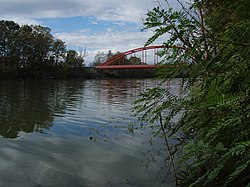 | |
 Spačva (region) together with Bosutska šuma | |
| Country | |
| Region | Continental Croatia (Syrmia) |
| County | |
| Municipality | Otok, Nijemci, Privlaka |
| Time zone | UTC+1 (CET) |
| • Summer (DST) | UTC+2 (CEST) |
The Spačva basin (Croatian: Spačvanski bazen) is a geographic microregion in eastern Croatia. The region is located in the south-western part of Syrmia—the latter being divided by Croatia and Serbia—and the southeastern part of Slavonia macroregion of Croatia, surrounding the Spačva river and the Studva river. The region's 40.000 hectares of oak (Quercus robur) forests makes Spačva basin one of the largest continuous lowland oak forests in Europe.[1][2][3] In addition, the region forms an organic continuum with the Bosutska šuma (Serbian Cyrillic: Босутска шума) literally Bosut Forest in Vojvodina in Serbia. Bosutska šuma is one of two strict nature reserves in Vojvodina.[4] Spačva basin and Bosutska šuma form the northern section of forest and swampland complex spreading south of the Sava river as well where it is known as the Donje Podrinje in Bosnia and Herzegovina and Central Serbia.[5] Wood industry based in Spačva basin is an important natural resource in the economic output of the Vukovar-Syrmia County. The major settlement in the region is the town of Otok.[2]
See also[]
- Geography of Croatia
- Kopački Rit
- Historical Palača Swamp of the Bobota Canal
- Lonjsko Polje and
- Gornje Podunavlje and in Vojvodina
- Danube–Tisza Interfluve and Danube-Drava National Park in Hungary
- Ramsar Convention
References[]
- ^ "Approved 10 projects over HRK million worth". 27 April 2016. Retrieved 2 December 2016.
- ^ a b Ika Lucić (2014). "The Impact of Spačvanski Bazen of Economic Development in Vukovar-Srijem County". Faculty of Science, University of Zagreb. Retrieved 2 December 2016.
- ^ Vuletić, Dijana. "Ecological and climate changes and regeneration related issues of pedunculate oak forests in Spačva basin". . Retrieved 25 February 2020.
- ^ "Bosutske šume – najveće lužnjačke šume u Evropi". Radio Television of Vojvodina. 7 May 2018. Retrieved 25 February 2020.
- ^ Jeremić, Jasna. "The area of Morovićko-bosutske šume and Spačvanski bazen as a potential retention and transboundary protected area". Retrieved 25 February 2020.
External links[]
| Principal historical regions |  | ||||||||
|---|---|---|---|---|---|---|---|---|---|
| Smaller regions |
| ||||||||
| |||||||||
Hydrography of Croatia | ||||||
|---|---|---|---|---|---|---|
| Rivers |
|  | ||||
| Lakes | ||||||
| Valleys, estuaries, canyons, wetlands | ||||||
| Waterfalls |
| |||||
| Canals |
| |||||
| Adriatic Sea | ||||||
Coordinates: 45°03′08″N 18°56′20″E / 45.0522881°N 18.93896646°E

- Regions of Croatia
- Syrmia
- Geography of Vukovar-Syrmia County
- Geographical regions of Serbia
- Croatia–Serbia border