Ratboř
Ratboř | |
|---|---|
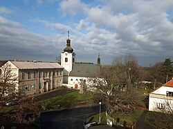 Church of Saint Wenceslaus | |
 Flag  Coat of arms | |
 Ratboř Location in the Czech Republic | |
| Coordinates: 49°58′41″N 15°9′33″E / 49.97806°N 15.15917°ECoordinates: 49°58′41″N 15°9′33″E / 49.97806°N 15.15917°E | |
| Country | |
| Region | Central Bohemian |
| District | Kolín |
| First mentioned | 1352 |
| Area | |
| • Total | 4.77 km2 (1.84 sq mi) |
| Elevation | 314 m (1,030 ft) |
| Population (2021-01-01)[1] | |
| • Total | 573 |
| • Density | 120/km2 (310/sq mi) |
| Time zone | UTC+1 (CET) |
| • Summer (DST) | UTC+2 (CEST) |
| Postal codes | 280 02, 281 41 |
| Website | www |

Ratboř is a municipality and village in Kolín District in the Central Bohemian Region of the Czech Republic. It has about 600 inhabitants.
Administrative parts[]
Villages of Sedlov and Těšínky are administrative parts of Ratboř.
Notable people[]
- Alfons von Czibulka (1888–1969), Czech-Austrian writer and painter
References[]
| Wikimedia Commons has media related to Ratboř. |
| Authority control: National libraries |
|---|
Categories:
- Populated places in Kolín District
- Villages in Kolín District
- Kolín geography stubs