Rayne, Louisiana
Rayne, Louisiana | |
|---|---|
| City of Rayne | |
 Downtown Rayne | |
| Nickname(s): Frog Capital of the World Louisiana City of Murals | |
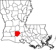
 Location of Rayne in Acadia Parish, Louisiana. | |
 Location of Louisiana in the United States | |
| Coordinates: 30°14′15″N 92°16′05″W / 30.23750°N 92.26806°WCoordinates: 30°14′15″N 92°16′05″W / 30.23750°N 92.26806°W | |
| Country | United States |
| State | Louisiana |
| Parish | Acadia |
| Government | |
| • Mayor | Chuck Robichaux (R)[1] |
| Area | |
| • Total | 3.80 sq mi (9.84 km2) |
| • Land | 3.79 sq mi (9.82 km2) |
| • Water | 0.01 sq mi (0.02 km2) |
| Elevation | 36 ft (11 m) |
| Population (2020) | |
| • Total | 7,326 |
| • Density | 1,900/sq mi (740/km2) |
| Time zone | UTC-6 (CST) |
| • Summer (DST) | UTC-5 (CDT) |
| Area code(s) | 337 |
| FIPS code | 22-63645 |
| Website | www |

Rayne is a city in the U.S. state of Louisiana, in Acadia Parish. With a population of 7,326 at the 2020 United States census,[3] it is nicknamed the "Frog Capital of the World",[4][5][6] as well as the "Louisiana City of Murals".[7] Rayne is part of the Crowley micropolitan statistical area, and within the Lafayette metropolitan statistical area in Acadiana.
History[]
An EF2 tornado hit Rayne on March 5, 2011, injuring at least twelve people and killing one person, leveling homes and causing natural gas leaks that prompted evacuations.[8][9][10][11][12]
Geography[]
According to the United States Census Bureau, the city has a total area of 3.8 square miles (9.9 km2), of which 0.0077 square miles (0.02 km2), or 0.18%, is water.[13] The city is located in Acadiana, and forms part of the Lafayette metropolitan area.
Demographics[]
| Historical population | |||
|---|---|---|---|
| Census | Pop. | %± | |
| 1890 | 569 | — | |
| 1900 | 1,007 | 77.0% | |
| 1910 | 2,247 | 123.1% | |
| 1920 | 2,720 | 21.1% | |
| 1930 | 3,710 | 36.4% | |
| 1940 | 4,974 | 34.1% | |
| 1950 | 6,485 | 30.4% | |
| 1960 | 8,634 | 33.1% | |
| 1970 | 9,510 | 10.1% | |
| 1980 | 9,066 | −4.7% | |
| 1990 | 8,502 | −6.2% | |
| 2000 | 8,552 | 0.6% | |
| 2010 | 7,953 | −7.0% | |
| 2020 | 7,326 | −7.9% | |
| U.S. Decennial Census[14] | |||
At the 2020 U.S. census, there were 7,326 people living in the city, down from 7,953 at the 2010 census.[3] The 2019 American Community Survey estimated 8,041 people and 2,834 households resided in the city.[15]
In 2019, the racial and ethnic makeup of the city was 58.0% non-Hispanic or Latino white, 37.6% Black or African American, 3.3% two or more races, and 1.1% Hispanic and Latin American of any race.[16] At the 2000 United States census, the racial and ethnic makeup of the city was 65.55% White American, 33.52% African American, 0.11% American Indian and Alaska Native, 0.16% Asian, 0.19% from other races, and 0.47% from two or more races; Hispanic and Latin Americans of any race were 0.81% of the population. From 2015 to 2019, the largest Hispanic and Latin American groups were Mexican Americans and stateside Puerto Ricans (0.3% each).[16]
There were 2,834 households and 3,463 housing units at the 2019 American Community Survey.[15] Of the 1,569 occupied housing units, 879 were married couples living together, 97 were male households with no female present, and 137 female households with no male present. The average family size was 3.34, up from 3.22 at the 2000 census, and 38.0% of the population were never married.
In the city, the population was spread out, with 10.9% aged 5 and under, 76.0% aged 18 and older, and 16.6% aged 65 and older.[15] The median age was 40.2 years, up from 34 years in 2000. The largest ancestry groups among the population were French (18.8%), Irish (6.6%), sub-Saharan African (2.1%), German (1.9%), English (1.4%), Scottish (0.9%), and Italian (0.7%). An estimated 10.1% spoke a language other than English at home, and Spanish was spoken by 1.1% of the population; other Indo-European languages were spoken by 8.7% of the population.
At the 2019 American Community Survey, the median household income was $32,266 and the median income for a family was $41,721; married couples had a median income of $53,373 and non-family households were $17,917. About 30.4% of the population lived at or below the poverty line, and 38.2% of the city aged under 18 lived at or below the poverty line; 32.4% of the population aged 65 and older were at or below the poverty line.
Arts and culture[]
Rayne holds a yearly Frog Festival the second full weekend in November as of 2008. The festival, which used to be held on the first full weekend of September following Labor Day, attracts thousands of visitors.[17] As of 2015, the festival is held Mother's Day weekend.
Education[]
The Acadia Parish School Board serves the city. Rayne High School, home of the Mighty Wolves, is located in Rayne.
Other schools in Rayne include:
- Central Rayne Kindergarten
- Martin Pettijean Elementary
- South Rayne Elementary
- Armstrong Middle School
- Rayne Catholic Elementary
Notable people[]
- Cajun musicians , Harry Choates, Joe Falcon, Jo-El Sonnier, Amedée Breaux, Johnnie Allan, Lawrence Walker, and Tony Thibodeaux
- Joshua Benton, director of Nieman Journalism Lab at Harvard University
- , former state representative for Lafourche Parish; born in Rayne in 1919
- Mike Heinen, professional golfer
- Donnie Meche and Gerard Melancon, jockeys
- Byron Mouton, former standout basketball player at Tulane and Maryland
- Gerald Paddio, basketball player
- Josh Reed, LSU standout and NFL wide receiver for the Buffalo Bills.
- , Republican former member of the Louisiana House of Representatives for Lafayette and Vermilion parishes; former resident of Rayne
- Ed Zaunbrecher, American football coach
- , Professional Boxer
- Addison Rae (Easterling), American social media personality and dancer
- , an American chef
Gallery[]

Frog mural
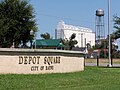
Depot Square with one of many Rayne rice mills in the background


References[]
- ^ "Early voting ends Tuesday – What's on your ballot?". KATC. 30 October 2018. Retrieved 25 June 2020.
- ^ "2019 U.S. Gazetteer Files". United States Census Bureau. Retrieved July 25, 2020.
- ^ Jump up to: a b "QuickFacts: Rayne city, Louisiana". United States Census Bureau. Retrieved August 14, 2021.
- ^ "Heart of Louisiana: Frog Capital of the World". FOX 8 Live. Retrieved 2021-08-14.
- ^ Scott, Michael. "Why Is Rayne Called The 'Frog Capital Of The World'?". 97.3 The Dawg. Retrieved 2021-08-14.
- ^ Ann, Jackie (2020-05-23). "The Frog Capital Of The World Is Hiding In Small Town Louisiana And It's As Weirdly Wonderful As You'd Expect". OnlyInYourState. Retrieved 2021-08-14.
- ^ "Rayne's murals bring unique beauty to downtown". KATC. 2019-05-09. Retrieved 2021-08-14.
- ^ http://www.therepublic.com/view/story/0269fa3ee4ca49fabcd0ef6e2c7bc379/LA--Louisiana_Tornado/ AP via Indiana Republic
- ^ http://www.theadvertiser.com/article/20110305/NEWS01/110305004 The Daily Advertiser
- ^ http://www.cnn.com/2011/US/03/05/louisiana.storm/ CNN
- ^ http://www.foxnews.com/weather/2011/03/05/people-injured-louisiana-tornado/ Fox News)
- ^ "One dead, 12 others injured after tornado in Rayne". kplctv.com. KLPC-TV. March 5, 2011. Retrieved July 9, 2021.
- ^ "Geographic Identifiers: 2010 Demographic Profile Data (G001): Rayne city, Louisiana". U.S. Census Bureau, American Factfinder. Archived from the original on February 12, 2020. Retrieved May 13, 2013.
- ^ "Census of Population and Housing". Census.gov. Retrieved June 4, 2015.
- ^ Jump up to: a b c "Geography Profile: Rayne city, Louisiana". United States Census Bureau. Retrieved 2021-08-14.
- ^ Jump up to: a b "2019 Demographic and Housing Estimates". United States Census Bureau. Retrieved 2021-08-14.
- ^ www.rayne.org "City of Rayne"
External links[]
| Wikimedia Commons has media related to Rayne, Louisiana. |
| show Municipalities and communities of Acadia Parish, Louisiana, United States |
|---|
| show Authority control |
|---|
- Rayne, Louisiana
- Populated places established in 1883
- Cities in Louisiana
- Cities in Acadia Parish, Louisiana
- 1883 establishments in Louisiana
- Cities in Lafayette, Louisiana metropolitan area