Richland Y, Washington
Richland Y, Washington | |
|---|---|
 Looking west toward Badger Mountain. | |
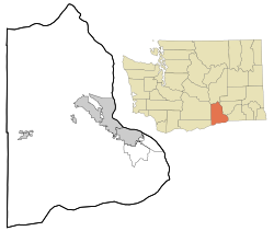 Richland Y, Washington Location of Richland Y, Washington | |
| Coordinates: 46°14′12″N 119°13′59″W / 46.2368015°N 119.2330713°WCoordinates: 46°14′12″N 119°13′59″W / 46.2368015°N 119.2330713°W[1] | |
| Country | United States |
| State | Washington |
| County | Benton |
| Elevation | 381 ft (116 m) |
| Time zone | UTC-8 (Pacific (PST)) |
| • Summer (DST) | UTC-7 (PDT) |
| ZIP code | 99353 |
| Area code(s) | 509 |
| GNIS feature ID | 1513420[2] |
Richland Y is an unincorporated community in Benton County, Washington, United States. It lies within the eastern city limits of Richland.

Looking west from park commemorating Sacajawea toward Badger Mountain through business zone
| Wikimedia Commons has media related to Richland Y, Washington. |
References[]
- ^ "Richland Y". Geographic Names Information System. United States Geological Survey. Retrieved 2012-10-28.
- ^ a b "US Board on Geographic Names". United States Geological Survey. 2007-10-25. Retrieved 2008-01-31.
- ^ "U.S. Census website". United States Census Bureau. Retrieved 2008-01-31.
Municipalities and communities of Benton County, Washington, United States | ||
|---|---|---|
| Cities |  | |
| CDPs | ||
| Unincorporated communities | ||
| Ghost towns | ||
| ||

This Benton County, Washington state location article is a stub. You can help Wikipedia by . |
Categories:
- Unincorporated communities in Benton County, Washington
- Northern Pacific Railway
- Unincorporated communities in Washington (state)
- Populated places on the Yakima River
- Washington (state) populated places on the Columbia River
- Central Washington geography stubs