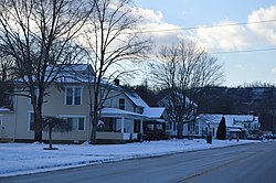
Rutland, Ohio
Rutland, Ohio | |
|---|---|
 | |
 Location of Rutland, Ohio | |
 Location of Rutland in Meigs County | |
| Coordinates: 39°2′32″N 82°7′44″W / 39.04222°N 82.12889°WCoordinates: 39°2′32″N 82°7′44″W / 39.04222°N 82.12889°W | |
| Country | United States |
| State | Ohio |
| County | Meigs |
| Township | Rutland |
| Incorporated | 1913 |
| Government | |
| • Type | Mayor council government |
| • Mayor | Tyler M. Eblin |
| Area | |
| • Total | 0.87 sq mi (2.26 km2) |
| • Land | 0.87 sq mi (2.26 km2) |
| • Water | 0.00 sq mi (0.00 km2) |
| Elevation | 574 ft (175 m) |
| Population | |
| • Total | 393 |
| • Estimate (2019)[5] | 378 |
| • Density | 432.49/sq mi (166.92/km2) |
| Time zone | UTC-5 (Eastern (EST)) |
| • Summer (DST) | UTC-4 (EDT) |
| ZIP code | 45775 |
| Area code(s) | 740 |
| FIPS code | 39-69358[4] |
| GNIS feature ID | 1049143[3] |
| Website | www.villageofrutland.org |

Rutland is a village in Meigs County, Ohio, United States. The population was 393 at the 2010 census.
Geography[]
Rutland is located at 39°2′32″N 82°7′44″W / 39.04222°N 82.12889°W (39.042291, -82.128967).[6] The village lies in the Appalachian Plateau physiographic region. It is situated in a wide valley along Little Leading Creek. The village is plagued by frequent flash floods, often causing road and school closures. The surrounding hills, once containing profitable amounts of bituminous coal, have been subjected to strip mining throughout the early and mid 1900s. Currently, there are no mining operations in the area. Acid mine drainage has been found seeping out some of the abandoned mines and has negatively impacted water quality in the Little Leading Creek watershed. Rutland is the only Meigs County village not located along the Ohio River.
According to the United States Census Bureau, the village has a total area of 0.83 square miles (2.15 km2), all land.[7]
Demographics[]
| Historical population | |||
|---|---|---|---|
| Census | Pop. | %± | |
| 1880 | 139 | — | |
| 1920 | 500 | — | |
| 1930 | 570 | 14.0% | |
| 1940 | 562 | −1.4% | |
| 1950 | 554 | −1.4% | |
| 1960 | 687 | 24.0% | |
| 1970 | 663 | −3.5% | |
| 1980 | 635 | −4.2% | |
| 1990 | 469 | −26.1% | |
| 2000 | 401 | −14.5% | |
| 2010 | 393 | −2.0% | |
| 2019 (est.) | 378 | [5] | −3.8% |
| U.S. Decennial Census[8] | |||
2010 census[]
As of the census[2] of 2010, there were 393 people, 161 households, and 115 families living in the village. The population density was 473.5 inhabitants per square mile (182.8/km2). There were 189 housing units at an average density of 227.7 per square mile (87.9/km2). The racial makeup of the village was 98.7% White, 0.3% from other races, and 1.0% from two or more races. Hispanic or Latino of any race were 1.0% of the population.
There were 161 households, of which 34.8% had children under the age of 18 living with them, 52.2% were married couples living together, 11.2% had a female householder with no husband present, 8.1% had a male householder with no wife present, and 28.6% were non-families. 26.1% of all households were made up of individuals, and 9.4% had someone living alone who was 65 years of age or older. The average household size was 2.44 and the average family size was 2.85.
The median age in the village was 39.3 years. 23.4% of residents were under the age of 18; 8.2% were between the ages of 18 and 24; 26.1% were from 25 to 44; 25.5% were from 45 to 64; and 17% were 65 years of age or older. The gender makeup of the village was 48.9% male and 51.1% female.
2000 census[]
As of the census[4] of 2000, there were 401 people, 163 households, and 109 families living in the village. The population density was 488.3 people per square mile (188.8/km2). There were 175 housing units at an average density of 213.1 per square mile (82.4/km2). The racial makeup of the village was 99.50% White, and 0.50% from two or more races. Hispanic or Latino of any race were 0.25% of the population.
There were 163 households, out of which 30.7% had children under the age of 18 living with them, 53.4% were married couples living together, 10.4% had a female householder with no husband present, and 33.1% were non-families. 30.7% of all households were made up of individuals, and 17.2% had someone living alone who was 65 years of age or older. The average household size was 2.46 and the average family size was 3.05.
In the village, the population was spread out, with 24.7% under the age of 18, 9.7% from 18 to 24, 26.4% from 25 to 44, 21.9% from 45 to 64, and 17.2% who were 65 years of age or older. The median age was 37 years. For every 100 females there were 85.6 males. For every 100 females age 18 and over, there were 78.7 males.
The median income for a household in the village was $27,500, and the median income for a family was $32,917. Males had a median income of $30,500 versus $11,375 for females. The per capita income for the village was $13,558. About 10.3% of families and 11.9% of the population were below the poverty line, including 10.8% of those under age 18 and 14.1% of those age 65 or over.
Education[]
Public education in the village of Rutland is provided by the Meigs Local School District. Campuses serving the village include Meigs Primary School (Grades K-2), Meigs Intermediate School (Grades 3–5), Meigs Middle School (Grades 6–8), and Meigs High School (Grades 9-12).
Government[]
Citizens in the village of Rutland quadrennially elect a Mayor and a six-member Village Council, with staggered terms. The Mayor serves as the chief executive officer of the municipality, oversees its daily operations and services and enforces the by-laws and ordinances of the municipality. In addition, the Mayor presides over meetings of the Village Council as well as Mayor's Court.
The Village Council acts as the legislative authority of the municipality and is responsible for considering for approval the annual municipal budget, the appointment and removal of village officers and employees and contractual agreements; conducts oversight on the expenditure of public funds and passes legislation, such as ordinances and resolutions.
Notable people[]
- Brewster Higley VI, composer of "Home on the Range"
- William P. Halliday, businessman and railroad executive
References[]
- ^ "2019 U.S. Gazetteer Files". United States Census Bureau. Retrieved July 28, 2020.
- ^ Jump up to: a b "U.S. Census website". United States Census Bureau. Archived from the original on 1996-12-27. Retrieved 2013-01-06.
- ^ Jump up to: a b "US Board on Geographic Names". United States Geological Survey. 2007-10-25. Archived from the original on 2012-02-26. Retrieved 2008-01-31.
- ^ Jump up to: a b "U.S. Census website". United States Census Bureau. Archived from the original on 1996-12-27. Retrieved 2008-01-31.
- ^ Jump up to: a b "Population and Housing Unit Estimates". United States Census Bureau. May 24, 2020. Retrieved May 27, 2020.
- ^ "US Gazetteer files: 2010, 2000, and 1990". United States Census Bureau. 2011-02-12. Archived from the original on 2019-08-24. Retrieved 2011-04-23.
- ^ "US Gazetteer files 2010". United States Census Bureau. Archived from the original on 2011-02-20. Retrieved 2013-01-06.
- ^ "Census of Population and Housing". Census.gov. Archived from the original on April 26, 2015. Retrieved June 4, 2015.
| show Municipalities and communities of Meigs County, Ohio, United States |
|---|

| show Authority control |
|---|
- Villages in Meigs County, Ohio
- Villages in Ohio