Sárbogárd
This article needs additional citations for verification. (April 2021) |
Sárbogárd | |
|---|---|
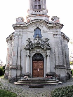 Sárhatvan Chapel of Sárbogárd | |
 Flag  Coat of arms | |
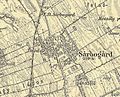
 Sárbogárd Location of Sárbogárd | |
| Coordinates: 46°53′16″N 18°37′10″E / 46.88776°N 18.61932°ECoordinates: 46°53′16″N 18°37′10″E / 46.88776°N 18.61932°E | |
| Country | |
| County | Fejér |
| District | Sárbogárd |
| Area | |
| • Total | 189.34 km2 (73.10 sq mi) |
| Population (2009) | |
| • Total | 12,922 |
| • Density | 68/km2 (180/sq mi) |
| Time zone | UTC+1 (CET) |
| • Summer (DST) | UTC+2 (CEST) |
| Postal code | 7000 |
| Area code | (+36) 25 |
| Website | www |

Sárbogárd (German: Bochart) is a town in Fejér county, Hungary. The town is at the intersection of important railroad routes in Hungary: this is where electrified routes from Balaton and Pécs merge with non-electrifed railways from Baja and Szekszárd. A double electrified track runs from Sárbogárd to Budapest allowing MÁV trains to provide quick access to the capital.
Twin towns — sister cities[]
Sárbogárd is twinned with:[1]
 Bene, Ukraine
 Zetea, Romania
Notable people[]
- Zoltán Lengyel (1960–), politician
- Géza Mészöly (1844–1887), Romantic painter
- Lajos Májer (1956–1998), footballer
- Béla Jurcsek (1893–1945), politician, Minister of Agriculture
- Gábor Varga (1968–), politician
Gallery[]

The map of Sárbogárd from the First Military Mapping Survey of Austria Empire

The map of Sárbogárd from the Second Military Mapping Survey of Austria Empire
The map of Sárbogárd from the 3rd Military Mapping Survey of Austria Empire


References[]
- ^ "Testvértelepüléseinkről". sarbogard.hu (in Hungarian). Sárbogárd. Retrieved 2021-04-09.
External links[]
| Wikimedia Commons has media related to Sárbogárd. |
- Official website in Hungarian


| show Authority control |
|---|
This Fejér location article is a stub. You can help Wikipedia by . |
Categories:
- Populated places in Fejér County
- Fejér geography stubs