Kajászó
Kajászó | |
|---|---|
 | |
 Flag  Coat of arms | |
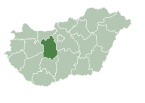
 Kajászó Location of Kajászó | |
| Coordinates: 47°19′26″N 18°43′11″E / 47.32390°N 18.71978°ECoordinates: 47°19′26″N 18°43′11″E / 47.32390°N 18.71978°E | |
| Country | |
| County | Fejér |
| Area | |
| • Total | 23.98 km2 (9.26 sq mi) |
| Population (2004) | |
| • Total | 1,007 |
| • Density | 41.99/km2 (108.8/sq mi) |
| Time zone | UTC+1 (CET) |
| • Summer (DST) | UTC+2 (CEST) |
| Postal code | 2472 |
| Area code(s) | 22 |
| Motorways | M7 |
| Distance from Budapest | 40.6 km (25.2 mi) Northeast |
| Website | www |
Kajászó is a village in Fejér county, Hungary.
Location[]
It is located 35 kilometers southwest of Budapest , about halfway between the capital and Székesfehérvár , in the Vál Valley , 2 kilometers from the M7 motorway , along the road 811 between Baracska and Alcsútdoboz .
Origin of the name Kajászó[]
The Huns, who attacked the Roman Empire from the east, crossed the Danube near today's Százhalombatta, and a significant battle took place in Tárnok Valley. The Hun leader Keve fell in the battle, and is said to be buried here. According to some sources, Attila the Hun himself rests in this area.
The name of the settlement was originally Keveháza (house of Keve), then Keveaszó, (Cuwe azoa, Keueozou), later Keazó, and finally Kajászó with today's pronunciation. Keve's memory is carried on in the name of the local agricultural co-op, Keve RT, and the local sport club, Keve SC.
1491: The village is named after its patron saint: Kajaszoszentpeter.
1950: The communist Ministry of Interior abbreviates the name to Kajaszo.
External links[]
 Media related to Kajászó at Wikimedia Commons
- Street map (in Hungarian)
- Lovarda
- Populated places in Fejér County
- Fejér geography stubs

