Szabadegyháza
Szabadegyháza | |
|---|---|
 | |
 Szabadegyháza Location of Szabadegyháza | |
| Coordinates: 47°04′42″N 18°41′32″E / 47.07845°N 18.69228°ECoordinates: 47°04′42″N 18°41′32″E / 47.07845°N 18.69228°E | |
| Country | |
| County | Fejér |
| Area | |
| • Total | 41.64 km2 (16.08 sq mi) |
| Population (2004) | |
| • Total | 2,237 |
| • Density | 53.72/km2 (139.1/sq mi) |
| Time zone | UTC+1 (CET) |
| • Summer (DST) | UTC+2 (CEST) |
| Postal code | 2432 |
| Area code(s) | 25 |
| Website | www |

Szabadegyháza is a village in Fejér county, Hungary.
Gallery[]

The map of Szabadegyháza from the First Military Mapping Survey of Austria Empire.
The map of Szabadegyháza from the Second Military Mapping Survey of Austria Empire.

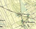
The map of Szabadegyháza from the 3rd Military Mapping Survey of Austria Empire.


See also[]
External links[]
 Media related to Szabadegyháza at Wikimedia Commons
- Street map (in Hungarian)


This Fejér location article is a stub. You can help Wikipedia by . |
Categories:
- Populated places in Fejér County
- Fejér geography stubs