Pákozd
Pákozd | |
|---|---|
 Battle of Pákozd monument from above | |
 Flag  Coat of arms | |
 Pákozd Location of Pákozd | |
| Coordinates: 47°13′16″N 18°32′42″E / 47.22112°N 18.54493°ECoordinates: 47°13′16″N 18°32′42″E / 47.22112°N 18.54493°E | |
| Country | |
| County | Fejér |
| Area | |
| • Total | 43.32 km2 (16.73 sq mi) |
| Population (2004) | |
| • Total | 2,829 |
| • Density | 65.3/km2 (169/sq mi) |
| Time zone | UTC+1 (CET) |
| • Summer (DST) | UTC+2 (CEST) |
| Postal code | 8095 |
| Area code(s) | 22 |
| Motorways | M7 |
| Distance from Budapest | 54.3 km (33.7 mi) Northeast |
| Website | www |

Pákozd is a village in Fejér county, Hungary.
In 1848, the Hungarian army defeated the Croatian army of Josip Jelačić here, in the Battle of Pákozd.[1]
Gallery[]
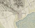
The map of Pákozd from the .

The map of Pákozd from the .

The map of Pákozd from the .


References[]
External links[]
 Media related to Pákozd at Wikimedia Commons
- Street map (in Hungarian)


| show Authority control |
|---|
This Fejér location article is a stub. You can help Wikipedia by . |
Categories:
- Populated places in Fejér County
- Fejér geography stubs