Sagaing Fault
| Sagaing Fault | |
|---|---|
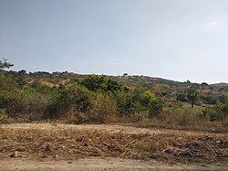 A pressure ridge formed along the fault, obscured by vegetation. | |
| Coordinates | 21°55'06.8"N 95°59'01.6"E |
| Country | Myanmar |
| Cities | Yangon, Nay Pyi Taw, Meiktila, Mandalay, Myitkyina |
| Characteristics | |
| Segments | Southern section: Bago, Pyu, Nay Pyi Taw, Meiktila, Sagaing. Northern section: Tawma, Ban Mauk, Indaw, Mawlu, Shaduzup, Kamaing, Mogang |
| Length | 1,400 km |
| Displacement | 18-20 mm/yr (0.71-0.79 in/yr) |
| Tectonics | |
| Status | Active |
| Type | Transform fault |
| Movement | Dextral |
| Age | 15-22 MYA |
The Sagaing Fault is a major fault in Burma, a mainly continental right-lateral transform fault between the Indian Plate and Sunda Plate. It links the divergent boundary in the Andaman Sea with the zone of active continental collision along the Himalayan front. It passes through populated cities of Mandalay, Yamethin, Pyinmana, the capital Naypyidaw, Toungoo and Pegu before dropping off into the Gulf of Martaban, running for a total length of over 1200 kilometers.[1][2]
Geomorphology[]
The Sagaing Fault begins offshore in the Andaman Sea before passing through the central Myanmar basin. The fault has a relatively low topographical relief for most of its length compared to the to the west.[3]
Slip rate and displacement[]
The total slip rate across the Indian–Sunda Plate boundary is about 35 mm/yr, of which 18 mm/yr is accommodated by the Sagaing Fault, according to GPS data.[4] The measured maximum displacement along the fault is about 100 km, although several authors have proposed between 360 km to 400 km.[5][6]
Associated seismicity[]
In the early 20th century, more than half the length of the Sagaing Fault was involved in significant earthquakes.
August 8 1929[]
The first earthquake that would be followed-up by subsequent larger events struck southwest of Nay Pyi Daw, and east of Thayetmyo in the Pegu Range.[7] There is insufficient reports of damage caused by this earthquake although it was said that buildings were swaying and objects were displaced at Yamethin, roughly 133.6 km north of the quake epicenter.[8] The magnitude of this earthquake was no greater than 7.0.
July 18 1930[]
A less-known earthquake in the Irrawaddy Division killed about 50 people.[9] There is no magnitude assigned to this event, very few published journals mentioned this event.
May 5 1930[]
On the night of May 5, a large shock registering Mw 7.5 struck north of the city of Pegu resulting in widespread deaths and destruction.[10] There were no foreshocks that preceded. The earthquake had a maximum intensity of IX to X on the Rossi-Forel scale.[5] The city of Pegu, Rangoon and several other towns were destroyed. In Pegu, fires erupted and severe liquefaction caused further damage. Approximately 500 people died in Pegu while 58 were killed in Rangoon, more deaths were recorded in other villages.[8] It triggered a small tsunami in that inundated villages along the coast. This is the deadliest earthquake in the 1929-1931 sequence.
December 4 1930[]
The night of December 3 was disturbed by two moderate foreshocks, the first lasting 5 seconds generated some panic, it was felt in Pyinmana and Rangoon and another that was described as being stronger than the first but was not felt as widespread like the first.[11][12][13]
The early morning of December 4 in Pyu, Taungoo District was suddenly disrupted by violent shaking from an Mw 7.3 earthquake.[14] The December 4 event occurred further north of the epicenter of the May earthquake, about 6.4 to 9.7 km west southwest of Pyu. Damage was severe, a railroad was shifted off and twisted while many buildings in the city collapsed. About 30 people were killed. Intensity reached X on the Rossi-Forel scale.[11] This event is not an aftershock of the May quake because it ruptured a different segment of the Sagaing Fault.[5]
January 31 1931[]
The largest earthquake in the sequence, an Mw 7.6 quake struck next to Indawgyi Lake resulting in large landslides and ground failures.[8][15] There were no casualties in this earthquakes.
August 10 - 19 1931[]
A violent earthquake of unknown magnitude 146.5 km north of Pyu. It was felt in Mandalay and Thanatpin.[8] Six brick buildings sustained damage. On August 19, another tremor caused cracks to appear in buildings in Mandalay and lightly affected Kalaw.[11]
September 23 1931[]
Another earthquake in Pyu resulted in the collapse of the Shwe Sandaw Pagoda in Taungoo.[8]
January 5-13 1932[]
Several short tremors were felt that woke people up in Taungoo, Pyuntaza and Nangyun.[11]
September 09 1946[]
Two powerful earthquakes north of Mandalay measuring 8.0 and 7.8 on the moment magnitude scale would remain as one of the largest in the country. Not much about this event is known due to sparse records.
July 16 1956[]
This magnitude 7.1 earthquake near the city of Mandalay resulted in the deaths of at least 38 people.
Cause[]
Looking back at the historical records of earthquakes, the years 1906 and 1908 saw two major events in the northernmost end of the Sagaing Fault.[16] The 1906 Putao earthquake on August 31 had an estimated moment magnitude of 7.0, and the 1908 earthquake measured Mw 7.5.[17][18] The 1908 earthquake resulted in the accumulation of stress towards the south, where the future 1931 quake would take place. Similarly, the 1946 earthquake rupture segments were directly south of the 1931 rupture. The first mainshock in the 1946 doublet sequence then triggered the second mainshock due to the sudden increase in stress levels on the fault. Ten years later, an Mw 7.1 earthquake near Mandalay killed at least 40 people. That earthquake broke a segment south of the 1946 rupture. In 1991, a small seismic gap between the two 1946 ruptures generated an Mw 7.0 earthquake, partially re-rupturing a small section of the 1946 quakes, killing two.[19] Although the May and December 1930 earthquakes occurred during this active period, they were separate events, unrelated to the activity in the northern part. The December 1930 earthquake, however, was triggered due to stress transfer from the previous event in May.[16]
Other earthquakes[]
- 1839 Ava earthquake: Powerful quake that destroyed the city of Inwa.[20]
- 2012 Shwebo earthquake: Magnitude 6.8 quake killed 26 people and left 12 missing.
See also[]
References[]
- ^ Win, Nilar (August 25–31, 2008). "Sagaing Fault surveyed to prepare for future quakes". The Myanmar Times. Archived from the original on 2012-06-07. Retrieved 2011-04-04.
- ^ Wang, Yu (2011). "Earthquakes and slip rate of the southern Sagaing fault: insights from an offset ancient fort wall, lower Burma (Myanmar)" (PDF). Geophysical Journal International. 185: 49–64. doi:10.1111/j.1365-246X.2010.04918.x.
- ^ SOE THURA TUN, WATKINSON. "The Sagaing Fault" (PDF). Myanmar: Geology, Resources and Tectonics. Geological Society, London, Memoir.
- ^ Tsutsumi, H.; Sato, T. (2009). "Tectonic geomorphology of the southernmost Sagaing fault and surface rupture associated with the May 1930 Pegu (Bago) earthquake, Myanmar". Bulletin of the Seismological Society of America. 99 (4): 2155–2168. doi:10.1785/0120080113.
- ^ Jump up to: a b c Yu, Wang (2014). "Active tectonics and earthquake potential of the Myanmar region" (PDF). Journal of Geophysical Research: Solid Earth. 119 (4): 3767. Bibcode:2014JGRB..119.3767W. doi:10.1002/2013JB010762 – via Caltech.
- ^ Yu Wang, Kerry Sieh, Thura Aung, Soe Min, Saw Ngwe Khaing (2011). "Earthquakes and slip rate of the southern Sagaing fault: insights from an offset ancient fort wall, lower Burma (Myanmar)". Geophysical Journal International. 185 (1): 49. Bibcode:2011GeoJI.185...49W. doi:10.1111/j.1365-246X.2010.04918.x.CS1 maint: multiple names: authors list (link)
- ^ "M 6.6 - Myanmar". USGS.
- ^ Jump up to: a b c d e Hla Hla Aung (2012). "Reinterpretation of historical earthquakes during 1929 to 1931, Myanmar". Solid Earth Science. 31: 43. Bibcode:2012aogs...31...43A. doi:10.1142/9789814405775_0005. ISBN 978-981-4405-76-8 – via Researchgate.
- ^ "Significant Earthquake: MYANMAR (BURMA): THARRAWADDY". NOAA.
- ^ "M 7.5 - Myanmar". USGS.
- ^ Jump up to: a b c d J. COGGIN BROWN AND P. LEICESTER. "THE PYU EARTHQUAKES of 3RD AND 4TH DECEMBER 1930 AND SUBSEQUENT BURMA EARTHQUAKES UP TO JANUARY 1932". Memoirs of the Geological Survey of India. LXII.
- ^ "Event 907776 Myanmar". International Seismological Centre.
- ^ "Event 907775 Near south coast of Myanmar". International Seismological Centre.
- ^ "M 7.4 - Myanmar". USGS.
- ^ "M 7.6 - Myanmar". USGS.
- ^ Jump up to: a b Xiong, X., B. Shan, Y. M. Zhou, S. J. Wei, Y. D. Li, R. J. Wang, and Y. Zheng (2017). "Coulomb stress transfer and accumulation on the Sagaing Fault, Myanmar, over the past 110 years and its implications for seismic hazard". Geophysical Research Letters. 44 (10): 4781–4789. doi:10.1002/2017GL072770.CS1 maint: multiple names: authors list (link)
- ^ "Event 914281 Myanmar-India border region". ISC: On-Line Bulletin. International Seismological Center. Retrieved 3 March 2021.
- ^ "Event 16958007 Myanmar". ISC: On-Line Bulletin. International Seismological Centre. Retrieved 3 March 2021.
- ^ "M 7.0 - Myanmar". USGS-ANSS. USGS. Retrieved 3 March 2021.
- ^ Htoo, Thant (2019-08-07). "Govt unveils quake preparedness plan". The Myanmar Times. Retrieved 2020-08-30.
External links[]
- Seismic faults of Asia
- Geology of Myanmar
- Earthquakes in Myanmar
- Strike-slip faults
- Seismic faults
- Geology of Asia
- Active faults