Saint-Frédéric, Quebec
Saint-Frédéric | |
|---|---|
Parish municipality | |
 | |
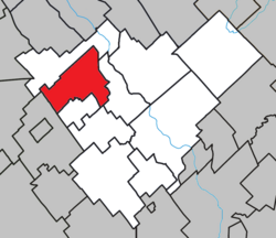 Location within Robert-Cliche RCM. | |
 Saint-Frédéric Location in southern Quebec. | |
| Coordinates: 46°18′N 70°58′W / 46.300°N 70.967°WCoordinates: 46°18′N 70°58′W / 46.300°N 70.967°W[1] | |
| Country | |
| Province | |
| Region | Chaudière-Appalaches |
| RCM | Robert-Cliche |
| Constituted | July 1, 1855 |
| Government | |
| • Mayor | Martin Nadeau |
| • Federal riding | Beauce |
| • Prov. riding | Beauce-Nord |
| Area | |
| • Total | 72.30 km2 (27.92 sq mi) |
| • Land | 72.87 km2 (28.14 sq mi) |
| There is an apparent contradiction between two authoritative sources | |
| Population (2011)[3] | |
| • Total | 1,085 |
| • Density | 14.9/km2 (39/sq mi) |
| • Pop 2006-2011 | |
| • Dwellings | 456 |
| Time zone | UTC−5 (EST) |
| • Summer (DST) | UTC−4 (EDT) |
| Postal code(s) | G0N 1P0 |
| Area code(s) | 418 and 581 |
| Highways | |
| Website | www |

Saint-Frédéric is a parish in the Municipalité régionale de comté Robert-Cliche in Quebec, Canada. It is part of the Chaudière-Appalaches region and the population is 1,066 as of 2009. It is named after Reverend Frédéric Caron, first priest of Saint-Frédéric.
People linked to Saint-Frédéric[]
- Louis-Albert Vachon, archbishop of Quebec
References[]
- ^ Reference number 56586 of the Commission de toponymie du Québec (in French)
- ^ Jump up to: a b Geographic code 27065 in the official Répertoire des municipalités (in French)
- ^ Jump up to: a b "(Code 2427065) Census Profile". 2011 census. Statistics Canada. 2012.
- Commission de toponymie du Québec
- Ministère des Affaires municipales, des Régions et de l'Occupation du territoire
| show Places adjacent to Saint-Frédéric, Quebec |
|---|
| show |
|---|
Categories:
- Parish municipalities in Quebec
- Incorporated places in Chaudière-Appalaches