Saint-Jules, Quebec
Saint-Jules | |
|---|---|
Parish municipality | |
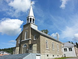 St-Jules' Church | |
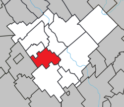 Location within Robert-Cliche RCM. | |
 Saint-Jules Location in southern Quebec. | |
| Coordinates: 46°13′N 70°57′W / 46.217°N 70.950°WCoordinates: 46°13′N 70°57′W / 46.217°N 70.950°W[1] | |
| Country | |
| Province | |
| Region | Chaudière-Appalaches |
| RCM | Robert-Cliche |
| Constituted | May 28, 1919 |
| Named for | Pope Julius I[1] |
| Government | |
| • Mayor | Ghislaine Doyon |
| • Federal riding | Beauce |
| • Prov. riding | Beauce-Nord |
| Area | |
| • Total | 55.70 km2 (21.51 sq mi) |
| • Land | 57.37 km2 (22.15 sq mi) |
| There is an apparent contradiction between two authoritative sources | |
| Population (2011)[3] | |
| • Total | 573 |
| • Density | 10.0/km2 (26/sq mi) |
| • Pop 2006-2011 | |
| • Dwellings | 225 |
| Time zone | UTC−5 (EST) |
| • Summer (DST) | UTC−4 (EDT) |
| Postal code(s) | G0N 1R0 |
| Area code(s) | 418 and 581 |
| Highways | No major routes |
| Website | www |

Saint-Jules is a parish municipality in the Robert-Cliche Regional County Municipality in the Chaudière-Appalaches region of Quebec, Canada. Its population was 573 as of the Canada 2011 Census. It is named after Pope Julius I.
People linked to Saint-Jules[]
- Janvier Grondin, Coalition Avenir Québec politician
- Placide Poulin, businessman
References[]
- ^ Jump up to: a b Reference number 57015 of the Commission de toponymie du Québec (in French)
- ^ Jump up to: a b Geographic code 27055 in the official Répertoire des municipalités (in French)
- ^ Jump up to: a b "(Code 2427055) Census Profile". 2011 census. Statistics Canada. 2012.
- Commission de toponymie du Québec
- Ministère des Affaires municipales, des Régions et de l'Occupation du territoire
| show Places adjacent to Saint-Jules, Quebec |
|---|
| show |
|---|
| show Authority control |
|---|
Categories:
- Parish municipalities in Quebec
- Incorporated places in Chaudière-Appalaches