Saint-Léger, Lot-et-Garonne
Saint-Léger | |
|---|---|
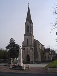 Church of Saint-Léger | |
show Location of Saint-Léger | |
 Saint-Léger | |
| Coordinates: 44°17′24″N 0°19′10″E / 44.29°N 0.3194°ECoordinates: 44°17′24″N 0°19′10″E / 44.29°N 0.3194°E | |
| Country | France |
| Region | Nouvelle-Aquitaine |
| Department | Lot-et-Garonne |
| Arrondissement | Nérac |
| Canton | Lavardac |
| Government | |
| • Mayor (2020–2026) | Bernard Sauboi[1] |
| Area 1 | 5.79 km2 (2.24 sq mi) |
| Population (Jan. 2018)[2] | 128 |
| • Density | 22/km2 (57/sq mi) |
| Time zone | UTC+01:00 (CET) |
| • Summer (DST) | UTC+02:00 (CEST) |
| INSEE/Postal code | 47250 /47160 |
| Elevation | 22–34 m (72–112 ft) (avg. 40 m or 130 ft) |
| 1 French Land Register data, which excludes lakes, ponds, glaciers > 1 km2 (0.386 sq mi or 247 acres) and river estuaries. | |


Saint-Léger (French pronunciation: [sɛ̃ leʒe] (![]() listen); Gascon: Sent Leugèr) is a commune in the Lot-et-Garonne department in south-western France.
listen); Gascon: Sent Leugèr) is a commune in the Lot-et-Garonne department in south-western France.
See also[]
References[]
- ^ "Répertoire national des élus: les maires". data.gouv.fr, Plateforme ouverte des données publiques françaises (in French). 2 December 2020. Retrieved 7 December 2020.
- ^ "Populations légales 2018". INSEE. 28 December 2020.
| Wikimedia Commons has media related to Saint-Léger (Lot-et-Garonne). |
This Lot-et-Garonne geographical article is a stub. You can help Wikipedia by . |
Categories:
- Communes of Lot-et-Garonne
- Lot-et-Garonne geography stubs