Saint-Placide, Quebec
Saint-Placide | |
|---|---|
Municipality | |
 | |
 Location within Deux-Montagnes RCM. | |
 Saint-Placide Location in central Quebec. | |
| Coordinates: 45°32′N 74°12′W / 45.533°N 74.200°WCoordinates: 45°32′N 74°12′W / 45.533°N 74.200°W[1] | |
| Country | |
| Province | |
| Region | Laurentides |
| RCM | Deux-Montagnes |
| Settled | 1780 |
| Constituted | August 3, 1994 |
| Government | |
| • Mayor | Denis Lavigne |
| • Federal riding | Argenteuil—Papineau—Mirabel |
| • Prov. riding | Mirabel |
| Area | |
| • Total | 62.10 km2 (23.98 sq mi) |
| • Land | 43.12 km2 (16.65 sq mi) |
| Population (2011)[3] | |
| • Total | 1,715 |
| • Density | 39.8/km2 (103/sq mi) |
| • Pop 2006-2011 | |
| • Dwellings | 862 |
| Time zone | UTC−5 (EST) |
| • Summer (DST) | UTC−4 (EDT) |
| Postal code(s) | J0V 2B0 |
| Area code(s) | 450 and 579 |
| Highways | |
| Website | www |

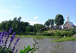
Saint-Placide is a municipality in the Laurentides region of Quebec, Canada, part of the Deux-Montagnes Regional County Municipality, along the north shore of the Ottawa River.
History[]
In 1780, the first European settlers arrived here.[4] In 1848, the Parish of Saint-Placide was formed when it was separated from the parish of Saint-Benoît. The new parish name was undoubtedly chosen because Saint Placide, a monk of the sixth century, was a disciple of Saint Benedict. In 1853, its post office opened, and in 1855, the Parish Municipality of Saint-Placide was formed.[5]
A wharf, built in 1867, allowed vessels of the Ottawa River Navigation Company to take delivery of wheat at that time in the region.[5]
In 1950, the Village Municipality of Saint-Placide was formed when it separated from the Parish Municipality, and was surrounded by the latter's territory. On August 3, 1994, these municipalities were rejoined again to form the new Municipality of Saint-Placide.[5]
Transportation[]
Highway 344 passes through Saint-Placide. The Oka Express goes to the Deux-Montagnes station and Terminus Saint-Eustache
Demographics[]
Population trend:[6]
- Population in 2011: 1715 (2006 to 2011 population change: 4.4%)
- Population in 2006: 1642 (2001 to 2006 population change: 6.8%)
- Population in 2001: 1537
- Population in 1996: 1479
- Population in 1991: 1387 (adjusted for boundary changes)
Private dwellings occupied by usual residents: 716 (total dwellings: 862)
Mother tongue:
- English as first language: 1.2%
- French as first language: 96%
- English and French as first language: 0.6%
- Other as first language: 2.2%
Education[]
This section needs expansion. You can help by . (December 2014) |
The Commission scolaire de la Seigneurie-des-Mille-Îles (CSSMI) operates Francophone public schools.[7]
- École de l'Amitié[8]
École secondaire d'Oka in Oka provides secondary education.[9]
The Sir Wilfrid Laurier School Board operates Anglophone public schools. Mountainview Elementary School and Saint Jude Elementary School, both in Deux-Montagnes, serve this community.[10][11] Lake of Two Mountains High School is the zoned high school.[12]
Notable people from Saint-Placide[]
- Adolphe-Basile Routhier (1839–1920), author of the original French lyrics of the Canadian national anthem[5]
References[]
- ^ Reference number 293601 of the Commission de toponymie du Québec (in French)
- ^ Jump up to: a b Geographic code 72043 in the official Répertoire des municipalités (in French)
- ^ Jump up to: a b "(Code 2472043) Census Profile". 2011 census. Statistics Canada. 2012.
- ^ "Découvrir Saint-Placide - Historique" (in French). Municipalité de Saint-Placide. Archived from the original on 2009-02-25. Retrieved 2009-03-11.
- ^ Jump up to: a b c d "Saint-Placide (Municipalité)" (in French). Commission de toponymie du Québec. Archived from the original on 2015-09-30. Retrieved 2009-03-11.
- ^ Statistics Canada: 1996, 2001, 2006, 2011 census
- ^ "Admission et inscription Archived 2015-01-31 at the Wayback Machine." Commission scolaire de la Seigneurie-des-Mille-Iles. Retrieved on December 7, 2014. "La Commission scolaire de la Seigneurie-des-Mille-Iles (CSSMI) offre ses services aux résidents des municipalités de : Blainville, Boisbriand, Bois-des-Filion, Deux-Montagnes, Lorraine, Mirabel (Saint-Augustin, Saint-Benoît, Sainte-Scholastique et secteur du Domaine-Vert), Oka, Pointe-Calumet, Rosemère, Sainte-Anne-des-Plaines, Sainte-Marthe-sur-le-Lac, Sainte-Thérèse, Saint-Eustache, Saint-Joseph-du-Lac, Saint-Placide et Terrebonne Ouest."
- ^ "de l'Amitié." Commission scolaire de la Seigneurie-des-Mille-Iles. Retrieved on September 20, 2017.
- ^ "Répertoire des aires de desserte par ville 2017 - 2018 (Généré le 21/9/2017) Ville Saint-Placide." Commission scolaire de la Seigneurie-des-Mille-Iles. Retrieved on September 22, 2017.
- ^ "Mountainview Elementary Zone." Sir Wilfrid Laurier School Board. Retrieved on December 8, 2014.
- ^ "Saint Jude Elementary School Zone Map." Sir Wilfrid Laurier School Board. Retrieved on December 8, 2014.
- ^ "LAKE OF TWO MOUNTAINS HS ZONE." Sir Wilfrid Laurier School Board. Retrieved on September 4, 2017.
External links[]
 Media related to Saint-Placide, Quebec at Wikimedia Commons
| show Adjacent Municipal Subdivisions |
|---|
| hide | |
|---|---|
| Cities & Towns |
|
| Municipalities | |
| |
| show Authority control |
|---|
- Incorporated places in Laurentides
- Municipalities in Quebec
- Greater Montreal
- Designated places in Quebec