Saint-Priest-en-Murat
show This article may be expanded with text translated from the corresponding article in French. (December 2008) Click [show] for important translation instructions. |
Saint-Priest-en-Murat | |
|---|---|
Commune | |
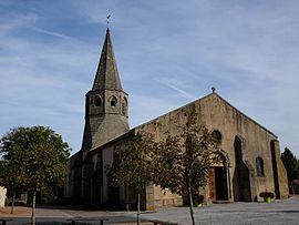 The church in Saint-Priest-en-Murat | |
show Location of Saint-Priest-en-Murat | |
 Saint-Priest-en-Murat | |
| Coordinates: 46°21′00″N 2°54′47″E / 46.35°N 2.9131°ECoordinates: 46°21′00″N 2°54′47″E / 46.35°N 2.9131°E | |
| Country | France |
| Region | Auvergne-Rhône-Alpes |
| Department | Allier |
| Arrondissement | Montluçon |
| Canton | Commentry |
| Government | |
| • Mayor (2020–2026) | Luc Perrin[1] |
| Area 1 | 25.48 km2 (9.84 sq mi) |
| Population (Jan. 2018)[2] | 219 |
| • Density | 8.6/km2 (22/sq mi) |
| Time zone | UTC+01:00 (CET) |
| • Summer (DST) | UTC+02:00 (CEST) |
| INSEE/Postal code | 03256 /03390 |
| Elevation | 265–433 m (869–1,421 ft) (avg. 387 m or 1,270 ft) |
| 1 French Land Register data, which excludes lakes, ponds, glaciers > 1 km2 (0.386 sq mi or 247 acres) and river estuaries. | |


Saint-Priest-en-Murat is a commune in the Allier department in Auvergne-Rhône-Alpes in central France.
Population[]
| Year | Pop. | ±% |
|---|---|---|
| 1968 | 413 | — |
| 1975 | 321 | −22.3% |
| 1982 | 268 | −16.5% |
| 1990 | 243 | −9.3% |
| 1999 | 231 | −4.9% |
| 2007 | 254 | +10.0% |
| 2012 | 204 | −19.7% |
| 2017 | 223 | +9.3% |
| Source: INSEE[3] | ||
See also[]
References[]
- ^ "Répertoire national des élus: les maires". data.gouv.fr, Plateforme ouverte des données publiques françaises (in French). 2 December 2020. Retrieved 7 December 2020.
- ^ "Populations légales 2018". INSEE. 28 December 2020.
- ^ Population en historique depuis 1968, INSEE
| Wikimedia Commons has media related to Saint-Priest-en-Murat. |
This Allier geographical article is a stub. You can help Wikipedia by . |
Categories:
- Communes of Allier
- Allier geography stubs