Sambava
Sambava | |
|---|---|
 Sambava Beach | |
 Coat of arms | |
 Sambava Location in Madagascar | |
| Coordinates: 14°16′S 50°10′E / 14.267°S 50.167°E | |
| Country | |
| Region | Sava |
| District | Sambava |
| Area | |
| • Total | 98.9 km2 (38.2 sq mi) |
| Population (2018 census) | |
| • Total | 84,039 |
| • Density | 850/km2 (2,200/sq mi) |
| • Ethnicities | Betsimisaraka |
| Time zone | UTC3 (EAT) |
| Climate | Af |
Sambava [samˈbav] is a city and commune (commune urbaine; Malagasy: kaominina) at the east coast of northern Madagascar. It is the capital of Sambava District and Sava Region. The population of the commune was 84,039 in as of the 2018 commune census.[1]
Infrastructure[]
Sambava is located on Route Nationale 5a Ambilobe - Antalaha. It has a local airport, regional airport. In addition to primary schooling the town offers secondary education at both junior and senior levels. The town provides access to hospital services to its citizens.[1]
Economy[]
Farming and raising livestock provides employment for 45% and 0.5% of the working population. The most important crop is vanilla, while other important products are coconut and rice. Industry and services provide employment for 0.5% and 53.5% of the population, respectively. Additionally fishing employs 0.5% of the population.[1]
Sambava disposes of white, sandy beaches with several hotels. The Marojejy National Park is close to Sambava on the road to Andapa.

Beach view from Sambava

Townhall
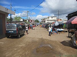
Market road in Sambava

Women grading vanilla beans

Beach view from Sambava


Education[]
A regional centre for distance education (CRTE) of the Centre National de Télé-Enseignement de Madagascar (CNETMAD) is located in Sambava.
Climate[]
| Climate data for Sambava | |||||||||||||
|---|---|---|---|---|---|---|---|---|---|---|---|---|---|
| Month | Jan | Feb | Mar | Apr | May | Jun | Jul | Aug | Sep | Oct | Nov | Dec | Year |
| Average high °C (°F) | 31 (88) |
31 (88) |
31 (88) |
30 (86) |
29 (84) |
27 (81) |
26 (79) |
26 (79) |
27 (81) |
28 (82) |
29 (84) |
30 (86) |
29 (84) |
| Daily mean °C (°F) | 26 (79) |
26 (79) |
26 (79) |
26 (79) |
24 (75) |
23 (73) |
21 (70) |
21 (70) |
23 (73) |
22 (72) |
24 (75) |
25 (77) |
24 (75) |
| Average low °C (°F) | 23 (73) |
23 (73) |
23 (73) |
22 (72) |
21 (70) |
19 (66) |
18 (64) |
18 (64) |
19 (66) |
20 (68) |
21 (70) |
22 (72) |
21 (70) |
| Average rainfall mm (inches) | 342 (13.5) |
257 (10.1) |
284 (11.2) |
227 (8.9) |
183 (7.2) |
183 (7.2) |
176 (6.9) |
195 (7.7) |
100 (3.9) |
109 (4.3) |
132 (5.2) |
219 (8.6) |
2,407 (94.8) |
| Average rainy days (≥ 1 mm) | 16 | 14 | 16 | 15 | 14 | 14 | 17 | 18 | 13 | 13 | 13 | 15 | 178 |
| Mean monthly sunshine hours | 222 | 218 | 216 | 215 | 222 | 191 | 191 | 201 | 215 | 243 | 230 | 240 | 2,604 |
| Source: The Weather Network[2] | |||||||||||||
References and notes[]
- ^ a b c "ILO census data". Cornell University. 2002. Retrieved 2008-02-23.
- ^ "Climate Statistics for Sambava, Madagascar (1961-1990)". Retrieved February 25, 2012.
Capital: Sambava | ||
| Andapa (17) |  | |
| Antalaha (14) |
| |
| Sambava (25) | ||
| Vohemar (19) | ||
4 districts; 75 communes | ||
- Cities in Madagascar
- Populated places in Sava Region
- Regional capitals in Madagascar