Santa Cruz, California
Santa Cruz, California | |
|---|---|
City | |
| City of Santa Cruz | |
 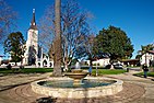     Clockwise: Downtown Santa Cruz; Mission Santa Cruz; U.S. Post Office; Santa Cruz Beach Boardwalk; Seaside Beach; Mission Plaza | |
 Seal Logo | |
| Nickname(s): Surf City[1] | |
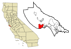 Location in Santa Cruz County and the state of California | |
 Santa Cruz Location within Northern California | |
| Coordinates: 36°58′19″N 122°1′35″W / 36.97194°N 122.02639°WCoordinates: 36°58′19″N 122°1′35″W / 36.97194°N 122.02639°W | |
| Country | United States |
| State | California |
| County | Santa Cruz |
| Mission | September 25, 1791[2] |
| Incorporated | March 31, 1866[3] |
| Chartered | April 1876[4] |
| Government | |
| • Type | Council/Manager[4] |
| • Mayor | Justin Cummings[5] |
| • State senator | John Laird (D)[6] |
| • Assemblymember | Mark Stone (D)[6] |
| • United States representatives | Anna Eshoo (D) and Jimmy Panetta (D)[7] |
| Area | |
| • City | 15.83 sq mi (41.00 km2) |
| • Land | 12.74 sq mi (33.00 km2) |
| • Water | 3.09 sq mi (8.00 km2) 19.51% |
| • Urban | 58.4 sq mi (151.1 km2) |
| • Metro | 607 sq mi (1,570 km2) |
| Elevation | 36 ft (11 m) |
| Population | |
| • City | 59,946 |
| • Estimate (2019)[11] | 64,608 |
| • Density | 3,800/sq mi (1,500/km2) |
| • Urban | 163,703 |
| • Metro | 262,382 |
| Time zone | UTC−8 (Pacific) |
| • Summer (DST) | UTC−7 (PDT) |
| ZIP codes[14] | 95060–95067 |
| Area code | 831 |
| FIPS code | 06-69112 |
| GNIS feature IDs | 1659596, 2411820 |
| Website | www |


Santa Cruz (Spanish for 'Holy Cross') is the county seat and largest city of Santa Cruz County, California. As of 2019, the U.S. Census Bureau estimated Santa Cruz's population at 64,608.
Situated on the northern edge of Monterey Bay, about 32 mi (51 km) south of San Jose and 75 mi (120 km) south of San Francisco, the city is part of the 12-county San Jose-San Francisco-Oakland Combined Statistical Area.
Santa Cruz is known for its moderate climate, natural environment, coastline, redwood forests, alternative community lifestyles, and socially liberal leanings. It is also home to the University of California, Santa Cruz, a premier research institution and educational hub, as well as the Santa Cruz Beach Boardwalk, an oceanfront amusement park operating continuously since 1907.
The present-day site of Santa Cruz was the location of Spanish settlement beginning in 1791, including Mission Santa Cruz and the pueblo of Branciforte. The City of Santa Cruz was incorporated in 1866 and chartered in April 1876.[4] Important early industries included lumber, gunpowder, lime and agriculture. Late in the 19th century, Santa Cruz established itself as a beach resort community.
History[]
The Awaswa and pre-contact period[]
Prior to the arrival of Spanish soldiers, missionaries and colonists in the late 18th century, Santa Cruz County was home to the Awaswas Natives. The misnomer Ohlone, while often used to describe the native people of the Santa Cruz area, is a generalized name for the many diverse groups that lived in the region stretching from San Francisco to the Monterey Bay. The diverse and numerous tribes of this region were also earlier referred to by the Spanish as Coastanoan. The term "Ohlone" has been used in place of "Costanoan" since the 1970s by some descendant groups and by most ethnographers, historians, and writers of popular literature. Awaswa was one of the eight Costanoan languages and made up a tribe of Native Americans living in Western Santa Cruz County, stretching slightly north of Davenport to Rio Del Mar. The Awaswas tribe was made up of no more than one thousand people and their language is now extinct. The only remnants of their spoken language are three local place names: Aptos, Soquel and Zayante; and the name of a native shellfish – abalone. The majority of Ohlone or Coastanoan tribes had no written language, and lived in small villages scattered around the Monterey Bay and San Francisco Bay regions. Within fifty years of the Spaniards' arrival, the Ohlone or Coastanoan culture and way of life had virtually disappeared in the Bay area. Today, two of the Coastanoan tribes, the Awaswa people 'missionized' in Santa Cruz and the Mutsun people 'missionized' at San Juan Bautista, have joined together as the Amah Mutsan Tribal Band in an effort to protect and maintain the authentic and distinct cultural history and practices.[15][16]
Spanish & Mexican period[]

The first European land exploration of Alta California, the Spanish Portolá expedition led by Gaspar de Portolá, passed through the area on its way north, still searching for the "port of Monterey" described by Sebastian Vizcaino in 1602. The party forded the river (probably near where the Soquel Avenue bridge now stands) and camped nearby on October 17, 1769. Franciscan missionary Juan Crespí, traveling with the expedition, noted in his diary that, "This river was named San Lorenzo." (for Saint Lawrence).
Next morning, the expedition set out again, and Crespi noted that, "Five hundred steps after we started we crossed a good arroyo of running water which descends from some high hills where it rises. It was named "El Arroyo de la Santisima Cruz, which translates literally as "The Stream of the Most Holy Cross".[17]
In 1791, Father Fermín Lasuén continued the use of Crespi's name when he declared the establishment of La Misión de la Exaltación de la Santa Cruz (also known as Mission Santa Cruz) for the conversion of the Awaswas of Chatu-Mu and surrounding Ohlone villages. Santa Cruz was the twelfth mission to be founded in California. The creek, however, later lost the name, and is known today as Laurel Creek because it parallels Laurel Street. It is the main feeder of Neary Lagoon.[18]
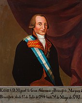
In 1797, Governor Diego de Borica, by order of the Viceroy of New Spain, Miguel de la Grúa Talamanca y Branciforte, marqués de Branciforte, established the Villa de Branciforte, a town named in honor of the Viceroy.[19] One of only three civilian towns established in California during the Spanish colonial period (the other two became Los Angeles and San Jose), the Villa was located across the San Lorenzo River, less than a mile from the Mission. Its original main street is now North Branciforte Avenue. Villa de Branciforte later lost its civic status, and in 1905 the area was annexed into the City of Santa Cruz.
In the 1820s, newly independent Mexico assumed control of the area.[20] Following the secularization of the Mission in 1834, the government attempted to rename the community that had grown up around the Mission, to Pueblo de Figueroa (after a former governor). The pueblo designation was never made official, however. The new name didn't catch on and Santa Cruz remained Santa Cruz. Mission farming and grazing lands, which once extended from the San Lorenzo River north along the coast to approximately today's Santa Cruz County border, were taken away and broken up into large land grants called ranchos. The grants were made by several different governors between 1834 and 1845 (see List of Ranchos of California).
Only two ranchos were totally within the boundaries of today's city of Santa Cruz. Rancho Potrero Y Rincon de San Pedro Regalado consisted mostly of flat, river-bottom pasture land north of Mission Hill ("potrero" translates as "pasture"). Rancho Tres Ojos de Agua was on the west side. Three other rancho boundaries later became part of the modern city limits: Rancho Refugio on the west. Rancho Carbonera on the north, and Rancho Arroyo del Rodeo on the east.
After secularization put most California land into private hands, immigrants from the United States began to arrive in steadily increasing numbers, especially in the 1840s when overland routes like the California Trail were opened. In 1848, following the Mexican–American War, Mexico ceded the territory of Alta California to the U.S. in the Treaty of Guadalupe Hidalgo. California was the first portion of the territory to become a state, in 1850. Santa Cruz County was established the same year, and Santa Cruz was incorporated as a town in 1866.
The Santa Cruz mission, along with the other twenty-one Franciscan missions, was secularized within a few years after 1833. Even before secularization, the Indian population had declined, and the adobe buildings slowly began to fall apart from wet weather and lack of maintenance. The chapel tower fell in 1840 and the entire front wall was destroyed in the 1857 Fort Tejon earthquake. In 1858 a "modern" church was built next door to the remaining rear portion of the chapel. That remainder was demolished in 1889, when today's Holy Cross church was built on the site, in a gothic style.
Indigenous history[]
Indigenous people have been living in the Santa Cruz region for at least 12,000 years.[21] At the time of colonization, the Indigenous people belonged to the Uypi tribe of the Awaswas-speaking dialectical group. They called the area Aulinta.[22] Awaswas is a dialect of the broader language group of the Ohlone people, who occupied the area from Monterey to San Francisco. Awaswas-speaking people lived in extended kinship networks throughout what is now Santa Cruz County, and maintained the natural landscape through controlled burning. Their diet consisted of a rich diversity of sources, including deer, elk, roots, berries, fish, and acorns .
When the Spanish arrived, they called the Indigenous communities living along the coast "Costanos". Costanos is derived from the Spanish word costa (coast). "Ohlone" is a more recent name for the same language group. The Costanos (anglicized as "Costanoan") people spoke eight known dialects under the Ohlone umbrella, each defining a different tribelet area. The ancestors of the Costanoan people are thought to have originally migrated to the San Francisco and Monterey Bay Area from the San Joaquin-Sacramento River system sometime around A.D. 500.
During the mission era, the number of Native people in the Bay Area, including Santa Cruz, began to rapidly decrease due to factors brought by Spanish colonization.[23] The Costanoan people experienced a cultural disruption. During their time with the missions the Indigenous people experienced cultural shock, mistreatment and diseases brought from Europe. As the missions closed, most of the remaining neophytes living at the missions became laborers on the ranchos that inherited the former mission lands.
In 1834, 14 years after Mexico won its independence from Spain, the twenty-one California missions were secularized. The vast lands they were supposed to be holding in trust for converted natives went instead mostly to friends and relatives of the Alta California government (including some foreign immigrants who had married into Californio families). The remaining Costanoan/Ohlone mission residents struggled to survive, and many became servants or agricultural laborers or vaqueros (cowboys). Some small communities were formed after this which promoted old ways but in different locations from their homelands.[24]
Today, the Amah Mutsun Tribal Band is composed of the descendants of the indigenous people taken to missions San Juan Bautista and Santa Cruz.
Early years of industry[]
Elihu Anthony (1818–1905) arrived in Santa Cruz in 1847[25] and opened many firsts for the city, including the first Protestant Church, the first blacksmith foundry, he built the first wharf and was the first postmaster.[25] He developed the first commercial blocks in downtown Santa Cruz with his early blacksmith foundry located at the corner of Pacific Street and Mission Street.[25] Anthony with Frederick A. Hihn, built the first private water supply network in the city and serving nearby communities.[26] The establishment of railroad lines in Santa Cruz in 1876 until 1881 with the Santa Cruz Railroad, brought workers to Santa Cruz and provided market access for the city's timber, leather and limestone industries.[27]
Civil War[]
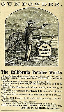
California Powder Works began manufacturing blasting powder for California mining when normal supplies were interrupted by the American Civil War. A powder mill built on the San Lorenzo River upstream of Santa Cruz used charcoal and powder kegs manufactured from local forests. The mill later manufactured smokeless powder used in United States Army Krag-Jørgensen rifles and guns of the United States Navy Pacific and Asiatic fleets. The mill was heavily damaged by a series of explosions on the evening of April 26, 1898. The explosions caused flaming debris to fall on Mission Hill and caused fires threatening the city. The powder works employed 150 to 275 men until operations ceased in 1914.[28]
Recent history[]
Santa Cruz was hard hit by the 1989 Loma Prieta earthquake that killed three people. It was also hit by ocean surges caused by the 2011 Tōhoku earthquake and tsunami, wherein the Santa Cruz Small Craft Harbor sustained an estimated $10 million of damage, with another $5 million of damage to docked boats there.[29]
Social activism[]
This section may be unbalanced towards certain viewpoints. (August 2020) |

As a center of liberal and progressive activism,[30] Santa Cruz became one of the first cities to approve marijuana for medicinal uses. In 1992, residents overwhelmingly approved Measure A,[31] which allowed for the medicinal uses of marijuana. Santa Cruz was home to the second above-ground medical marijuana club in the world when the Santa Cruz Cannabis Buyers Club opened its doors in April 1995. Santa Cruz also became one of the first cities in California to test the state's medical marijuana laws in court after the arrest of Valerie Corral and , founders of the Wo/Men's Alliance for Medical Marijuana, by the DEA.[32] The case was ruled in favor of the growers. In 2005, the Santa Cruz City Council established a city government office to assist residents with obtaining medical marijuana.[33] On November 7, 2006, the voters of Santa Cruz passed Measure K by a vote of 64–36 percent. Measure K made adult non-medical cannabis offenses the lowest priority for law enforcement; this does not apply to cultivation, distribution, sale in public, sale to minors, or driving under the influence.[34][35] The measure requests the Santa Cruz city clerk send letters annually to state and federal representatives advocating reform of cannabis laws.[36] In January 2020, Santa Cruz became the third city in the US and second city in California to decriminalize psilocybin mushrooms in addition to a slew of other entheogenic plants on the Federal Schedule 1 Substance List.[37]
In 1998, the Santa Cruz community declared itself a nuclear-free zone,[38] and in 2003, the Santa Cruz City Council became the first city council in the U.S. to denounce the Iraq War.[39] The City Council of Santa Cruz also issued a proclamation opposing the USA PATRIOT Act.[40]
Notable feminist activists Nikki Craft and Ann Simonton resided in Santa Cruz, where they formed the "Praying Mantis Brigade". This collection of activists organized the "Myth California Pageant" in the 1980s protesting "the objectification of women and the glorification of the beauty myth."[41][42] Myth California was staged concurrently with the Miss California pageant held in Santa Cruz since the 1920s. The protests ran for nine years and eventually contributed to the Miss California pageant leaving Santa Cruz.[43] Simonton founded and coordinates the non-profit group "Media Watch" which monitors and critiques media images of women and ethnic minorities.[44]
Riots occurred on May 1, 2010, sparked when leftist extremists threw jugs of paint at police cars and painted anarchist symbols and anti-capitalist phrases onto buildings. Property damages are estimated to top roughly $100,000. Prior to the riot, a May Day rally was being held for worker and immigrant rights.[45] According to police, the rally was infiltrated by a local anarchists group, who used the rally as a cover for attacking corporate premises. The riots started when the protesters began vandalizing nearby buildings; by 10:30 pm, approximately, a dozen buildings were already vandalized.[45] The scene then intensified when a group of about ten people began breaking storefront windows at approximately 11:05 pm.[46] Several police officers were stationed downtown, but retreated after protesters threw stones at their vehicles. After calling in backup resources from around the county, law enforcement reached the riots at 11:23 pm, over 45 minutes after it began, the delay due to a large number of phony 911 calls, which diverted the police force all around the county.[46]
Occupy Santa Cruz formed as an autonomous organization in solidarity with the worldwide Occupy movement, a broad-based protest against economic and social inequality. Occupy Santa Cruz was most active in the fall of 2011, and included over a thousand active members at its peak.[citation needed] The organization gained most of its notoriety when members barricaded themselves in an empty bank building owned by Wells Fargo[47] and occupied the building for 72 hours, causing $30,000 in damages.[48][49] Eleven criminal charges were filed, at least seven of which have since been dropped.[48]
Geography[]
Santa Cruz is on the northern edge of Monterey Bay. The area is losing several feet of beach a year.[50]
According to the United States Census Bureau, the city covers an area of 15.8 square miles (41 km2), of which 12.7 square miles (33 km2) is land, and 3.1 square miles (8.0 km2) (19.51%s) is water. To Santa Cruz locals, the area is often discussed in terms of three distinct regions: east side, west side, and midtown.
Climate[]
| Santa Cruz, California | ||||||||||||||||||||||||||||||||||||||||||||||||||||||||||||
|---|---|---|---|---|---|---|---|---|---|---|---|---|---|---|---|---|---|---|---|---|---|---|---|---|---|---|---|---|---|---|---|---|---|---|---|---|---|---|---|---|---|---|---|---|---|---|---|---|---|---|---|---|---|---|---|---|---|---|---|---|
| Climate chart (explanation) | ||||||||||||||||||||||||||||||||||||||||||||||||||||||||||||
| ||||||||||||||||||||||||||||||||||||||||||||||||||||||||||||
| ||||||||||||||||||||||||||||||||||||||||||||||||||||||||||||
Santa Cruz has mild weather throughout the year, experiencing a warm-summer Mediterranean climate characterized by mild, wet winters and warm, mostly dry summers. Due to its proximity to Monterey Bay, fog and low overcast are common during the night and morning hours, especially in the summer. Santa Cruz frequently experiences an Indian summer, with the year's warmest temperatures often occurring in the autumn.
| hideClimate data for Santa Cruz, California (1981–2010 normals) | |||||||||||||
|---|---|---|---|---|---|---|---|---|---|---|---|---|---|
| Month | Jan | Feb | Mar | Apr | May | Jun | Jul | Aug | Sep | Oct | Nov | Dec | Year |
| Record high °F (°C) | 83 (28) |
89 (32) |
90 (32) |
97 (36) |
98 (37) |
106 (41) |
105 (41) |
108 (42) |
108 (42) |
103 (39) |
92 (33) |
87 (31) |
108 (42) |
| Average high °F (°C) | 62.6 (17.0) |
64.2 (17.9) |
66.4 (19.1) |
69.5 (20.8) |
71.9 (22.2) |
74.7 (23.7) |
75.3 (24.1) |
76.2 (24.6) |
76.4 (24.7) |
73.2 (22.9) |
66.8 (19.3) |
61.9 (16.6) |
69.9 (21.1) |
| Daily mean °F (°C) | 51.9 (11.1) |
53.8 (12.1) |
55.4 (13.0) |
57.8 (14.3) |
60.4 (15.8) |
63.2 (17.3) |
64.7 (18.2) |
65.2 (18.4) |
64.7 (18.2) |
61.4 (16.3) |
55.8 (13.2) |
51.4 (10.8) |
58.8 (14.9) |
| Average low °F (°C) | 41.3 (5.2) |
43.3 (6.3) |
44.4 (6.9) |
46.0 (7.8) |
48.9 (9.4) |
51.8 (11.0) |
54.0 (12.2) |
54.3 (12.4) |
53.0 (11.7) |
49.5 (9.7) |
44.9 (7.2) |
41.2 (5.1) |
47.7 (8.7) |
| Record low °F (°C) | 15 (−9) |
22 (−6) |
28 (−2) |
29 (−2) |
28 (−2) |
34 (1) |
36 (2) |
38 (3) |
26 (−3) |
20 (−7) |
26 (−3) |
19 (−7) |
15 (−9) |
| Average precipitation inches (mm) | 6.28 (160) |
6.24 (158) |
4.63 (118) |
1.97 (50) |
0.84 (21) |
0.19 (4.8) |
0.01 (0.25) |
0.04 (1.0) |
0.27 (6.9) |
1.45 (37) |
3.75 (95) |
5.68 (144) |
31.35 (795.95) |
| Average precipitation days | 10.6 | 10.9 | 10.0 | 5.9 | 3.3 | 1.3 | 0.3 | 0.7 | 1.5 | 3.5 | 7.5 | 10.7 | 66.2 |
| Source 1: NOAA (averages)[51] | |||||||||||||
| Source 2: Weatherbase[52] | |||||||||||||
Economy[]

The principal industries of Santa Cruz are agriculture, tourism, education (UC Santa Cruz) and high technology. Santa Cruz is a center of the organic agriculture movement, and many specialty products as well as housing the headquarters of California Certified Organic Farmers. Tourist attractions include the classic Santa Cruz Beach Boardwalk on the beach, the redwood forests in the Santa Cruz Mountains above the town, and Monterey Bay, which is protected as a marine sanctuary.
Technology companies have made Santa Cruz their home since the 1980s. Examples from that era include the Santa Cruz Operation (later Tarantella, Inc.), Plantronics, Parallel Computers, Inc., and a number of others.[53]
Top employers[]
As of 2020,[54] the top employers in the city were:
| # | Employer | # of Employees |
|---|---|---|
| 1 | University of California, Santa Cruz | 8,266 |
| 2 | County of Santa Cruz | 2,558 |
| 3 | City of Santa Cruz | 903 |
| 4 | Plantronics | 529 |
| 5 | Costco | 314 |
| 6 | New Teacher Center | 211 |
| 7 | Safeway Inc. | 210 |
| 8 | DBA Santa Cruz Nutritionals | 200 |
| 9 | Crow's Nest Restaurant | 194 |
| 10 | Santa Cruz Beach Boardwalk | 186 |
Demographics[]
| Historical population | |||
|---|---|---|---|
| Census | Pop. | %± | |
| 1860 | 950 | — | |
| 1870 | 2,561 | 169.6% | |
| 1880 | 3,898 | 52.2% | |
| 1890 | 5,596 | 43.6% | |
| 1900 | 5,659 | 1.1% | |
| 1910 | 11,146 | 97.0% | |
| 1920 | 10,917 | −2.1% | |
| 1930 | 14,395 | 31.9% | |
| 1940 | 16,896 | 17.4% | |
| 1950 | 21,970 | 30.0% | |
| 1960 | 25,596 | 16.5% | |
| 1970 | 32,076 | 25.3% | |
| 1980 | 41,483 | 29.3% | |
| 1990 | 49,040 | 18.2% | |
| 2000 | 54,593 | 11.3% | |
| 2010 | 59,946 | 9.8% | |
| 2019 (est.) | 64,608 | [11] | 7.8% |
| U.S. Decennial Census[55] | |||
2000[]

Recorded from the census of 2000,[56] there were 54,593 people total with 20,442 households and 10,404 families residing in the city. The population density includes 1,682.2/km2 (4,356.0/sq mi). There were 21,504 housing units at an average density of 1,715.8 per square mile (662.6/km2). The racial makeup of the city was 78.7% White, 17.4% Hispanic or Latino, 1.7% African American, 0.9% Native American, 4.9% Asian, 0.1% Pacific Islander, 9.1% from other races, and 4.5% from two or more races.
There were 20,442 households, out of which 25.1% had children under the age of 18 living with them, 37.0% were married couples living together, 9.6% had a female householder with no husband present, and 49.1% were non-families. 29.3% of all households were made up of individuals, and 7.6% had someone living alone who was 65 years of age or older. The average household size was 2.44 and the average family size was 2.98.
In the city, the age distribution of the population shows 17.3% under the age of 18, 20.5% from 18 to 24, 32.6% from 25 to 44, 21.0% from 45 to 64, and 8.5% who were 65 years of age or older. The median age was 32 years. For every 100 females, there were 99.2 males. For every 100 females age 18 and over, there were 97.9 males age 18 and over.
The median income for a household in the city was $50,605, and the median income for a family was $62,231 (these figures had risen to $59,172 and $80,496 respectively as of a 2007 estimate[57]). Males had a median income of $44,751 versus $32,699 for females. The per capita income for the city was $25,758. About 6.6% of families and 16.5% of the population were below the poverty line, including 12.5% of those under age 18 and 4.8% of those age 65 or over.
2010[]
The 2010 United States Census[58] reported that Santa Cruz had a population of 59,946. The population density was 3,787.2 people per square mile (1,462.3/km2). The racial makeup of Santa Cruz was 44,661 (74.5%) White, 1,071 (1.8%) African American, 440 (0.7%) Native American, 4,591 (7.7%) Asian, 108 (0.2%) Pacific Islander, 5,673 (9.5%) from other races, and 3,402 (5.7%) from two or more races. Hispanic or Latino of any race were 11,624 persons (19.4%).
The Census reported that 51,657 people (86.2% of the population) lived in households, 7,910 (13.2%) lived in non-institutionalized group quarters, and 379 (0.6%) were institutionalized.
There were 21,657 households, out of which 4,817 (22.2%) had children under the age of 18 living in them, 7,310 (33.8%) were opposite-sex married couples living together, 1,833 (8.5%) had a female householder with no husband present, 862 (4.0%) had a male householder with no wife present. There were 1,802 (8.3%) unmarried opposite-sex partnerships, and 379 (1.8%) same-sex married couples or partnerships. 6,773 households (31.3%) were made up of individuals, and 1,862 (8.6%) had someone living alone who was 65 years of age or older. The average household size was 2.39. There were 10,005 families (46.2% of all households); the average family size was 2.92.
The age distribution of the population shows 8,196 people (13.7%) under the age of 18, 17,449 people (29.1%) aged 18 to 24, 15,033 people (25.1%) aged 25 to 44, 13,983 people (23.3%) aged 45 to 64, and 5,285 people (8.8%) who were 65 years of age or older. The median age was 29.9 years. For every 100 females, there were 100.5 males. For every 100 females age 18 and over, there were 99.7 males.
There were 23,316 housing units at an average density of 1,473.0 per square mile (568.7/km2), of which 9,375 (43.3%) were owner-occupied, and 12,282 (56.7%) were occupied by renters. The homeowner vacancy rate was 1.2%; the rental vacancy rate was 3.4%. 22,861 people (38.1% of the population) lived in owner-occupied housing units and 28,796 people (48.0%) lived in rental housing units. The median price of a home being $640,000 as of April 2013.[59]
Crime and public safety[]
A 2013 news article noted that Santa Cruz had the highest property crime rates per capita for medium and large-sized cities in the state of California,[60][61] in addition to some of the highest violent crime rates in the state of California for medium and large-sized cities.[61] A 2020 report from the Santa Cruz Police Department shows that crime rates remain high, both for violent crimes and for property crimes.[62]
In 1973, after the discovery of four bodies in Henry Cowell Redwoods State Park (later determined to be victims of the serial killer Herbert Mullin), Santa Cruz received the moniker "Murder Capital of the World" in the press.[63]
Homelessness[]
Santa Cruz has one of the highest rates of homelessness in the US, with 9,041 estimated homeless in Santa Cruz county in 2011, approximately 3.5% of the total county population.[64] with over 52% of homeless experiencing some form of mental illness, including clinical depression or PTSD and over 26% suffering unspecified mental illness.[64] Additionally, 38% of homeless surveyed in Santa Cruz county in 2011 experienced drug and/or alcohol dependency.[64] In recent years, citizen groups such as Take Back Santa Cruz, established in 2009, have lobbied city government and officials to address what they view as a public safety crisis, a situation that has gathered national attention.[65][66]
Government[]
In the California State Legislature, Santa Cruz is in the 17th Senate District, represented by Democrat John Laird, and in the 29th Assembly District, represented by Democrat Mark Stone.[6]
In the United States House of Representatives, Santa Cruz is split between California's 18th congressional district, represented by Democrat Anna Eshoo, and California's 20th congressional district, represented by Democrat Jimmy Panetta.[7]
Transportation[]
State Routes 1 and 17 are the main roads in and out of Santa Cruz, with the latter being the primary route north to San Jose and the rest of the San Francisco Bay Area. Geographically constrained between the Santa Cruz Mountains and the Monterey Bay, the narrow transportation corridor served by SR 1, California's Pacific Coast Highway, suffers excessive congestion. The ramp from SR 1 northbound to SR 17 southbound, onto Ocean Street, is commonly known as the "fish hook" due to its tightening curve. A project to widen the highway and this interchange was begun in 2006 and completed in the fall of 2008.[67]

Horsecars offered tram service from 1876, and the Santa Cruz, Garfield Park, and Capitola Electric Railroad began operations in 1881. The Union Traction Company consolidated three electric tram service routes in 1904. One line ran from DeLaveaga Park along Water Street and Pacific Avenue to the beach, another from Ocean Cliffs to downtown along what would become SR 1, and a line through Seabright to Capitola was completed in 1906. Competition from automobiles ended streetcar service in 1926.[68] The Santa Cruz Metropolitan Transit District now provides bus service throughout Santa Cruz County.
Amtrak serves Santa Cruz via Amtrak Thruway Motorcoach from rail connections at Amtrak San Jose Diridon Train Station operated by the Santa Cruz Metropolitan Transit District by way of a partnership with the Amtrak, Capitol Corridor, and Santa Clara Valley Transportation Authority. Other rail connections such as Altamont Corridor Express and Caltrain are also available at Amtrak's San Jose passenger station.
Greyhound Lines bus service is another, albeit less commonly used, option for visiting Santa Cruz.
The nearest airports served by major commercial airlines are San Jose International Airport, Monterey Regional Airport, San Francisco International Airport, and Oakland International Airport. The nearest public airport of any kind is Watsonville Municipal Airport, about eight miles to the southeast, which serves general aviation users.
Santa Cruz has an extensive network of bike lanes and bike paths. Most major roads have bike lanes, and wide bike lanes were recently installed on Beach Street, near the Santa Cruz Beach Boardwalk. Additionally, there are levee bike paths along the San Lorenzo River. A Rail Trail – a bicycle and pedestrian path beside an existing coastal train track—is under consideration.[69]
The Santa Cruz, Big Trees and Pacific Railway operates diesel-electric tourist trains between the Santa Cruz Beach Boardwalk and Roaring Camp in Felton, through Henry Cowell Redwoods State Park, with its famous Redwood Grove walking trail.
The Santa Cruz Railroad was a narrow gauge railroad that operated between Santa Cruz and Pajaro, California.[70]
Education[]
Santa Cruz is home to several notable educational institutions, including Harbor High School, Georgiana Bruce Kirby Preparatory School (a grade 6–12 private school), Pacific Collegiate School (a grade 7–12 charter school), Cypress Charter High School, Monterey Coast Preparatory (also a 6–12 private school), Santa Cruz High School, the University of California, Santa Cruz, Cabrillo College, (which is located in nearby Aptos and Watsonville and holds some classes within Santa Cruz city), and Five Branches University.
The Long Marine Laboratory is a marine research facility on the western edge of the city.
Tourism[]
Downtown[]

By the 1860s, Pacific Avenue had become the main street of downtown Santa Cruz, and remains so today. Local architect Kermit Darrow and landscape architect Roy Rydell were engaged in 1969 to convert several blocks of Pacific Avenue into a semi-pedestrian street named the Pacific Garden Mall.[71] The Loma Prieta earthquake of 1989 destroyed nearly all of the 19th-century buildings in the downtown area. The had been recognized by the National Register of Historic Places; it was delisted in 1991. After the earthquake, the Pacific Garden Mall theme was eliminated, and an updated downtown design plan by ROMA Design Group was implemented.[72] As of 2016, only one empty lot remains on Pacific Avenue from the destruction of the 1989 earthquake.
Downtown Santa Cruz houses a variety of storefronts and businesses. It is also stage to many street performers, musicians, and artists, oftentimes creating the presence of background music and miscellaneous street side entertainment when visiting downtown. Consequently, Pacific Avenue serves as an outlet for the artistic and unique culture[citation needed] that Santa Cruz possesses.
Parks, beaches, greenbelt districts, and marine protected areas[]


Santa Cruz is home to several state parks and beaches, including Lighthouse Field State Beach, Natural Bridges State Beach, Santa Cruz Mission State Historic Park, Twin Lakes State Beach, and Seabright State Beach.
Santa Cruz has three greenbelt open space properties along the city limits, including Arana Gulch, Moore Creek, and Pogonip.[73] There are also five community parks and eighteen neighborhood parks.
Pogonip Open Space is located adjacent to the University of California, Santa Cruz. It includes second-growth oak and redwood forest, meadows and several streams, and is crossed by several hiking trails. Pogonip was the name of the former country club there, which once had a golf course and polo field.
Natural Bridges State Marine Reserve is a marine protected area off the coast at the northern edge of Santa Cruz. Like underwater parks, marine protected areas help conserve ocean wildlife and marine ecosystems. Most of the rest of the coastline of Santa Cruz lies adjacent to the Monterey Bay National Marine Sanctuary.
Sports and recreation[]

Santa Cruz is well known for watersports such as sailing, diving, swimming, stand up paddle boarding, paddling, and is regarded as one of the best spots in the world for surfing.[74] It is the home of O'Neill Wetsuits and Santa Cruz Surfboards, as well as Santa Cruz Skateboards and Santa Cruz Bicycles. The Santa Cruz Beach Boardwalk is California's oldest amusement park and a designated State Historic Landmark. It is family-operated, and celebrated its Centennial in 2007. It is home to the iconic Giant Dipper roller coaster, which is currently the fifth oldest coaster in the United States. Home to a National Historic Landmark, a 1911 Charles I. D. Looff Carousel and 1924 Giant Dipper roller coaster, the Boardwalk has been owned and operated by the Santa Cruz Seaside Company since 1915.[75]
In one of the first published descriptions of surfing in California, three Hawaiian princes, Prince David Kawānanakoa, Prince Edward Abnel Keliʻiahonui and Prince Jonah Kalanianaʻole, surfed on locally milled redwood boards at the mouth of the San Lorenzo River in July 1885.[76][77] Santa Cruz has 11 world-class surf breaks, including the point breaks over rock bottoms near Steamer Lane and Pleasure Point, which create some of the best surfing waves in the world.[74] The Santa Cruz Surfing Museum at Steamer Lane is staffed by docents from the Santa Cruz Surfing Club who have surfed Santa Cruz waves since the 1930s. Santa Cruz hosts several surf contests drawing international participants each year, including the O'Neill Cold Water Classic, the International Longboard Association contest, and many others.
The Santa Cruz Wharf is known for fishing, viewing marine mammals and other recreation. Local parks offer many opportunities for birding and butterfly watching, as well as outdoor sports such as skateboarding, cycling, camping, hiking, and rock climbing. The Santa Cruz Skatepark is open to the public 7 days a week and is free. In addition to its reputation in surfing and skateboarding, Santa Cruz is known for other sports such as disc ultimate and disc golf. The DeLaveaga Disc Golf Course designed by hall of fame and local disc sports promoter Tom Schot, hosts PDGA tournaments, including the annual Masters Cup. DeLaveaga was the disc golf and discathon venue for the WFDF-sanctioned World Disc Games overall event held in Santa Cruz in July 2005.[78][79]

In recent years, Santa Cruz has become home to several minor-league and amateur sports teams. The Santa Cruz Warriors (an NBA G League team), and Santa Cruz Derby Girls (an amateur roller derby league) regularly play games in the Kaiser Permanente Arena.[80]
Cultural attractions[]
Santa Cruz has a number of cultural institutions and other attractions, including the University of California, Santa Cruz, Arboretum; Mission Santa Cruz; the Santa Cruz Museum of Natural History; the Santa Cruz Museum of Art and History; the Santa Cruz Art League (which includes an art gallery, theater, and classroom);[81] the Santa Cruz Surfing Museum (housed in a lighthouse near Steamer Lane); and the Tannery Arts Center.[82]
Cultural events[]

- Santa Cruz County Symphony — Founded in 1958, the Santa Cruz County Symphony is a fully professional ensemble of 65 members which presents an annual concert series at the Santa Cruz Civic Auditorium and the Mello Center in Watsonville. Additional offerings include musician school visits, free concerts for area school children, family concerts, and pops concerts.[83]
- Santa Cruz Shakespeare — An annual summer festival. The event typically performs two Shakespeare plays and one other play every summer.
- Jewel Theatre Company – Year-round theater, offering both familiar and lesser known plays.[84]
- Cabrillo Festival of Contemporary Music – an annual festival of contemporary music for orchestra that has been called a "new music mecca" by The New York Times.[85]
- Santa Cruz Film Festival — An annual event for independent filmmakers to share their work with film enthusiasts[86]
- Santa Cruz Pride — The annual parade is a celebration of sexual orientation and diversity in Santa Cruz, held on the Pacific Avenue mall.[87]
- Open Studios Art Tour — The art fair has been run for more than three decades and draws artists and patrons from around the area.[88]
- First Friday Santa Cruz — Dozens of art openings in the Santa Cruz area on the first Friday of the month.[89]
- O'Neill Cold Water Classic — An annual surfing event that draws crowds at the popular Steamer Lane.[90]
- Wharf to Wharf Race — An annual race which has been held for more than three decades.[91]
- Woodies on the Wharf — An annual woodies show that takes place on the Santa Cruz Wharf.[92]
- Santa Cruz Farmers Market – Several year-round outdoor markets showcasing the agricultural diversity of the Central Coast region with emphasis on sustainable agriculture and organic food. Regional specialties include strawberry, apple, artichoke, artisan goat cheeses and brassica. The main market is held downtown on Wednesdays.[93]
Historic places[]


- Landmarks on the National Register of Historic Places listings in Santa Cruz County, California:[94]
- A. J. Hinds House (August 25, 1983)
- Allan Brown Site (June 25, 1981)
- Bank of Santa Cruz County (March 15, 1982)
- Branciforte Adobe (January 31, 1979)
- Carmelita Court (March 20, 1986)
- Cope Row Houses (January 28, 1982)
- Cowell Lime Works Historic District (November 21, 2007)
- Elias H. Robinson House (1/9/1998)
- Garfield Park Branch Library (March 26, 1992)
- Golden Gate Villa (July 24, 1975)
- Live Oak Ranch (7/10/1975)
- Looff Carousel and Roller Coaster (February 27, 1987)
- Mission Hill Area Historic District (May 17, 1976)
- Neary-Rodriguez Adobe (February 24, 1975)
- Octagon Building (March 24, 1971)
- Santa Cruz Downtown Historic District (July 27, 1989)
- US Post Office-Santa Cruz Main (1/11/1985)
- Veterans Memorial Building (April 27, 1992)
- Landmarks on the California Register of Historical Resources:[95]
- Mission Santa Cruz
- Center of Villa de Branciforte
- Santa Cruz Beach Boardwalk
Media[]
Television[]
The Monterey-Salinas metropolitan statistical (or service) area (MSA) is served by a variety of local television stations, and is the 124th largest designated market area (DMA) in the U.S. with 222,900 homes:
- KLFB-LD – Channel 21: – Salinas
- KSBW – channel 8: – (NBC; ABC on DT2) – Salinas
- KMUV-LD – channel 23: – (Telemundo) – Monterey/Salinas/Santa Cruz (Simulcast of KSTS 48)
- KQET – channel 25: – (PBS) – Watsonville (Simulcast of San Francisco's KQED)
- KDJT-CD – channel 33: – (Telefutura) – Salinas/Monterey
- KCBA – channel 35: – (Fox Broadcasting Company) – Salinas
- KMCE-LD – channel 43: – (Azteca) – Monterey/Salinas
- KION – channel 46: – (CBS) – Salinas
- KSMS – channel 67: – (Univision) – Monterey
- KYMB – channel 27: – (This TV) – Monterey
Due to its close proximity to San Jose, the city also routinely receives coverage in the Silicon Valley and Bay Area media markets.
Radio[]
AM[]
FM[]
- KZSC, 88.1 FM
- KLVM, 88.9 FM
- KBCZ, 90.1 FM
- KSQD, 90.7 FM
- KXZM, 93.7 FM
- KSQL, 99.1 FM
- KAPU, 104.7 FM
- KPIG-FM, 107.5 FM
Newspapers[]
The Santa Cruz Sentinel is Santa Cruz's only daily newspaper. The area is also served by the weekly newspaper Good Times, bought in 2014 by the owners of its competitor Santa Cruz Weekly, who then merged the two, continuing one paper under the Good Times name, and the legal paper Santa Cruz Record.[96] University of California has its own publication, City on a Hill Press, and an alternative humor publication, Fish Rap Live!. There is also an online newspaper called Santa Cruz Wire.
"Surf City" nickname controversy[]
After Huntington Beach, California, trademarked the "Surf City USA" name, Santa Cruz politicians tried to stop the mark from being registered by the U.S. Patent and Trademark Office because of a 10-year-old controversy over Santa Cruz's nickname "Surf City."[97] Huntington Beach has obtained a total of seven registrations for the "Surf City USA" trademark.[98] None of these registrations of the trademark are on the principal register, but on the secondary register, which means that Huntington Beach has no exclusive right to assert ownership over the "Surf City USA" trademark. Two Santa Cruz surf shops, Shoreline Surf Shop and Noland's on the Wharf, sued the city of Huntington Beach in order to protect the public use of the term "Surf City."[99] The parties reached a confidential settlement in January 2008, in which neither side admitted liability and all claims and counterclaims were dismissed. The Santa Cruz surf shops continue to print T-shirts, and the Visitor's Bureau retains the right to use the trademark.[100]
Sister cities[]
Sister cities of Santa Cruz are:[101]
 Alushta, Crimea, Ukraine (1984)
 Jinotepe, Nicaragua (1990)
 Puerto la Cruz, Venezuela (1966)
 Sestri Levante, Italy (1980)
 Shingū, Japan (1974)
Gallery[]
This section is empty. You can help by . (June 2021) |
See also[]
- List of people from Santa Cruz, California
- List of birds of Santa Cruz County, California
- List of cities and towns in California
- List of ranchos of California (sortable by city or county)
References[]
- ^ Steve Marble (June 16, 2009). "The real Surf City? It's Santa Cruz, says magazine". Los Angeles Times. L.A. Now blog. Retrieved June 16, 2009.
- ^ Yenne, Bill (2004). The Missions of California. Thunder Bay Press, San Diego, California. p. 112. ISBN 978-1-59223-319-9.
- ^ "California Cities by Incorporation Date". California Association of Local Agency Formation Commissions. Archived from the original (Word) on February 21, 2013. Retrieved August 25, 2014.
- ^ Jump up to: a b c "A Guide to Your City Government". City of Santa Cruz. Retrieved February 4, 2015.
- ^ "Mayor Justin Cummings". City of Santa Cruz. Archived from the original on June 3, 2020. Retrieved May 31, 2020.
- ^ Jump up to: a b c "Statewide Database". UC Regents. Retrieved October 8, 2014.
- ^ Jump up to: a b "Communities of Interest – City". California Citizens Redistricting Commission. Archived from the original on September 30, 2013. Retrieved September 27, 2014.
- ^ "2019 U.S. Gazetteer Files". United States Census Bureau. Retrieved July 1, 2020.
- ^ "Santa Cruz". Geographic Names Information System. United States Geological Survey.
- ^ "American FactFinder". United States Census Bureau. Archived from the original on February 12, 2020. Retrieved June 15, 2014.
- ^ Jump up to: a b "Population and Housing Unit Estimates". United States Census Bureau. May 24, 2020. Retrieved May 27, 2020.
- ^ "Census Urban Area List". United States Census Bureau. Retrieved May 14, 2018.
- ^ "American FactFinder". United States Census Bureau. Archived from the original on April 20, 2015. Retrieved April 20, 2015.
- ^ "ZIP Code(tm) Lookup". United States Postal Service. Retrieved December 1, 2014.
- ^ "Amah Mutsun - Tribal Band". amahmutsun.org. Retrieved June 5, 2017.
- ^ "Ohlone, Coastanoan or Awaswas: Correcting History's Misnomers". Retrieved June 5, 2017.
- ^ Bolton, Herbert E. (1927). Fray Juan Crespi: Missionary Explorer on the Pacific Coast, 1769–1774. HathiTrust Digital Library. p. 214.
- ^ City of Santa Cruz Creeks map – Laurel Creek at Neary Lagoon Archived April 1, 2014, at the Wayback Machine
- ^ Heron, David W. (1997). "Branciforte: The Viceroy from Sicily". Santa Cruz County History Journal (3). Santa Cruz. Archived from the original on July 30, 2019. Retrieved February 11, 2020.
- ^ Richman, Irving Berdine (1911). California Under Spain and Mexico, 1535–1847: A Contribution Toward the History of the Pacific Coast of the United States, Based on Original Sources (chiefly Manuscript) in the Spanish and Mexican Archives and Other Repositories. Houghton Mifflin.
- ^ Linville, Kyla (October 13, 2020). "Native Americans have been living in the Santa Cruz County region for at least 12,000 years". KSBW. Retrieved May 4, 2021.
- ^ "Virtual Exhibit: First Peoples of California". Santa Cruz Museum of Natural History. Retrieved May 4, 2021.
- ^ "Santa Cruz Historic Preservation Commission recommends removal of final mission bell". Santa Cruz Sentinel. November 20, 2020. Retrieved May 4, 2021.
- ^ Teixeira, Lauren S. The Costanoan/Ohlone Indians of the San Francisco and Monterey Bay Area: A Research Guide. Menlo Park, California: Ballena Press, 1997.
- ^ Jump up to: a b c "Elihu Anthony, Pioneer of 1847 Was God Fearing Man And Santa Cruz' First Progressive Business Leader". Santa Cruz Evening News. January 2, 1937. p. 9. Retrieved April 10, 2017.
- ^ "An Act to Authorize Elihu Anthony and F. A. Hihn and Others, to Lay down and Maintain Water Pipes in the Streets of the Town of Santa Cruz" (PDF). Santa Cruz Sentinel. December 30, 1865. Retrieved March 2, 2020.
- ^ Lehmann, Susan. "Santa Cruz County History, Transportation: Railroads and Streetcars". Santa Cruz Public Libraries. City of Santa Cruz Planning and Development Department. Archived from the original on April 13, 2017. Retrieved April 11, 2017.
- ^ "The California Powder Works". Santa Cruz Public Library Local History Articles. Archived from the original on June 26, 2010. Retrieved November 21, 2011.
- ^ Tsunami Damages Santa Cruz, Crescent City Harbors Archived March 16, 2011, at the Wayback Machine, KSBW, March 11, 2011
- ^ Hadley Robinson; Jim Seaman (2005). Uc Santa Cruz College Prowler Off The Record. College Prowler, Inc. p. 17. ISBN 978-1-59658-147-0.
- ^ "Santa Cruz County Measure A Marijuana For Medical Use Initiative". Retrieved December 18, 2008.
- ^ "Federal Suit Charges DEA's Raids Of California Medi-Pot Patients Are Unconstitutional". National Organization for the Reform of Marijuana Laws. Archived from the original on December 2, 2006. Retrieved January 7, 2007.
- ^ "Nation's First Government Office to Provide Medical Marijuana Directly to Patients Established by Santa Cruz, CA City Council". American Civil Liberties Union. Retrieved October 3, 2008.
- ^ . Smart Votertitle=Measure K: Marijuana Law Enforcement Priority – Santa Cruz County, CA http://www.smartvoter.org/2006/11/07/ca/sba/meas/. Retrieved December 24, 2006. Missing or empty
|title=(help) - ^ "Measure K: text of measure – Santa Cruz, CA". Retrieved September 20, 2011.
- ^ "Measure K – Lowest Law Enforcement Priority Initiative: FAQ". Santa Cruz Citizens for Sensible Marijuana Policy. Archived from the original on February 12, 2007. Retrieved June 11, 2007.
- ^ https://www.marijuanamoment.net/santa-cruz-city-council-approves-psychedelics-decriminalization-measure/
- ^ COUNCIL POLICY 11.4: DECLARING THE CITY OF SANTA CRUZ A NUCLEAR FREE ZONE Archived November 18, 2008, at the Wayback Machine
- ^ "Support House Concurrent Resolution 35 – Withdrawal of U. S. Armed Force from Iraq". City of Santa Cruz. Retrieved October 4, 2008.[dead link]
- ^ "ACLU press release announcing that the City of Santa Cruz passed a resolution opposing the USA PATRIOT Act". American Civil Liberties Union. Retrieved June 8, 2006.
- ^ Bacon, Amity (May 22, 2005). "Miss California Pageant united the community and served as a platform for protest". Santa Cruz Sentinel. Archived from the original on September 30, 2007. Retrieved May 18, 2007.
- ^ Clarke, De. "MYTH CALIFORNIA: But Is It Art Or Is It Politics?". No Status Quo. Retrieved June 23, 2008.
- ^ Dunn, Geoffrey (1987). "Miss... or Myth". The New York Times. Retrieved June 23, 2008.
- ^ White, Dan (September 7, 2003). "Santa Cruz makes its mark on the world". Santa Cruz Sentinel. Archived from the original on September 27, 2007. Retrieved May 18, 2007.
- ^ Jump up to: a b Wilson, Alia (May 3, 2010). "Riot breaks out in downtown Santa Cruz; windows broken on dozens of businesses, porch of cafe set on fire". San Jose Mercury News. Retrieved May 6, 2010.
- ^ Jump up to: a b Cain, Jenny; Reis, Julia. "Vandals Strike Downtown Santa Cruz". City on a Hill Press. Retrieved May 6, 2010.
- ^ Jessica M. Pasko and Stephen Baxter (November 30, 2011). "Occupy Santa Cruz takes over vacant building on River Street". Santa Cruz Sentinel. Archived from the original on December 30, 2013. Retrieved December 30, 2013.CS1 maint: uses authors parameter (link)
- ^ Jump up to: a b Pasko, Jessica M. (April 30, 2013). "Legal battle drags on: More than a year after the 75 River St. occupation, four defendants remain embroiled in ongoing case". Good Times. Archived from the original on December 31, 2013. Retrieved December 30, 2013.
- ^ Sentinel, Jondi Gumz | Santa Cruz (December 15, 2017). "Santa Cruz County Bank snags new home in vacant building downtown". Santa Cruz Sentinel. Retrieved November 22, 2019.
- ^ Milman, Oliver (October 11, 2018). "Sinking Santa Cruz: climate change threatens famed California beach town". The Guardian. Retrieved February 4, 2020.
- ^ "NowData – NOAA Online Weather Data". National Oceanic and Atmospheric Administration. Retrieved March 3, 2012.
- ^ "Santa Cruz, California". Weatherbase. Retrieved November 26, 2014.
- ^ Isenberg, Sara (April 23, 2015). "Don't let anyone tell you tech is new in Santa Cruz!". Santa Cruz Tech Beat.
- ^ "Comprehensive Annual Financial Report for the Fiscal Year ended June 30, 2020". City of Santa Cruz. Retrieved February 12, 2021.
- ^ "Census of Population and Housing". Census.gov. Retrieved June 4, 2015.
- ^ "U.S. Census website". United States Census Bureau. Retrieved January 31, 2008.
- ^ "Santa Cruz city, California". American Community Survey. US Census Bureau. Archived from the original on February 11, 2020. Retrieved June 6, 2010.
- ^ "2010 Census Interactive Population Search: CA – Santa Cruz city". U.S. Census Bureau. Archived from the original on July 15, 2014. Retrieved July 12, 2014.
- ^ "Santa Cruz County median home price $640,000 in April: Sellers in the driver's seat". Archived from the original on September 20, 2013. Retrieved June 5, 2017.
- ^ Hoppin, Jason (March 6, 2013). "AT RISK: Santa Cruz crime among state's highest". Santa Cruz Sentinel. Retrieved December 29, 2013.
- ^ Jump up to: a b "Uniform Crime Reporting". Retrieved June 5, 2017.
- ^ "Report shows Santa Cruz crime stats for 2019". January 22, 2020. Retrieved August 30, 2020.
- ^ Young, Ann. "Santa Cruz County History – Santa Cruz Public Libraries". www.santacruzpl.org. Archived from the original on March 16, 2014. Retrieved February 8, 2016.
- ^ Jump up to: a b c 2011 Santa Cruz County Homeless Census & Survey: Executive Summary (PDF) (Report). Applied Survey Research. 2011. pp. 1–6. Archived from the original (PDF) on November 1, 2013. Retrieved December 29, 2013.
- ^ Onishi, Norimiysu (March 24, 2013). "Violence Brings an Identity Crisis in a Free-Spirited California Beach Town". The New York Times. Retrieved December 29, 2013.
- ^ Ho, Vivian (March 1, 2013). "Santa Cruz seeks solutions to violence". San Francisco Chronicle. Retrieved December 29, 2013.
- ^ "Highway 1 and 17 Interchange Project". California Department of Transportation. Retrieved September 6, 2009.
- ^ Brandt, Randolph (1977). "Union Traction of Santa Cruz". Western Railroader and Western Railfoan. 40 (444): 3.
- ^ Santa Cruz County Regional Transportation Commission, January, 2007, "Santa Cruz Coastal Trail Network Fact Sheet" Archived March 26, 2009, at the Wayback Machine
- ^ Robertson, Donald B. (1998). Encyclopedia of Western Railroad History: California. Caldwell, Idaho: Caxton Printing. p. 181. ISBN 978-0870043857.
- ^ Baine, Wallace (October 3, 2009). "Pacific Garden Mall is remembered 40 years after its founding and 20 years since its demise". Santa Cruz Sentinel. Archived from the original on December 31, 2013. Retrieved December 30, 2013.
- ^ Elizabeth Limbach (October 14, 2009). "Looking Back Looking Ahead – Remembering Loma". Good Times. Archived from the original on December 3, 2010. Retrieved September 16, 2010.
- ^ "City of Santa Cruz Open Space". Archived from the original on April 10, 2014. Retrieved June 5, 2017.
- ^ Jump up to: a b Wilson, Alia (June 5, 2009). "Surfer Magazine picks Santa Cruz as top spot to surf".
- ^ "About Us". Santa Cruz Beach Boardwalk web site. Santa Cruz Seaside Company. Archived from the original on January 20, 2011. Retrieved January 29, 2011.
- ^ Genevieve Bookwalter (November 25, 2009). "Hawaiian royals honor Santa Cruz surfing history". Santa Cruz Sentinel. Archived from the original on October 16, 2011. Retrieved September 14, 2011.
- ^ Geoffrey Dunn and Kim Stoner (March 31, 2010). "Riders of the Sea Spray". Santa Cruz Good Times. Archived from the original on September 13, 2011. Retrieved September 14, 2011.
- ^ "Tom Schot". PDGA Hall or Fame. Archived from the original on October 27, 2014. Retrieved October 19, 2014.
- ^ "Disc Golfer". Tom Schot. Retrieved October 19, 2014.
- ^ Dunn, Geoffrey (2013). Sports of Santa Cruz County. Charleston, South Carolina: Arcadia Publishing. p. 91. ISBN 9781467130073.
- ^ "SCAL website home page". Santa Cruz Art League. Retrieved April 10, 2013.
- ^ "The Tannery Arts Center « The Arts Campus of Santa Cruz". tanneryartscenter.org. Retrieved June 5, 2017.
- ^ Pappas, Stephanie (January 23, 2009). "Santa Cruz County Symphony Appeals for Funds To Keep Season Afloat". San Jose Mercury News.
- ^ "Performing Arts & Live Drama Plays in Santa Cruz – Jewel Theatre Company". www.jeweltheatre.net. Retrieved March 17, 2018.
- ^ "New Music at Festival, but Familiar Players". The New York Times. Retrieved April 17, 2013.
- ^ Wallace Baine (May 20, 2010). "'Westsiders' highlight of successful Film Fest". Santa Cruz Sentinel. Archived from the original on June 11, 2011. Retrieved June 6, 2010.
- ^ "Santa Cruz Pride Lesbian, Gay, Bisexual, Transgender Pride Parade". Diversity Center. Archived from the original on August 28, 2008. Retrieved October 3, 2008.
- ^ Jessica Lussenhop. "The Craft of The Cutback". Metro Santa Cruz. Archived from the original on July 14, 2011. Retrieved October 3, 2008.
- ^ "First Friday Santa Cruz".
- ^ "O'neill Cold Water Classic Day Four Highlights". Surfing Magazine. November 9, 2009. Retrieved October 3, 2008.[permanent dead link]
- ^ Jacob May. "Collegians abound in Wharf to Wharf". Santa Cruz Sentinel. Archived from the original on June 26, 2014. Retrieved October 3, 2008.
- ^ Lisa Hirschmann. "Woodies line the wharf for 14th time". Santa Cruz Sentinel. Retrieved October 3, 2008.
- ^ "Santa Cruz Community Farmers Market". official web site. Retrieved June 6, 2010.
- ^ "National Register Information System". National Register of Historic Places. National Park Service. July 9, 2010.
- ^ "California Register of historic Resources: Santa Cruz". California Department of Parks and Recreation. Retrieved October 4, 2008.
- ^ "Santa Cruz Record – Best Publishing Service in Santa Cruz County". Santa Cruz Record. Retrieved June 5, 2017.
- ^ "A Tale Of Two Surf Cities". Surfer. Retrieved October 4, 2008.
- ^ "Surf City USA? Huntington Beach lands trademark". Santa Cruz Sentinel. Retrieved May 14, 2006.
- ^ Lisa Leff (October 13, 2006). "Surf City Rivalry Gets Gnarly". Associated Press. Retrieved October 16, 2006.
- ^ McCord, Shanna (January 26, 2008). "It's official: Santa Cruz is not Surf City USA". San Jose Mercury News.
- ^ "Sister Cities Committee". cityofsantacruz.com. City of Santa Cruz. Retrieved December 4, 2020.
External links[]
| Wikimedia Commons has media related to Santa Cruz, California. |
| Wikivoyage has a travel guide for Santa Cruz. |
| Wikisource has the text of a 1911 Encyclopædia Britannica article about Santa Cruz, California. |
- Official website

- Santa Cruz LocalWiki
- Santa Cruz Chamber of Commerce
- Santa Cruz at Curlie
- California Missions Online – Mission Santa Cruz
| show Municipalities and communities of Santa Cruz County, California, United States |
|---|

| show |
|---|

| show Authority control |
|---|
- Santa Cruz, California
- Cities in Santa Cruz County, California
- County seats in California
- Monterey Bay
- Populated coastal places in California
- Populated places established in 1791
- 1791 establishments in Alta California
- Populated places established in 1866
- 1866 establishments in California
- Busking venues
- Spanish mission settlements in North America
- Incorporated cities and towns in California