Santa Lucía District, Lampa
Santa Lucía | |
|---|---|
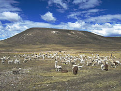 Alpacas grazing on the plateau west of Lagunillas Lake, Santa Rosa District | |
 Flag  Coat of arms | |
| Country | |
| Region | Puno |
| Province | Lampa |
| Founded | April 17, 1936 |
| Capital | |
| Government | |
| • Mayor | Salvador Alejo Tunco |
| Area | |
| • Total | 1,595.67 km2 (616.09 sq mi) |
| Elevation | 4,025 m (13,205 ft) |
| Population (2005 census) | |
| • Total | 8,130 |
| • Density | 5.1/km2 (13/sq mi) |
| Time zone | UTC-5 (PET) |
| UBIGEO | 210709 |
Santa Lucía District is one of ten districts of the province Lampa in Peru.[1]
Geography[]
Some of the highest mountains of the district are listed below:[2]
- Allqamarini
- Anka Wachana
- Awallani
- Hatun Q'asa
- Iru Parki
- Jayu Laqhi
- Jichu Qullu
- Kuntur Puñuna
- Kuntur Uma
- Kuntur Umaña
- Kunturini
- Lluqu
- Mamañawi
- Pirwani
- Puka Punchu
- Puka Salla
- Pukara
- Putusillu
- Phisqa Tira
- Qaqinkurani
- Qina Qutu
- Q'atawini
- Q'iru Pata
- Q'iwiri
- Silla Pata
- Tarujani
- Tisña Quta
- T'ula Uqhu
- Uturunqani
- Wankara
- Wanqarani
- Wiqu Qullu
- Yana Qaqa
- Yanawara
- Yaritani
- Yuraq Qaqa
Ethnic groups[]
The people in the district are mainly indigenous citizens of Quechua descent. Quechua is the language which the majority of the population (56.93%) learnt to speak in childhood, 42.36% of the residents started speaking using the Spanish language (2007 Peru Census).[3]
See also[]
- Lagunillas Lake
- Suyt'uqucha
References[]
- ^ (in Spanish) Instituto Nacional de Estadística e Informática. Banco de Información Distrital Archived 2008-04-23 at the Wayback Machine. Retrieved April 11, 2008.
- ^ escale.minedu.gob.pe - UGEL map of the Lampa Province (Puno Region)
- ^ inei.gob.pe Archived 2013-01-27 at the Wayback Machine INEI, Peru, Censos Nacionales 2007, Frequencias: Preguntas de Población: Idioma o lengua con el que aprendió hablar (in Spanish)
| |
|---|---|
| Azángaro | |
| Carabaya | |
| Chucuito | |
| El Collao |
|
| Huancané | |
| Lampa | |
| Melgar | |
| Moho | |
| Puno | |
| San Antonio de Putina | |
| San Román | |
| Sandia | |
| Yunguyo | |
This Puno Region geography article is a stub. You can help Wikipedia by . |
Coordinates: 15°41′44″S 70°36′33″W / 15.69556°S 70.60917°W

Categories:
- Districts of the Puno Region
- Districts of the Lampa Province
- Puno Region geography stubs