Santo-Pietro-di-Tenda
show This article may be expanded with text translated from the corresponding article in French. (December 2008) Click [show] for important translation instructions. |
Santo-Pietro-di-Tenda
Santu Pietru di Tenda | |
|---|---|
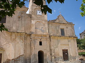 The church in Santo-Pietro-di-Tenda | |
show Location of Santo-Pietro-di-Tenda | |
 Santo-Pietro-di-Tenda | |
| Coordinates: 42°36′17″N 9°15′22″E / 42.60470°N 9.25620°ECoordinates: 42°36′17″N 9°15′22″E / 42.60470°N 9.25620°E | |
| Country | France |
| Region | Corsica |
| Department | Haute-Corse |
| Arrondissement | Calvi |
| Canton | Biguglia-Nebbio |
| Government | |
| • Mayor (2020–2026) | Marc Tomi[1] |
| Area 1 | 125.66 km2 (48.52 sq mi) |
| Population (Jan. 2018)[2] | 353 |
| • Density | 2.8/km2 (7.3/sq mi) |
| Time zone | UTC+01:00 (CET) |
| • Summer (DST) | UTC+02:00 (CEST) |
| INSEE/Postal code | 2B314 /20246 |
| Elevation | 0–869 m (0–2,851 ft) |
| 1 French Land Register data, which excludes lakes, ponds, glaciers > 1 km2 (0.386 sq mi or 247 acres) and river estuaries. | |


Santo-Pietro-di-Tenda is a commune in the Haute-Corse department of France on the island of Corsica.
Population[]
| Year | Pop. | ±% |
|---|---|---|
| 1962 | 523 | — |
| 1968 | 540 | +3.3% |
| 1975 | 316 | −41.5% |
| 1982 | 286 | −9.5% |
| 1990 | 291 | +1.7% |
| 1999 | 332 | +14.1% |
| 2008 | 341 | +2.7% |
See also[]
- Communes of the Haute-Corse department
References[]
- ^ "Répertoire national des élus: les maires". data.gouv.fr, Plateforme ouverte des données publiques françaises (in French). 2 December 2020.
- ^ "Populations légales 2018". INSEE. 28 December 2020.
External links[]
| Wikimedia Commons has media related to Santo-Pietro-di-Tenda. |
| show Communes of the Haute-Corse department |
|---|
| show Authority control |
|---|
This Haute-Corse geographical article is a stub. You can help Wikipedia by . |
Categories:
- Communes of Haute-Corse
- Haute-Corse geography stubs