Saunemin, Illinois
Saunemin, Illinois | |
|---|---|
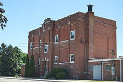 Saunemin Elementary School | |
 Location in Livingston County, Illinois | |
 Saunemin Location in Illinois | |
| Coordinates: 40°53′34″N 88°24′24″W / 40.89278°N 88.40667°WCoordinates: 40°53′34″N 88°24′24″W / 40.89278°N 88.40667°W | |
| Country | |
| State | |
| County | Livingston |
| Township | Saunemin |
| Government | |
| • Village Mayor | Bryce Osborn |
| Area | |
| • Total | 0.23 sq mi (0.60 km2) |
| • Land | 0.23 sq mi (0.60 km2) |
| • Water | 0.00 sq mi (0.01 km2) |
| Elevation | 689 ft (210 m) |
| Population (2010) | |
| • Total | 420 |
| • Estimate (2019)[3] | 404 |
| • Density | 1,748.92/sq mi (674.80/km2) |
| Time zone | UTC-6 (CST) |
| • Summer (DST) | UTC-5 (CDT) |
| ZIP code | 61769 |
| Area codes | 815 & 779 |
| FIPS code | 17-67795 |
| Wikimedia Commons | Saunemin, Illinois |
| Website | www |


Saunemin is a village in Livingston County, Illinois, United States. The population was 420 at the 2010 census.[4] It was named after a Kickapoo chief.
Geography[]
Saunemin is located in eastern Livingston County at 40°53′34″N 88°24′24″W / 40.89278°N 88.40667°W (40.892889, -88.406531).[5] Illinois Route 116 passes through the southern side of the village, leading west 12 miles (19 km) to Pontiac, the county seat, and east 26 miles (42 km) to Ashkum. The village limits extend west along Route 116 to the crossroads with Illinois Route 47, which leads north 15 miles (24 km) to Dwight and south 10 miles (16 km) to Forrest.
According to the 2010 census, Saunemin has a total area of 0.25 square miles (0.65 km2), all land.[6]
Demographics[]
| Historical population | |||
|---|---|---|---|
| Census | Pop. | %± | |
| 1890 | 366 | — | |
| 1900 | 350 | −4.4% | |
| 1910 | 357 | 2.0% | |
| 1920 | 360 | 0.8% | |
| 1930 | 376 | 4.4% | |
| 1940 | 341 | −9.3% | |
| 1950 | 338 | −0.9% | |
| 1960 | 392 | 16.0% | |
| 1970 | 415 | 5.9% | |
| 1980 | 463 | 11.6% | |
| 1990 | 399 | −13.8% | |
| 2000 | 456 | 14.3% | |
| 2010 | 420 | −7.9% | |
| 2019 (est.) | 404 | [3] | −3.8% |
| U.S. Decennial Census[7] | |||
As of the census[8] of 2000, there were 456 people, 155 households, and 121 families residing in the village. The population density was 2,045.9 people per square mile (800.3/km2). There were 167 housing units at an average density of 749.3 per square mile (293.1/km2). The racial makeup of the village was 99.34% White, 0.22% African American, and 0.44% from two or more races. Hispanic or Latino of any race were 1.75% of the population.
There were 155 households, out of which 43.2% had children under the age of 18 living with them, 66.5% were married couples living together, 5.2% had a female householder with no husband present, and 21.9% were non-families. 19.4% of all households were made up of individuals, and 9.7% had someone living alone who was 65 years of age or older. The average household size was 2.94 and the average family size was 3.39.
In the village, the population was spread out, with 33.6% under the age of 18, 7.7% from 18 to 24, 29.6% from 25 to 44, 19.3% from 45 to 64, and 9.9% who were 65 years of age or older. The median age was 32 years. For every 100 females there were 112.1 males. For every 100 females age 18 and over, there were 107.5 males.
The median income for a household in the village was $45,536, and the median income for a family was $46,071. Males had a median income of $35,000 versus $21,591 for females. The per capita income for the village was $15,439. About 5.7% of families and 6.5% of the population were below the poverty line, including 7.3% of those under age 18 and none of those age 65 or over.
Notable people[]
- George S. Brydia, journalist, salesman, and politician,; born in Saunemin[9]
- Albert Cashier, a transgender man who enlisted in the army during the American Civil War; lived and buried in Saunemin
- Arthur R. Falter, businessman and politician[10]
- Ira M. Lish, businessman and politician[11]
Media[]
School scenes from Grandview U.S.A. were shot in and around Saunemin High School, which has since been torn down.
References[]
- ^ "2019 U.S. Gazetteer Files". United States Census Bureau. Retrieved July 14, 2020.
- ^ "USGS detail on Newtown". Retrieved 2007-10-21.
- ^ a b "Population and Housing Unit Estimates". United States Census Bureau. May 24, 2020. Retrieved May 27, 2020.
- ^ "Profile of General Population and Housing Characteristics: 2010 Census Summary File 1 (DP-1), Saunemin village, Illinois". American FactFinder. U.S. Census Bureau. Archived from the original on February 13, 2020. Retrieved January 16, 2020.
- ^ "US Gazetteer files: 2010, 2000, and 1990". United States Census Bureau. 2011-02-12. Retrieved 2011-04-23.
- ^ "G001 - Geographic Identifiers - 2010 Census Summary File 1". United States Census Bureau. Archived from the original on 2020-02-13. Retrieved 2015-12-25.
- ^ "Census of Population and Housing". Census.gov. Retrieved June 4, 2015.
- ^ "U.S. Census website". United States Census Bureau. Retrieved 2008-01-31.
- ^ 'Illinois Blue Book 1963-1964,' Biographical Sketch of George S. Brydia, pg. 272
- ^ 'Illinois Blue Book 1961-1962,' Biographical Sketch of Arthur R. Falter, p. 310-311
- ^ 'Illinois Blue Book 111-1912,' Biographical Sketch of Ira M. Lish, pg. 204-205
External links[]
Municipalities and communities of Livingston County, Illinois, United States | ||
|---|---|---|
| Cities | ||
| Town | ||
| Villages | ||
| Townships | ||
| Unincorporated communities | ||
| Ghost town | ||
| Footnotes | ‡This populated place also has portions in an adjacent county or counties | |
| ||
- Villages in Livingston County, Illinois