Scarborough, Toronto
Scarborough | |
|---|---|
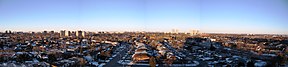
Clockwise from top left: Scarborough City Centre, Bluffers Park, panoramic view of western Scarborough at dawn | |
 Flag  Coat of arms | |
| Nickname(s): "Scarberia", "Scarlem" | |
| Motto(s): Home Above the Bluffs | |
 Interactive map of Scarborough | |
| Coordinates: 43°45′21″N 79°13′51″W / 43.75583°N 79.23083°WCoordinates: 43°45′21″N 79°13′51″W / 43.75583°N 79.23083°W | |
| Country | Canada |
| Province | Ontario |
| Municipality | Toronto |
| Incorporated | January 1, 1850 (township) January 1, 1967 (borough) June 1983 (city) |
| Changed Region | 1954 Metropolitan Toronto from York County |
| Amalgamated | January 1, 1998 into Toronto |
| Government | |
| • Councillors | Ward councillors |
| • MPs | Federal reps |
| • MPPs | Provincial reps |
| Area | |
| • Total | 187.70 km2 (72.47 sq mi) |
| Population | |
| • Total | 632,098 |
| • Density | 3,367.6/km2 (8,722/sq mi) |
| Time zone | UTC−05:00 (EST) |
| • Summer (DST) | UTC−04:00 (EDT) |
| Postal code span | M1(B-X) |
| Area code(s) | 416, 647, and 437 |


Scarborough (/ˈskɑːrbʌroʊ/; 2016 Census 632,098) is an administrative district of Toronto, Ontario, Canada. Situated atop the Scarborough Bluffs, it occupies the eastern part of the city. Scarborough is contained within the borders of Victoria Park Avenue on the west, Steeles Avenue to the north, Rouge River and the city of Pickering to the east, and Lake Ontario to the south. It borders Old Toronto, East York and North York in the west and the city of Markham in the north. Scarborough was named after the English town of Scarborough, North Yorkshire.
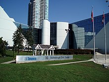
Scarborough, which was first settled by Europeans in the 1790s, has grown from a collection of small rural villages and farms to become fully urbanized with a diverse cultural community. Incorporated in 1850 as a township, Scarborough became part of Metropolitan Toronto in 1953 and was reconstituted as a borough in 1967. Scarborough rapidly developed as a suburb of Toronto over the next decade and became a city in 1983. In 1998, Scarborough and the rest of Metropolitan Toronto were amalgamated into the present city of Toronto. The Scarborough Civic Centre – the former city's last seat of government – is occupied by City of Toronto offices.
Since the end of the Second World War, Scarborough has been a popular destination for new immigrants in Canada. As a result, it is one of the most diverse and multicultural areas in the Greater Toronto Area, being home to various religious groups and places of worship. It includes a number of natural landmarks, including the Toronto Zoo, Rouge Park and the Scarborough Bluffs. The northeast corner of Scarborough is largely rural with some of Toronto’s last remaining farms, earning Scarborough its reputation of being greener than any other part of Toronto.[3]
Etymology[]
The area was named after the English town of Scarborough by Elizabeth Simcoe, the wife of John Graves Simcoe, the first lieutenant governor of Upper Canada.[4] The bluffs along Scarborough's Lake Ontario shores reminded her of the limestone cliffs in Scarborough, England. On August 4, 1793, she wrote in her diary, "The shore is extremely bold, and has the appearance of chalk cliffs, but I believe they are only white sand. They appeared so well that we talked of building a summer residence there and calling it Scarborough."[5] Before that, the area was named Glasgow, after the Scottish city.[6]
Scarborough has acquired several nicknames. A popular one is Scarberia, a portmanteau of Scarborough and Siberia, a reference to its seemingly distant eastern location from downtown Toronto and apparent lack of notable attractions.[7][8] The word originated sometime in the 1960s and has remained a source of contention ever since. In May 1988, Joyce Trimmer, who was campaigning to be mayor of the city of Scarborough, said, "The city of Scarborough needs strong leadership if it is to shed its 'Scarberia' image".[9] With the increased popularity of social media, ScarbTO has become a popular online signifier of the community. Scarborough has also acquired nicknames related to its diversity. Such nicknames typically use the prefix "Scar" and a suffix derived from the name of a region, nation, or ethnicity; for instance, "Scompton" or "Scarlem", alluding to Compton and Harlem respectively.[10]
History[]

The first known evidence of people in Scarborough comes from an archaeological site in Fenwood Heights, which has been dated to 8000 BCE.[11] The site contains the remains of a camp of nomadic hunters and foragers, and there is no evidence of permanent settlers.[11]
In the 17th century, the area was inhabited by the Seneca at the village of Ganatsekwyagon.[12] They were later displaced by the Mississaugas, who were themselves displaced by the European settlers who began to arrive in the late 18th century. After the land was surveyed in 1793, it was opened to settlement by British subjects with the first issue of land patents in 1796, although squatters had already been present for a few years. The first settlers were David and Andrew Thomson. They were stonemasons who worked on the first parliament buildings for York. They each built mills. This activity led to the creation of a small village known as the Thomson Settlement.[13] The first post office opened in 1832, in Scarborough Village.[14]
During the early part of life in Upper Canada, local administration and justice was administered by the colonial government. From 1792 to 1841, magistrates were appointed by District Councils. There were four districts in the colony of which Scarborough was part of the Home District. Partly due to a political reorganization that was a result of the Durham Report, Scarborough gained elected representation on the Home District Council. Scarborough elected two councillors.[15]
In 1850, Scarborough was incorporated as a township.[16] After incorporation, Scarborough government was led by a reeve, a deputy-reeve and three councillors, each elected annually.[17] Initially the council met in the village of Woburn but it was relocated to Birch Cliff in 1922, where most of the population was then located. During the Great Depression the local government was on the verge of bankruptcy. The Ontario Municipal Board stepped in and appointed an oversight committee which prevented the collapse of local government.[15]
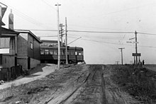
The expansion of Toronto in the east, in the 19th century, led to the development of housing stock along the Kingston Road and Danforth Road corridors in Scarborough. This led to the creation of a transit line. In 1893, the Toronto and Scarboro' Electric Railway, Light and Power Company built a single-track radial line along Kingston Road to Blantyre. Over the next 13 years this was extended to West Hill. In 1904, the line became the Scarboro Division of the Toronto and York Radial Railway. Service continued along this line until 1936 when it was replaced by bus service.[15]
On April 15, 1953, Scarborough was included within Metropolitan Toronto, a new upper level of municipal government with jurisdiction over regional services such as arterial roads and transit, police, and ambulance services. (Fire fighting services remained separate.) Scarborough retained its local council but gained representation on a new Metro Council. The new council had 24 members, 12 from the old city of Toronto and 12 from the suburban municipalities. The council was not directly elected but was made up of members of each of the local councils. Scarborough's contribution was its reeve who at the time was Oliver E. Crockford.[15]
In 1967, Scarborough was incorporated as a borough. The reeve was replaced with a mayor. Albert Campbell, who had been reeve since 1957, became Scarborough's first mayor. The new borough's council consisted of the mayor and four members of the board of control (which functioned as an executive committee). There were also ten aldermen. The mayor and the controllers also sat on Metro Council. In 1973, Scarborough increased in size when the West Rouge area, formerly within the Township of Pickering, was transferred to it with the creation of the Regional Municipality of Durham. The borough's status was changed to city in 1983. The number of aldermen was increased to 14 and the term of office extended to three years from two.[15]

As the urban area continued to expand, much of rural Scarborough was converted to suburban housing developments in the last third of the 20th century. At the start of the 21st century, growth occurred along the Highway 401 corridor at the northern end of the Scarborough RT; highrise condominium projects have increased the residential density around Scarborough City Centre.[14]
In 1988, there was a reorganization. The board of control was abolished. Alderman was changed to councillor. Six additional metro council positions were created and these were elected separately for the first time. Scarborough's council consisted of a mayor, 14 local councillors and six Metro councillors.[15]
In 1998, Scarborough was amalgamated with North York, Etobicoke, York, East York and the old city of Toronto to become the new city of Toronto.
Coat of arms[]

The coat of arms of Scarborough was adopted when the borough became a city on June 29, 1983. A grant of arms was issued by the Canadian Heraldic Authority on February 1, 1996.[18]
Blazon[]
Arms[]
- Or a columbine flower and a chief embattled Azure issuant from the upper chief a demi-sun Or;[18]
Crest[]
- Issuant from a coronet heightened with four ears of corn (one and two-halves visible) alternating with four millstones (two visible) Or a maple leaf Gules;
Supporters[]
- Two stags Or attired and unguled Azure each gorged with a collar of braid Gules Argent and Azure standing upon a representation of the Scarborough Bluffs proper rising above the waters of Lake Ontario Azure and Argent;
Motto[]
- HOME ABOVE THE BLUFFS
Prior arms[]
The previous coat of arms of Scarborough had a shield within a laurel wreath.[19] Upon this shield were the following elements, in quarters:
- The arms of the province of Ontario
- A sheaf of wheat
- Two cog wheels and a factory
- A view of the Scarborough Bluffs
Geography[]

Scarborough's borders are Victoria Park Avenue (North York, East York, and Old Toronto) to the west, the Rouge River, the Little Rouge Creek and the Scarborough-Pickering Townline (Pickering) to the east, Steeles Avenue (Markham) to the north, and Lake Ontario to the south.[20]
Topographically, Scarborough is dominated by two watersheds, Highland Creek and the Rouge River. Highland Creek lies almost entirely within Scarborough and occupies approximately 70% of its total area. It occupies the western half of Scarborough, while the Rouge River flows through the eastern portion. Both of these rivers flow into Lake Ontario on Scarborough's shore.[21] Due to the location of the Lakeshore CN railway right-of-way, both river deltas are constricted to narrow channels where they flow into the lake.
Highland Creek is the most urbanized watershed in the Toronto area without about 85% of its land use devoted to urban uses.[22] Some sections of the river run through parks and remain in a fairly natural state, while other parts run through industrial or residential districts where the flow is often diverted or channelled. Sections of the creek are marked by deep ravines and valleys, which contain little or no urban development. The deep valley the creek cuts in its bottom sections remains primarily parkland, with little or no development taking place within the valley.
Conversely, the Rouge River Valley, parts of which are still in a natural, wooded state. The valley is home to a great variety of wildlife including deer, foxes, and the occasional coyote, while the river hosts salmon and catfish.[23] The Rouge River Valley forms a part of Rouge National Urban Park, a national urban park situated along the eastern portion of Scarborough, and its neighbouring municipalities.
Scarborough is home to an earthen escarpment formation known as the Scarborough Bluffs. The Bluffs can be found along the shore of Lake Ontario, stretching about 14 kilometres (8.7 mi), and reaching heights of more than 60 metres (200 ft) in places. They are part of a much larger formation known as the Iroquois Shoreline, most of which is located somewhat further inland. The Iroquois Shoreline marks the extent of a prehistoric lake, Glacial Lake Iroquois, whose level was quite a bit higher than present-day Lake Ontario's. It shrank in size at the close of the last ice age.[24]
Erosion has been a problem along the Scarborough Bluffs. Properties located near the brink have been abandoned, and houses condemned, as the brink wears back away from the lake. Since the 1980s, large areas of beach at the base of the Bluffs have been reinforced with limestone breakwaters and construction rubble infilling.[25]

Climate[]
Scarborough's climate is moderate for Canada due to its southerly location within the country and its proximity to Lake Ontario. It has a humid continental climate (Köppen climate classification Dfa/Dfb), with warm, humid summers and generally cold winters. Mean temperature and precipitation tends to be slightly lower than the downtown core or south Etobicoke for instance, due in part to the weather station being farther from the moderating influence of the lake and also because of its more northeast location. Conditions vary based on proximity to the lake, with fog more common in the south and areas close to the lake noticeably cooler on hot summer days.[26]
| Climate data for Scarborough (Malvern) 1981−2010 | |||||||||||||
|---|---|---|---|---|---|---|---|---|---|---|---|---|---|
| Month | Jan | Feb | Mar | Apr | May | Jun | Jul | Aug | Sep | Oct | Nov | Dec | Year |
| Record high °C (°F) | 13.0 (55.4) |
14.4 (57.9) |
23.5 (74.3) |
31.5 (88.7) |
32.5 (90.5) |
35.5 (95.9) |
37.5 (99.5) |
35.5 (95.9) |
34.5 (94.1) |
25.5 (77.9) |
22.8 (73.0) |
19.5 (67.1) |
37.5 (99.5) |
| Average high °C (°F) | −2 (28) |
−0.9 (30.4) |
3.8 (38.8) |
11.3 (52.3) |
18.5 (65.3) |
23.3 (73.9) |
26.6 (79.9) |
25.2 (77.4) |
20.3 (68.5) |
13.4 (56.1) |
6.7 (44.1) |
0.7 (33.3) |
12.2 (54.0) |
| Daily mean °C (°F) | −5.5 (22.1) |
−4.4 (24.1) |
−0.3 (31.5) |
7.0 (44.6) |
13.4 (56.1) |
18.2 (64.8) |
21.6 (70.9) |
20.4 (68.7) |
15.9 (60.6) |
9.3 (48.7) |
3.4 (38.1) |
−2.4 (27.7) |
8.1 (46.6) |
| Average low °C (°F) | −9 (16) |
−7.9 (17.8) |
−4.3 (24.3) |
2.5 (36.5) |
8.3 (46.9) |
13.0 (55.4) |
16.6 (61.9) |
15.7 (60.3) |
11.5 (52.7) |
5.2 (41.4) |
0.2 (32.4) |
−5.5 (22.1) |
3.9 (39.0) |
| Record low °C (°F) | −31.5 (−24.7) |
−27.5 (−17.5) |
−21.5 (−6.7) |
−11.5 (11.3) |
−2.5 (27.5) |
3.0 (37.4) |
8.5 (47.3) |
5.0 (41.0) |
−1 (30) |
−5.6 (21.9) |
−14 (7) |
−29 (−20) |
−31.5 (−24.7) |
| Average precipitation mm (inches) | 51.8 (2.04) |
56.1 (2.21) |
57.8 (2.28) |
72.9 (2.87) |
78.4 (3.09) |
67.2 (2.65) |
71.8 (2.83) |
91.6 (3.61) |
95.6 (3.76) |
78.1 (3.07) |
95.1 (3.74) |
75.7 (2.98) |
892.0 (35.12) |
| Average rainfall mm (inches) | 21.1 (0.83) |
26.6 (1.05) |
43.3 (1.70) |
70.0 (2.76) |
78.4 (3.09) |
67.2 (2.65) |
71.8 (2.83) |
91.6 (3.61) |
95.6 (3.76) |
77.7 (3.06) |
87.4 (3.44) |
42.0 (1.65) |
772.6 (30.42) |
| Average snowfall cm (inches) | 30.7 (12.1) |
29.5 (11.6) |
14.5 (5.7) |
3.0 (1.2) |
0.0 (0.0) |
0.0 (0.0) |
0.0 (0.0) |
0.0 (0.0) |
0.0 (0.0) |
0.38 (0.15) |
7.7 (3.0) |
33.7 (13.3) |
119.4 (47.0) |
| Average precipitation days (≥ 0.2 mm) | 13.9 | 11.3 | 12.4 | 14.0 | 13.1 | 11.3 | 10.6 | 10.1 | 11.8 | 13.8 | 13.9 | 13.9 | 150.0 |
| Average rainy days (≥ 0.2 mm) | 4.9 | 4.1 | 8.5 | 12.5 | 13.1 | 11.3 | 10.6 | 10.1 | 11.8 | 13.8 | 12.6 | 7.4 | 120.6 |
| Average snowy days (≥ 0.2 cm) | 9.9 | 8.5 | 5.6 | 2.2 | 0.0 | 0.0 | 0.0 | 0.0 | 0.0 | 0.33 | 2.5 | 9.2 | 38.2 |
| Source: Environment Canada[27] | |||||||||||||
Demographics[]

The vast majority of Scarborough's population is composed of immigrants who have arrived in the last five decades, and their descendants. In 2016, 56.6% of residents were foreign-born.[28][29][30][31][32][33] Visible minorities make up 73.4% of the population.[34][35][36][37][38]
The immigrant population has created vibrant multicultural locales in various areas of Scarborough. One of the more notable among these is the heavy concentration of Chinese businesses and restaurants in the Agincourt neighbourhood. Many of Scarborough's main arteries, including segments of Kingston Road, Eglinton Avenue East and Lawrence Avenue East, feature Caribbean, Chinese, African, and Indian restaurants and shops, as well as businesses representing the other ethnic groups in the area. Scarborough also has the largest concentration of Sri Lankan Tamils outside Sri Lanka.[1]
In terms of religion, there were 280,330 Christians (49.1%), 75,325 Hindus (13.1%) and 60,425 Muslims (10.5%) residing in Scarborough according to the 2011 National Household Survey.[39]
The majority of Scarborough's population is between 25 and 64 years old.[40] 52% fell into that "working age" during the last major survey, which also found 21% of Scarborough's population was 14 years old or younger, 15% were between 15 and 24, while senior citizens aged 65+ made up the remaining 12%.[40] Like the rest of Canada, Scarborough's population is aging. It is projected that close to 30% of Scarborough residents will be senior citizens by 2041.[41] This had made Scarborough a popular location for retirement communities,[42][43] which attracts more seniors to the area creating a situation where the two largest age demographics in Scarborough will be over 55 and under 25.[44]
| Ethnic groups in Scarborough (2016) Source: [1][2][3][4][5][6] |
Population | % | |
|---|---|---|---|
| Ethnic group | European | 167,215 | 26.8% |
| South Asian | 158,275 | 25.4% | |
| East Asian | 122,585 | 19.7% | |
| Black | 67,250 | 10.8% | |
| Southeast Asian | 57,070 | 9.2% | |
| Middle Eastern | 18,430 | 3% | |
| Latin American | 8,045 | 1.3% | |
| Aboriginal | 7,065 | 1.1% | |
| Other | 26,100 | 4.2% | |
| Total population | 632,098 | 100% | |
As of the 2016 census, Asians (both immigrants from the continent of Asia and their Canadian-born descendants) make up the majority of the population at 55.6%.[45]
Crime[]
Long term trends show that Scarborough is less prone to violent crime than the rest of Toronto. Between 1997 and 2006, the proportion of violent crime committed in Scarborough averaged 20.4% despite its making up on average 23.6% of the city's total population over that period.[46] Murder rates for Scarborough and Toronto show no particular trend. Between 1997 and 2006, the ratio of murders in Scarborough as compared to the rest of Toronto ranged from a low of 8.8% to a high of 32.2%.[47] According to former Toronto Police Chief Bill Blair, "[42 Division is] the safest division in the city"; this division includes north Scarborough.[48] The safest part of Toronto is north Scarborough from Victoria Park Ave. to the Pickering border, north of Highway 401.[48]
In 2008, councillors Norm Kelly and Michael Thompson argued that the media was distorting how crime was reported in Scarborough. They noted that whenever a shooting occurred in the rest of the city the location was given as the nearest major intersection, while when a shooting happened in Scarborough the location was given as 'Scarborough'. According to the councillors, this gave people an erroneous impression of Scarborough as 'crime-ridden'. They proposed that news outlets sign a 'media protocol' so that all crime locations were given as intersections. However, the city's Executive Committee turned down the request citing this as a form of censorship. Mayor David Miller said "It’s not city council’s role to tell the media how to do their job".[49][50]
Economy[]

Scarborough is a former borough of the former Metropolitan Toronto, and as such, its economy is an integral component of the economy of Toronto. Compared to the City of Toronto as a whole, industry in Scarborough is similar in all labour force categories, save for manufacturing which is higher in Scarborough, and professional, scientific and technical services which are lower.[51] Notable companies that have their headquarters in Scarborough include Toyota Canada, Owens Corning (Toronto), , Enterprise Holdings, Inc., Thomson Carswell, Bell Media, Teva Canada, Cinram, Royal Doulton, SKF, Amphenol, Dart Canada, Mastermind Toys, Alfa Laval, President's Choice Financial, Aviva, Yellow Pages Group, Telus, and Lee Kum Kee Canada.[52][53] The pizza chains 241 Pizza and Pizza Nova have their headquarters in Scarborough.[54][55] Amazon will open a new fulfillment centre in north Scarborough in 2020.[56] Large companies that have moved out of Scarborough include: General Motors Canada Van Assembly plant (1993) and Eli Lilly Canada (2019).
Several points of attraction exist in the western portion of Scarborough City Centre, between McCowan and the Midland stations. Points of interest in that area include Scarborough Town Centre, Albert Campbell Square, Canadian government buildings and office towers. The area has become one of Toronto's new secondary business districts outside of Downtown Toronto.[57]
Culture[]
Most of the Scarborough-based news media have been either weekly or monthly publications. The earliest newspaper was the Scarborough News and Advertiser which was published weekly starting in September 1921, which lasted until the 1930s. Other short-lived papers and magazines included The Enterprise (1945–1966), Scarborough Mail (1946–1955) and The News (1952–1996) and 54east magazine (2005–2009). The only remaining English-language local newspaper is the Scarborough Mirror, which started publication in 1962 and was later acquired by the Toronto Star's community news division, Metroland. A Scarborough edition of the Toronto-wide photography publication SNAP Scarborough was launched in 2009. Ming Pao Daily News is a Chinese-language newspaper whose headquarters are in Scarborough. They started publication in 1993.[15]
The headquarters of CTV Toronto and TSN are in the Agincourt neighbourhood, near the intersection of McCowan Road and Highway 401.
In 1970, Trillium Cable started to provide cable TV service to Scarborough. It was purchased by Shaw Cable in 1995. During the early days of the company, they produced several local shows for their own cable channel. These shows were produced by volunteers and showed a wide variation in quality. These shows were satirized by Mike Myers in his comedy film Wayne's World.[15]
Scarborough residents have developed their own unique sense of humour, as evidenced by Myers, whose Wayne's World character was inspired by growing up in the area.[58] Other Scarborough natives include Lilly Singh, Eric McCormack[58] (Will & Grace), John Candy[58] (Second City, SCTV), musical group Barenaked Ladies and the R&B/Hip Hop singer Abel Tesfaye known as The Weeknd. Actor Jim Carrey also lived in Scarborough during his teen years.[58] Scarborough has also been the home of prominent hip hop artists, including Maestro Fresh Wes, Choclair, Kardinal Offishall, Saukrates, and the group BrassMunk.[59] Scarborough has also produced athletes that excel in various sports like Andre De Grasse, Dwayne De Rosario, Rowan Barret, Anson Carter, Jamal Magloire, and Paul Tracy.
According to the list of largest shopping malls in Canada, the Scarborough Town Centre is the tenth largest in the country and the fourth largest in the GTA. It is located next to the Scarborough Civic Centre, Albert Campbell Square, and Consilium Place. This area was developed as a city centre under the old City of Scarborough government. The Scarborough Walk of Fame is also located in the Town Centre, consisting of plaques embedded in the floor to honour notable residents, past and current. The inaugural inductees included National Basketball Association player Jamaal Magloire, Olympic gold medalist Vicky Sunohara, and eight prominent residents who contributed to advances in medicine, arts, and the community.[60]
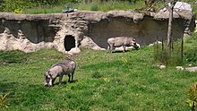
In 1974, the Toronto Zoo was moved from its original downtown location to its current location in the Rouge River valley. The new location enabled the zoo to increase its overall area from 3 hectares (7.4 acres) to over 300 hectares (740 acres). The zoo was transformed at that time from a 19th-century zoo with a few animals cramped behind iron bars into a zoo where space was provided to animals and the setting attempted to duplicate the animals' natural environments.[61]
The topography of Scarborough has provided the area with an abundance of golf courses. There is a mix of public and private courses. Dentonia Park is a public course established in 1967 and is situated in the Taylor-Massey Creek ravine beside the Victoria Park subway station.[62] Formerly a private club, the Tam O'Shanter Golf Course was established in 1973 as a public course and is located alongside Highland Creek.[62] Private clubs include the Toronto Hunt Club which was the first golf course in Scarborough, established in 1895 alongside Lake Ontario.[63] and the Scarboro Golf and Country Club was established in 1912.[64] The Cedarbrae Golf & Country Club was established in 1922 and moved to its current Rouge River Valley location at Steeles Ave East in 1954.[65]
On May 17, 2006, the Nike Malvern Sports Complex was opened in the Malvern neighbourhood. Nike Canada donated $500,000 to build the complex, which includes a basketball court, a practice soccer pitch, and a running track. The track was constructed from 50,000 used running shoes. The complex was built on the grounds of the St. Mother Teresa Catholic Academy and is open to the public. Olympic hurdler Perdita Felicien was on hand at the opening to encourage youth to participate in sports.[66]

Scarborough is one of the prominent destinations for Sri Lankan Tamils in the Greater Toronto Area, who came from Sri Lanka during the civil war. Efforts to integrate Sri Lankan Tamil culture include establishing cross-cultural and cross-national alliances and the building of many Tamil schools across the GTA.[67][68]
Scarborough is home to several local arts organizations. Scarborough Worldwide Film Festival is an annual celebration of multicultural films held every first week of June. , Scarborough Players, and Scarborough Theatre Guild work together under the name Theatre Scarborough. The Scarborough Choral Society performs one full-scale musical and a Christmas concert each year.
Education[]
Four public school boards operate primary and secondary institutions in Scarborough, Conseil scolaire catholique MonAvenir (CSCM), Conseil scolaire Viamonde (CSV), the Toronto Catholic District School Board (TCDSB), and the Toronto District School Board (TDSB). CSV and TDSB operate as secular public school boards, the former operating French first language institution, whereas the latter operated English first language institutions. The other two school boards, CSCM and TCDSB, operate as public separate school boards, the former operating French first language separate schools, the latter operating English first language separate schools.
In addition to primary and secondary schools, two post-secondary institutions were established in Scarborough. The University of Toronto expanded in 1964 and built the University of Toronto Scarborough, which has an enrolment of 10,000 students as of 2006.[69] Centennial College was opened in 1966. It was the first vocational college to open in Ontario. Starting from one campus in Warden Woods, it grew to three campuses across Scarborough (and two others located in East York and North York).
Scarborough's first schoolhouse opened in 1805 on the Thomson farmstead. In 1847 Egerton Ryerson recommended that 11 school districts be created. By 1904, 28 schools had been built throughout the township. In 1914, Agincourt Continuation School offered education from up to grade 12.[15]
Both Agincourt Collegiate Institute and R. H. King Academy claim to be the oldest secondary schools in Scarborough. Agincourt Collegiate Institute opened in 1915[70] as the Agincourt Continuation School. It became a high school in 1954. R. H. King Academy opened in 1922 as the Scarborough High School being the first high school for in the Scarborough area at that time and became a collegiate in 1930.[71]
In 1954, the Scarborough Board of Education was established to operate the English-language, secular public schools in Scarborough. In 1998, the board was merged with the other Metro boards to form the Toronto District School Board. As of 2008, there are 28 secondary schools in Scarborough.[72] In 1953, the Metropolitan Separate School Board, now known as the Toronto Catholic District School Board was formed to operate public anglophone separate schools in Metropolitan Toronto. As of 2013, Scarborough's Mary Ward Catholic Secondary School is one of two self-directed learning schools in Ontario, and one of seven in Canada.
Governance[]
From the incorporation of Scarborough as a township in 1850, the head of the local government was a reeve who chaired the town council. In 1953, Scarborough and twelve other townships, towns, and villages in York County federated with the City of Toronto to form Metropolitan Toronto. Scarborough retained its own town council but an added layer of government, the Metropolitan Toronto Council, with the reeve of Scarborough having a seat. In 1967, Scarborough was incorporated as borough at which point the head of the local government was styled as mayor. A Board of Control, consisting of the mayor and four directly elected Controllers, was also created as an executive committee of Scarborough's council, whose members also sat on Metro Council. In 1983, Scarborough attained city status, but its governing structure remained the same. In 1988, the Board of Control was abolished.[16][17][15][73]
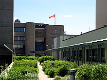
In 1998, the municipalities of Metropolitan Toronto were amalgamated into a single City of Toronto. Since 1998, Scarborough has been a community within the city of Toronto, and the head of the local government is the Mayor of Toronto and governed by Toronto City Council, though the members of city council elected from Scarborough also meet as a community council, which reports to Toronto City Council but has final decision-making power on certain items, such as front yard parking and appointments to local boards and Business Improvement Areas.[74] Since 1973, meetings of the Borough Council, then the Scarborough City Council, and now the Scarborough Community Council occur at the Scarborough Civic Centre, which functioned as Scarborough's city hall, until amalgamation.
Scarborough is represented by five ridings for the provincial government and five full ridings plus one partial riding for the Federal government. The Federal riding of Pickering—Scarborough East straddles the border between Scarborough and Pickering. Municipal riding boundaries were harmonized within the City of Toronto to match the provincial boundaries in 1999 through provincial legislation called The Fewer Municipal Politicians Act of 1999. This took effect on December 1, 2000.[75] Each provincial riding is represented by one city councillor. Thus Scarborough is represented by five councillors.
After amalgamation with Toronto, community councils were formed to process issues considered local to their community.[76] Scarborough's community council, made up of Scarborough's five councillors, meets once a month at the former offices of the city of Scarborough just south of the Scarborough Town Centre. The council deals with a variety of local issues such as outdoor patio applications, neighbourhood traffic plans, and exemptions from certain by-laws such as retail signs, fences, trees and ravines.[77] Decisions made by community council are approved by Toronto City Council in order to take effect.[78]
Infrastructure[]
Public transit[]

Public transportation in Scarborough is primarily provided by the Toronto Transit Commission (TTC), operating bus and rapid transit routes in the district.
Scarborough is at the eastern terminus of Line 2 Bloor–Danforth of the Toronto subway system. There are three subway stations in Scarborough: Victoria Park, Warden, and Kennedy. Beginning at Kennedy station, Line 3 Scarborough, also known as the Scarborough RT, runs north and east toward Scarborough City Centre. It runs at grade for two stops until Ellesmere Road where it becomes elevated until it reaches its terminus at McCowan Road. Feeding the rapid transit stations are the extensive bus routes operated by the Toronto Transit Commission (TTC) in Scarborough.
The extension of Line 2 started in June 2021 and is expected to be complete around 2030. The line will be extended 7.8 kilometres and will include three new stations from the existing Kennedy station to McCowan Road and Sheppard Avenue. Line 3 is planned to be decommissioned in 2023.[79] Line 5 Eglinton is a light rail line under construction, which will have its eastern terminus at Kennedy station.
Other public transportation services that operate in Scarborough includes GO Transit, and York Region Transit. These services may be accessed at GO Transit stations. Seven of these stations also provide access to two commuter rail lines operated by GO Transit. The Lakeshore East line runs across the south end of the district, while the Stouffville line runs north-south in the west end of Scarborough. GO Transit also has a few bus terminals and stops in Scarborough.
Roads and highways[]
The arterial roads of Scarborough were laid out on a grid system of north–south and east–west. Kingston Road and Danforth Road were laid out prior to the surveying of the township, and both run diagonally in a southwest–northeast direction across the south end of Scarborough. From north to south, the major east–west arterial roads are Steeles Avenue, Finch Avenue, Sheppard Avenue, Ellesmere Road, Lawrence Avenue, Eglinton Avenue and St. Clair Avenue. From west to east, the major north–south arterial roads are Victoria Park Avenue, Pharmacy Avenue, Warden Avenue, Birchmount Road, Kennedy Road, Midland Avenue, Brimley Road, McCowan Road, Bellamy Road North, Markham Road, Neilson Road, Morningside Avenue, Meadowvale Road and Port Union Road.[80]
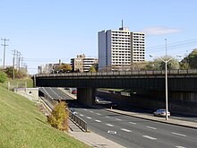
Kingston Road was formerly Ontario Highway 2, and was the main highway through Scarborough until the building of the Highway 401, which runs east–west across the middle of Scarborough, with six to eight lanes in each direction. The short, minor freeway Highway 2A runs parallel to Lake Ontario in the eastern part of Scarborough. In the 1960s, Metropolitan Toronto planned to build a second east–west highway across Scarborough. It was intended to link Highway 2A with an eastern extension of the Gardiner Expressway. The highway, known as the Scarborough Expressway, was cancelled due to public opposition.
Water, sewage and hydro[]

Scarborough's drinking water is supplied by the R.C. Harris Filtration Plant at the foot of Victoria Park Avenue and the F. J. Horgan Filtration Plant.[81] The F. J. Horgan Filtration Plant was built in 1979 and was formerly known as the 'Easterly Plant'. Upgrades completed in 2011 allow it to process up to 800 megalitres per day and it will also be the first plant to replace chlorine with ozone as its primary cleansing method.[82][83] Wastewater for Scarborough is treated at the Highland Creek Water Pollution Control Plant. This plant was constructed in 1954 and started processing in 1956. It has undergone continual expansion to meet ongoing demand.[81] Electricity is mainly provided in Scarborough by Toronto Hydro.
Solid waste[]
Early garbage collection in Scarborough was performed by individual communities and dumped in local landfills which were located in nearby ravines. In 1967 waste collection was reorganized. Local landfills were closed and most of the garbage was directed to a new landfill on Beare Road in eastern Scarborough. This dump was eventually closed in 1981. A waste transfer site was constructed near Markham Road and Sheppard Avenue East. From there garbage was trucked to the Keele Valley dump in Vaughan and the Brock Road dump in Pickering.[15] In 2002 the Keele Valley landfill was closed. As part of Toronto's overall waste management, garbage was then trucked to Michigan. This arrangement lasted until 2010 when garbage was sent to the new Green Lane landfill site in Elgin County.
See also[]
- List of reeves and mayors of Scarborough, Ontario
- Scarborough Board of Control
- List of neighbourhoods in Scarborough
- McClure radioactive site
References[]
Notes[]
- ^ Population calculated by combining the populations of the six proposed Federal ridings.
Citations[]
- ^ a b c "2001 Community Profiles". Statistics Canada. Retrieved April 10, 2008.
- ^ "Proposed Boundaries-Ontario". Government of Canada. 2012.
- ^ Kuitenbrouwer, Peter (July 8, 2006). "How green is my city?". National Post. Retrieved July 19, 2006.
- ^ Welch, Deborah; Payne, Michael (November 14, 2019). "Scarborough". The Canadian Encyclopedia. Retrieved November 16, 2019.
- ^ "Travels with Elizabeth Simcoe". Ministry of Government and Consumer Services (Ontario). Archived from the original on August 2, 2007.
- ^ "Scarborough Historical Society". Scarborough Historical Society. Archived from the original on August 13, 2007. Retrieved August 23, 2007.
- ^ DiManno, Rosie (January 15, 2007). "A cheeky look at the rump of Toronto: Shhh on the S-word, coupled with crime, councillors say". Toronto Star.
- ^ "Scarberia, Scarlem, Scareborough?". blogto.com.
- ^ Fulford, Robert (March 1996). Accidental City: The Transformation of Toronto. Houghton Mifflin. p. 112. ISBN 978-0-395-77307-9.
- ^ Brown, Maureen (March 31, 2003). "Growing up black in Oakville" (PDF). Community Development Halton. Retrieved June 15, 2006.
- ^ a b McCowan, Bruce (March 23, 1995). "Scarborough Fair: The first settlers foraged 10,000 years ago". Toronto Star. p. SC. 2.
- ^ "Native and Newcomers, 1600–1793". City of Toronto government. July 14, 2017. Archived from the original on March 6, 2007.
- ^ Thomson Settlement. Toronto Historical Plaque. Toronto Historical Plaques
- ^ a b "Scarborough History". Stand Up Scarborough. Archived from the original on March 12, 2008.
- ^ a b c d e f g h i j k l Schofield, Richard; Meredyth Schofield; Karen Whynot (1996). Scarboro: Then and Now. Scarborough: Scarborough Board of Education, Scarborough Historical Society.
- ^ a b "Scarborough Records". City of Toronto. August 24, 2017. Archived from the original on March 28, 2007.
- ^ a b "Scarborough Community Names". Scarborough Historical Society. Archived from the original on April 12, 2008. Retrieved May 11, 2008.
- ^ a b "Public Register of Arms, Flags, and Badges of Canada". Retrieved December 29, 2012.
- ^ Scarborough arms image
- ^ "Map of Slo-Pitch Parks& Slo-Pitch Diamonds". Slopitch 1. Archived from the original on April 16, 2008. Retrieved April 21, 2008.
- ^ "Watershed Strategies". Toronto and Region Conservation Authority. Archived from the original on January 7, 2008. Retrieved May 11, 2008.
- ^ "Highland Creek Watershed". Toronto and Region Conservation Authority. 2015.
- ^ "For Buyers". Toronto Real Estate. Archived from the original on February 5, 2007.
- ^ Eyles, Nick. Ontario Rocks: Three Billion Years of Environmental Change. Markham, Ontario: Fitzhenry & Whiteside. p. 339.
- ^ "Lakeshores Old and New". Natural Resources Canada. Archived from the original on July 13, 2007.
- ^ Canadian climate normals for 1971 to 2000, Environment Canada (2004). Retrieved on December 17, 2006.
- ^ "Toronto Malvern, Ontario". Canadian Climate Normals 1981–2010. Environment Canada. Archived from the original on July 17, 2020. Retrieved October 28, 2013.
- ^ "Immigrant status and period of immigration". Statistics Canada. Retrieved July 6, 2021.
- ^ "Immigrant status and period of immigration". Statistics Canada. Retrieved July 6, 2021.
- ^ "Immigrant status and period of immigration". Statistics Canada. Retrieved July 6, 2021.
- ^ "Immigrant status and period of immigration". Statistics Canada. Retrieved July 6, 2021.
- ^ "Immigrant status and period of immigration". Statistics Canada. Retrieved July 6, 2021.
- ^ "Immigrant status and period of immigration". Statistics Canada. Retrieved July 6, 2021.
- ^ "Visible minority population". Statistics Canada. Retrieved July 6, 2021.
- ^ "Visible minority population". Statistics Canada. Retrieved July 6, 2021.
- ^ "Visible minority population". Statistics Canada. Retrieved July 6, 2021.
- ^ "Visible minority population". Statistics Canada. Retrieved July 6, 2021.
- ^ "Visible minority population". Statistics Canada. Retrieved July 6, 2021.
- ^ "NHS Profile". Statistics Canada. October 15, 2013. Retrieved April 21, 2015.
- ^ a b "City of Toronto Neighbourhood Profiles:Scarborough" (PDF). toronto.ca. City Of Toronto. Retrieved November 20, 2015.
- ^ "Regional Age Structure". Ontario Population Projections. Government Of Ontario. Retrieved November 20, 2015.
- ^ "Trinity Ravine Towers Toronto's Newest 55 Plus Christian Lifestyle Community". Trinity Ravine Towers. Global Kingdom Ministries. Retrieved November 20, 2015.
- ^ "Scarborough Retirement Homes & Communities For Seniors". Comfort Life. Our Kids Media. Retrieved November 20, 2015.
- ^ "With Hiring Scarborough Renews Focus On Seniors And Youth". Keep Me Current. Keep Me Current. Archived from the original on November 22, 2015. Retrieved November 20, 2015.
- ^ https://www.toronto.ca/wp-content/uploads/2018/05/8f80-City_Planning_2016_Census_Profile_2014_Wards_CCA_Scarborough.pdf
- ^ Toronto Police Service. Year-to-date Statistics, 1997-2006. Data for violent crime was summarized for 1st and 2nd degree murder, manslaughter, attempted murder, sexual assaults, and all other assaults and totaled for Divisions 41, 42, and 43. Toronto Police Service YTD Stats
- ^ Toronto Police Service. Year-to-date Statistics, 1997-2006. Data for murder was summarized for 1st and 2nd degree murder and totaled for Divisions 41, 42, and 43. Toronto Police Service YTD Stats
- ^ a b Milley, Danielle (April 16, 2008). "Police bring message of safety to 42 Division meeting". Daily Mirror. Archived from the original on June 9, 2008. Retrieved April 28, 2008.
- ^ "Scarborough Tries To Clear Its "Crime" Rep". CityNews. Archived from the original on January 8, 2009. Retrieved May 16, 2008.
- ^ Chris Richardson. "A Tale of Two Scarboroughs" (PDF). The Ryersonian. Archived from the original (PDF) on May 29, 2008. Retrieved May 16, 2008.
- ^ "City of Toronto's community economic profile for Scarborough" (PDF). City of Toronto government. Retrieved August 5, 2006.
- ^ "Contact Information Archived August 12, 2014, at the Wayback Machine." Lee Kum Kee. Retrieved on November 9, 2012. "3660 Midland Avenue, Suite #309 Scarborough, Ontario M1V 0B8 CANADA"
- ^ "Innovation Performance—The Greater Toronto Area Region". Government of Canada. Archived from the original on October 9, 2008. Retrieved April 21, 2008.
- ^ "Contact Us." 241 Pizza. Retrieved on December 6, 2012. "77 Progress Avenue Toronto, ON M1P 2Y7"
- ^ "Contact." Pizza Nova. Retrieved on December 6, 2012. "2247 Midland Ave., Toronto, ON, M1P 4R1"
- ^ "Amazon Expands in Ontario with New Fulfillment Centre in Scarborough". www.businesswire.com. September 23, 2019. Retrieved January 1, 2020.
- ^ "Subway schedules". Toronto Transit Commission. Retrieved April 21, 2008.
- ^ a b c d "Scarborough's dilemma". Toronto Star. January 16, 2008. Retrieved May 12, 2008.
- ^ "Mike Myers". IMDb. Retrieved April 21, 2008.
- ^ Ferenc, Leslie (May 18, 2006). "Scarborough stars shine on Walk of Fame". Toronto Star. p. A20.
- ^ Rusk, James (August 16, 2004). "Zoo celebrates 30th anniversary". The Globe and Mail.
- ^ a b "Toronto Golf History". City of Toronto government. Retrieved May 3, 2008.
- ^ "Toronto Hunt Club AGM". International Wine & Food Society of Toronto. Retrieved April 21, 2008.
- ^ "Scarboro Golf & Country Club". Archived from the original on May 9, 2008. Retrieved May 3, 2008.
- ^ "Cedar Brae Golf & Country Club". Archived from the original on October 8, 2007. Retrieved May 3, 2008.
- ^ Christie, James (May 18, 2006). "Malvern complex aimed at youth". The Globe and Mail.
- ^ Durak, Sean (March 30, 2003). "Newcomers find a home in Scarborough". Tamil Canadian. Retrieved April 21, 2008.
- ^ Thedipidi (May 4, 2009). "find Tamil business in Scarborough". . Retrieved May 4, 2009.
- ^ "Facts & Figures". University of Toronto Scarborough. Retrieved May 11, 2008.
- ^ "Agincourt Collegiate Institute's Website". Archived from the original on February 11, 2006. Retrieved July 6, 2006.
- ^ "R.H. King Academy website". Archived from the original on April 27, 2006. Retrieved July 6, 2006.
- ^ "School Listing". Toronto District School Board. Retrieved May 11, 2008.
- ^ Scarboro council backs 48 per cent raise in pay" Abbate, Gay. The Globe and Mail (1936-2016); Toronto, Ont. [Toronto, Ont]22 Sep 1988: A23.
- ^ City of Toronto. "City Council and its Committees". www1.toronto.ca. City of Toronto. Retrieved March 23, 2016.
- ^ "Pre-November 2003 Community Councils History". City of Toronto government. Retrieved May 11, 2008.
- ^ "Scarborough Community Council - Area D". City of Toronto government. Retrieved May 11, 2008.
- ^ "2008 Scarborough Community Council Agendas and Minutes". City of Toronto government. Archived from the original on June 7, 2011. Retrieved May 11, 2008.
- ^ "Community Councils". City of Toronto government. Retrieved May 11, 2008.
- ^ Fox, Chris (June 23, 2021). "Ontario breaks ground on Scarborough subway extension". Toronto. Retrieved July 4, 2021.
- ^ "Kingston Road" (PDF). City of Toronto government. Archived from the original (PDF) on May 29, 2008. Retrieved April 21, 2008.
- ^ a b Fenco MacLaren Inc.; et al. (December 1996). Integrated Shoreline Management Plan, Tommy Thompson Park To Frenchman's Bay. Toronto.
- ^ Dan O'Reilly (August 26, 2010). "Frank J. Horgan plant in Scarborough, Ontario gets upgrade". Daily Construction News and Commercial Record. Archived from the original on March 5, 2014.
- ^ "F.J. Horgan Water Treatment Plant". City of Toronto (Toronto Water). 2015.
External links[]
| Wikimedia Commons has media related to Scarborough, Ontario. |
 Scarborough, Toronto travel guide from Wikivoyage
- Scarborough Historical Society and Scarborough Archives
- Scarborough section of Toronto Archives
- Scarborough Walk of Fame
- A History of Scarborough (1968)
Authority control | |
|---|---|
| General | |
| National libraries | |
| Other |
|
- Scarborough, Toronto
- Former municipalities in Toronto
- Former cities in Ontario
- Metropolitan Toronto
- Neighbourhoods in Toronto
- Populated places established in 1796
- Populated places disestablished in 1998
- 1796 establishments in Canada
- 1998 disestablishments in Ontario