Shaheed Benazirabad District
This article needs additional citations for verification. (February 2018) |
Shaheed Benazir Abad District
شہید بینظیرآباد ضلع Nawab Shah District نواشاہ ضلعہ | |
|---|---|
District | |
 Map of Sindh with Shaheed NawabshahDistrict | |
| Country | |
| Province | |
| Division | Shaheed Benazir Abad |
| Headquarters | Nawabshah |
| Government | |
| • D.C | Abrar Ahmed Jaffar |
| • District Chairman | Sardar Jam Tamachi Unar |
| Area | |
| • Total | 4,502 km2 (1,738 sq mi) |
| Population | |
| • Total | 1,612,847 |
| • Density | 360/km2 (930/sq mi) |
| Time zone | UTC+5 (PST) |
| Website | District Govt. website http://sba.gos.pk/index.php Nawabshah City website |
Shaheed Benazirabad District (Urdu :شہید بینظیرآباد ضلع) (Sindhi ضلعو بينظير آباد ), previously known as Nawabshah District, is one of the districts in the province of Sindh, Pakistan.
Renaming[]
The district was renamed in September 2008 when most of MPAs of Nawabshah demanded the district be renamed to honour the late party leader.[2]
The renaming of the district was criticised by the family of Syed Nawabshah and others who, while saddened at the death of Bhutto, felt that Nawabshah was a historic district and ought to have kept its name.[2]
History[]
At the establishment of the district in 1912, the seven talukas were included in this district:
- Kandiaro
- Naushero Feroze
- Moro
- Sakrand
- Nawabshah
- Sinjhoro
- Shahdadpur
In 1953 the talukas of Shahdadpur and Sinjhoro became part of the newly established Sanghar District, while in 1989 another part of the district (the talukas of Nausehro Feroz, Kandiaro and half of the taluka of Moro) were cleaved out to form the new Naushahro Feroze District.[3]
In May 2014, a 5.0 magnitude earthquake struck the district, killing one person and injuring 70.[4]
Administrative subdivisions[]
Shaheed Benazir Abad formerly formed part of Nawabshah District. The Deputy Commissioner is responsible for overall administration of the district. The district is sub-divided into four Talukas:
- Sakrand
- Nawabshah
- Qazi Ahmed
- Daur
Demographics[]
The population counted in the 1998 census was 1,072,000,[5] which according to estimates from 2011 has increased to 1,585,000.[6] 96.3% of the population are Muslim, and 2.77% – Hindu.[7] The major first language is Sindhi, accounting for 79% of the population. Urdu was the first language of 8.7%, Punjabi – 7.9% and Balochi – 1.8%.[8]
Education[]
District Shaheed Benazirabad is ranked at the 125th position in the education score index of the Pakistan District Education Rankings 2017 published by Alif Ailaan.
Low learning outcome issues remain a hindrance for district Shaheed Benazirabad. Issues reported by the residents via the Taleem Do! App complain of the lack of primary schools in the area. The debate on whether basic education should be provided in the regional, national or official languages has been a point of debate in Pakistan for several years.
Events[]
The H. M. Khoja Annual Flower Show was introduced by H. M. Khoja in 1954 at Khoja Garden. The celebrations take place for three or four days.[9]
Major educational institutes[]
Educational institutions in district Benazirabad include:
- Quaid-e-Awam University of Engineering, Science and Technology
- Shaheed Benazir Bhutto University
- Shaheed Benazir Bhutto University of Veterinary and Animal Sciences, Sakrand
- Peoples University of Medical and Health Sciences
- Jamiaa Sardarul Uloom Rehmani Islamic Education Bandhi
List of Dehs[]
The following is a list of Dadu District's 351 dehs, organised by taluka:[10]
- (51 dehs)
- (169 dehs)
- (65 dehs)
- Noor Muhammad
- Qazi Ahmed
- (64 dehs)
References[]
- ^ "DISTRICT WISE CENSUS RESULTS CENSUS 2017" (PDF). www.pbscensus.gov.pk. Archived from the original (PDF) on 2017-08-29.
- ^ Jump up to: a b "Nawabshah renamed after Benazir Bhutto". Retrieved 2016-12-26.
- ^ PCO 2000, p. 10.
- ^ Magnitude 5 Earthquake Kills 1 In Pakistan Archived 2014-05-12 at the Wayback Machine, npr.org.
- ^ PCO 2000, p. 21.
- ^ "Sindh population surges by 81.5 pc, households by 83.9 pc". Thenews.com.pk. 2 April 2012. Retrieved 2013-04-21.
- ^ PCO 2000, p. 24.
- ^ PCO 2000, p. 26.
- ^ The H.M Khoja Annual Flower Show[permanent dead link]
- ^ "List of Dehs in Sindh" (PDF). Sindh Zameen. Retrieved 22 March 2021.
Sources[]
- 1998 District census report of Nawabshah. Census publication. 63. Islamabad: Population Census Organization, Statistics Division, Government of Pakistan. 2000.
- Website of the Election Commission of Pakistan (Election Results National Assembly)
- The book Aeena Zila Nawabshah compiled and written by Muhammad Ayub Shad
| hide | ||
|---|---|---|
Provincial capital: Karachi | ||
| Banbhore | 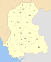 | |
| Hyderabad | ||
| Karachi | ||
| Larkana | ||
| Mirpur Khas |
| |
| Sukkur | ||
| Shaheed Benazir Abad |
| |
| show Authority control |
|---|

- Shaheed Benazir Abad District
- Districts of Sindh
- Memorials to Benazir Bhutto