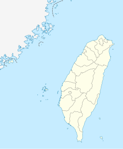
Shalu District
Shalu
沙鹿區 | |
|---|---|
| Shalu District | |
 | |
 Shalu District in Taichung City | |
 Shalu Shalu District in Taichung City | |
| Coordinates: 24°14′21.9″N 120°33′43.6″E / 24.239417°N 120.562111°ECoordinates: 24°14′21.9″N 120°33′43.6″E / 24.239417°N 120.562111°E | |
| Location | Taichung, Taiwan |
| Government | |
| • Mayor | 廖財崇 |
| Area | |
| • Total | 40.46 km2 (15.62 sq mi) |
| Population (December 2018)[3] | |
| • Total | 94,079 |
| • Rank | 12 out of 29 |
| • Density | 2,300/km2 (6,000/sq mi) |
| Website | www |
Shalu District (Chinese: 沙鹿區; pinyin: Shālù Qū) is a suburban district in central Taichung City, Taiwan.
History[]
Originally a settlement of the Papora people, this region was named 沙轆社. During the Kingdom of Tungning (1662-1683), the Taiwanese Plains Aborigines were driven away or sinicized, and the area became a Han settlement. In 1731 during Qing rule, Tamsui Subprefecture (淡水廳) extended from the Tai-kah River northward up to Kelang (雞籠; Keelung).
In 1920, during Japanese rule, the written name was changed to Sharoku (沙鹿). Administratively, Sharoku was under Taikō District (大甲郡), Taichū Prefecture. In Taiwanese Hokkien, the old name (Soa-la̍k) is still used.
In 1945 the village was changed to an township, and was upgraded to a district in 2010.
Administrative divisions[]

Juren, Luoquan, Shalu, Meiren, Xingren, Xingan, Doudi, Lufeng, Luliao, Zhulin, Lifen, Fuxing, Beishi, Jinjiang, Liulu, Nanshi, Puzi, Sanlu, Gongming, Qingquan and Xishi Village.
Native products[]
Education[]
Tourist attractions[]
Transportation[]
Airport[]
Railway stations[]
- Shalu Station
Notable natives[]
- Hung Tzu-yung, member of Legislative Yuan (2016–2020)
- Yen Ching-piao, member of Legislative Yuan (2002–2012)
- Yen Kuan-heng, member of Legislative Yuan (2013–2020)
See also[]
References[]
External links[]
| Wikimedia Commons has media related to Shalu District, Taichung. |
- Official website
 (in Chinese)
- Districts of Taichung
- Taiwan placenames originating from Formosan languages

