Shark River Draw
Shark River Draw | |
|---|---|
| Coordinates | 40°11′05″N 74°01′33″W / 40.184636°N 74.025849°WCoordinates: 40°11′05″N 74°01′33″W / 40.184636°N 74.025849°W |
| Carries | New York and Long Branch (to 1976) Conrail North Jersey Coast Line |
| Crosses | Shark River Inlet |
| Owner | New Jersey Transit |
| ID number | NJT 433 |
| Characteristics | |
| Design | bascule bridge |
| History | |
| Construction end | 1937 |
| Location | |
 | |

Shark River Draw is a moveable bridge over the Shark River Inlet, an inlet at the mouth of the Shark River in the towns of Belmar and Avon-by-the-Sea Monmouth County, New Jersey United States just west of the Atlantic Ocean.[1]
The bascule bridge carries NJ Transit Rail Operations North Jersey Coast Line[2] between the Bradley Beach and Belmar stations. The bridge was built in 1937 by the New York and Long Branch Railroad.[3] It underwent major rehabilitation in 2013-2014.[4][5][6]
The drawbridge runs parallel and downstream to the fixed crossing of the New Jersey Route 35 and upstream of the moveable crossing of New Jersey Route 71 bridge to the east, together with which it is subject to the opening regulations as set out in Title 33 of the Code of Federal Regulations.[7]
See also[]
- NJT movable bridges
- List of crossings of the Raritan River
References[]
- ^ "Shark River Railroad Bridge is a Bascule bridge located at N 40° 11.088', W 074° 01.539' - Waterway Guide Bridge Listing". Retrieved 7 November 2016.
- ^ "NJT - Shark River Draw". Retrieved 7 November 2016.
- ^ "New York and Longbranch Railroad Bascule Bridge, Belmar, New Jersey, United States". Retrieved 7 November 2016.
- ^ http://www.njtransit.com/tm/tm_servlet.srv?hdnPageAction=CapProjectDetailsTo&CapitalProjectId=25[bare URL]
- ^ "Big Shark River Drawbridge Structural Steel Repairs - AmerCom Corp. - New Jersey Consulting Engineers". Retrieved 7 November 2016.
- ^ "Shark River -". Retrieved 7 November 2016.
- ^ "Shark River (South Channel)". Retrieved 7 November 2016.
| Hoboken Division | 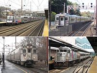 | |
|---|---|---|
| Newark Division | ||
| Connections | ||
| Current rolling stock | ||
| Bridges and tunnels |
| |
| Stations and yards | ||
| Proposed lines | ||
| Other topics |
| |
- Railroad bridges in New Jersey
- NJ Transit bridges
- Bascule bridges in the United States
- Belmar, New Jersey
- Avon-by-the-Sea, New Jersey
- Bridges in Monmouth County, New Jersey
- Bridges completed in 1937
- Central Railroad of New Jersey
- Pennsylvania Railroad bridges
- 1937 establishments in New Jersey