Shelby, Ohio
Shelby, Ohio | |
|---|---|
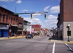 West Main Street in downtown Shelby looking east at the intersection of Gamble Street. | |
 Location of Shelby, Ohio | |
 Location of Shelby in Richland County | |
| Coordinates: 40°53′5″N 82°39′34″W / 40.88472°N 82.65944°WCoordinates: 40°53′5″N 82°39′34″W / 40.88472°N 82.65944°W | |
| Country | United States |
| State | Ohio |
| County | Richland |
| Founded | 1834 |
| Incorporated | 1853 (village) |
| - | 1921 (city) |
| Government | |
| • Mayor | Steven L. Schag |
| Area | |
| • Total | 6.44 sq mi (16.69 km2) |
| • Land | 6.30 sq mi (16.32 km2) |
| • Water | 0.14 sq mi (0.37 km2) |
| Elevation | 1,102 ft (336 m) |
| Population | |
| • Total | 9,317 |
| • Estimate (2019)[5] | 9,031 |
| • Density | 1,433.04/sq mi (553.31/km2) |
| Time zone | UTC-5 (Eastern (EST)) |
| • Summer (DST) | UTC-4 (EDT) |
| ZIP code | 44875 |
| Area code(s) | 419 |
| FIPS code | 39-72102[4] |
| GNIS feature ID | 1065313[3] |
| Website | shelbycity |

Shelby is a city in Richland County in the U.S. state of Ohio, northwest of the city of Mansfield. It is part of the Mansfield, Ohio Metropolitan Statistical Area. The population was 9,317 as of the 2010 census.
History[]
Shelby was originally called Gamble's Mills, and under the latter name was platted in 1834.[6]
On April 14, 2019, Shelby was struck by a long tracked EF2 Tornado with winds of 120-125 MPH. The tornado was 1/2 a Mile wide at its peak. [7] The tornado damaged more than half a dozen homes, as well as a car dealership on the south of side of Shelby. [8] [9]
Geography[]

Shelby is located at 40°53′5″N 82°39′34″W / 40.88472°N 82.65944°W (40.884645, -82.659529),[10] along the Black Fork of the Mohican River.[11]
According to the United States Census Bureau, the city has a total area of 6.49 square miles (16.81 km2), of which 6.35 square miles (16.45 km2) is land and 0.14 square miles (0.36 km2) is water.[12] Much of the water area consists of the Black Fork of the Mohican River, which flows through downtown; its location makes the city vulnerable to floods.[13]
Demographics[]
| Historical population | |||
|---|---|---|---|
| Census | Pop. | %± | |
| 1860 | 1,003 | — | |
| 1870 | 1,807 | 80.2% | |
| 1880 | 1,871 | 3.5% | |
| 1890 | 1,977 | 5.7% | |
| 1900 | 4,685 | 137.0% | |
| 1910 | 4,903 | 4.7% | |
| 1920 | 5,578 | 13.8% | |
| 1930 | 6,198 | 11.1% | |
| 1940 | 6,643 | 7.2% | |
| 1950 | 7,971 | 20.0% | |
| 1960 | 9,106 | 14.2% | |
| 1970 | 9,847 | 8.1% | |
| 1980 | 9,643 | −2.1% | |
| 1990 | 9,564 | −0.8% | |
| 2000 | 9,821 | 2.7% | |
| 2010 | 9,317 | −5.1% | |
| 2019 (est.) | 9,031 | [5] | −3.1% |
| Sources:[4][14][15] | |||
2000 census[]
As of the census[4] of 2000, there were 9,821 people, 4,073 households, and 2,667 families residing in the city. The population density was 1,949.3 people per square mile (752.4/km2). There were 4,330 housing units at an average density of 859.4 per square mile (331.7/km2). The racial makeup of the city was 98.40% White, 0.14% African American, 0.18% Native American, 0.35% Asian, 0.37% from other races, and 0.56% from two or more races. Hispanic or Latino of any race were 1.02% of the population.
There were 4,073 households, out of which 31.6% had children under the age of 18 living with them, 52.1% were married couples living together, 10.0% had a female householder with no husband present, and 34.5% were non-families. 30.8% of all households were made up of individuals, and 14.3% had someone living alone who was 65 years of age or older. The average household size was 2.38 and the average family size was 2.97.
In the city the population was spread out, with 25.7% under the age of 18, 8.6% from 18 to 24, 26.8% from 25 to 44, 22.6% from 45 to 64, and 16.3% who were 65 years of age or older. The median age was 37 years. For every 100 females, there were 91.4 males. For every 100 females age 18 and over, there were 85.1 males.
The median income for a household in the city was $35,938, and the median income for a family was $43,373. Males had a median income of $32,551 versus $21,573 for females. The per capita income for the city was $17,096. About 7.4% of families and 10.2% of the population were below the poverty line, including 16.1% of those under age 18 and 7.4% of those age 65 or over.
2010 census[]
As of the census[2] of 2010, there were 9,317 people, 3,911 households, and 2,510 families residing in the city. The population density was 1,467.2 inhabitants per square mile (566.5/km2). There were 4,354 housing units at an average density of 685.7 per square mile (264.8/km2). The racial makeup of the city was 98.2% White, 0.2% African American, 0.2% Native American, 0.3% Asian, 0.2% from other races, and 1.0% from two or more races. Hispanic or Latino of any race were 1.2% of the population.
There were 3,911 households, of which 31.3% had children under the age of 18 living with them, 47.5% were married couples living together, 12.7% had a female householder with no husband present, 4.0% had a male householder with no wife present, and 35.8% were non-families. 31.3% of all households were made up of individuals, and 14.1% had someone living alone who was 65 years of age or older. The average household size was 2.34 and the average family size was 2.91.
The median age in the city was 40.1 years. 24.5% of residents were under the age of 18; 8% were between the ages of 18 and 24; 24.2% were from 25 to 44; 25.6% were from 45 to 64; and 17.6% were 65 years of age or older. The gender makeup of the city was 47.0% male and 53.0% female.
Notable people[]
- Joseph Carens, Professor of Political Science at The University of Toronto
- Charles Follis, the first black professional football player, played for the Shelby Blues Football team.[16]
- Joel Hunter, retired pastor of Northland Community Church, Casselberry, FL
- Dawn Powell, a writer from the 20th century, lived in Shelby for a period of time.
- Larry Siegfried, professional basketball player who played for Boston Celtics and earlier for the Ohio State Buckeyes. Lived in Shelby.
- William W. Skiles, a U.S. congressman. The football field is named after him.
Parks[]
The city of Shelby has five parks which are operated and maintained by the city of Shelby Parks Department.
Library[]
The sole library in the city of Shelby is Marvin Memorial Library. Marvin Library offers Story Time and summer reading programs for youth, a Teen Cafe for teenagers and the Adult Book Club for adults. Community meeting rooms and computer access are also offered through the library.
Marvin Library is named for Daniel Marvin, a veteran of the American Civil War, and son of Stephen and Sarah (Burr) Marvin who built the first frame house in Shelby. He studied law, went to California during the gold rush, then returned to Ohio by the outbreak of the Civil War, during which he participated in the battles of Shiloh & Stone River, and was severely wounded. Marvin practiced law for many years. He purchased the house on West Whitney Avenue for $6,500 and presented it to the city in the early 1900s. His generosity to the city was greatly appreciated and memorialized in the name of the library.[citation needed]
Public safety[]
- Fire and EMS - Shelby Fire Department
- Police - Shelby Police Department - 17 sworn officers and 4 dispatchers.
Facilities[]
As a result of the 2007 flooding, the former police department building was severely damaged and was demolished in August 2009. In May 2011, Shelby voters approved a bond issue allowing for construction of a new police and court facility, which opened in December 2012.
The Shelby Fire Department operates out of the oldest operating fire station in the state of Ohio, built in 1872.[17] Though also heavily damaged in the 2007 flood, the Shelby Fire Department remained in their historic building alongside the Black Fork of the Mohican River.
METRICH[]
The Shelby Police Department works jointly with METRICH, an investigative group that began in 1986 with a goal of reducing availability of illegal drugs in Richland County region.
Education[]

Shelby's public education is provided by the Shelby City School District [6]. The district serves students in kindergarten through high school in six school facilities. Shelby High School built a new, state of the art facility adjacent to the current high school's location. The new Shelby High School opened in 2013. Shelby High School was one of five "Race to the Top" grant recipients in the State of Ohio in 2011 and is scheduled to implement a new technology & project based curriculum as a result.
See also[]

Shelby Cycle Company, a bicycle manufacturer formerly located in Shelby. The Shelby Bicycle Days Festival takes place in early July in downtown Shelby.[9]
References[]
- ^ "2019 U.S. Gazetteer Files". United States Census Bureau. Retrieved July 28, 2020.
- ^ Jump up to: a b "U.S. Census website". United States Census Bureau. Retrieved 2013-01-06.
- ^ Jump up to: a b "US Board on Geographic Names". United States Geological Survey. 2007-10-25. Retrieved 2008-01-31.
- ^ Jump up to: a b c "U.S. Census website". United States Census Bureau. Retrieved 2008-01-31.
- ^ Jump up to: a b "Population and Housing Unit Estimates". Retrieved May 21, 2020.
- ^ Overman, William Daniel (1958). Ohio Town Names. Akron, OH: Atlantic Press. p. 126.
- ^ US Department of Commerce, NOAA. "April 14, 2019 Severe Storms, Damaging Winds, and Tornadoes". www.weather.gov. Retrieved 2020-07-15.
- ^ Whitmire, Lou. "'This thing was humongous': Shelby residents grateful they survived tornado". Mansfield News Journal. Retrieved 2020-07-15.
- ^ "Tornado levels beloved dealership; employees volunteer to help owner". WEWS. 2019-04-15. Retrieved 2020-07-15.
- ^ "US Gazetteer files: 2010, 2000, and 1990". United States Census Bureau. 2011-02-12. Retrieved 2011-04-23.
- ^ DeLorme (1991). Ohio Atlas & Gazetteer. Yarmouth, Maine: DeLorme. ISBN 0-89933-233-1.
- ^ "US Gazetteer files 2010". United States Census Bureau. Archived from the original on 2012-01-25. Retrieved 2013-01-06.
- ^ "Ohio governor declares flood emergency Hundreds displaced from worst deluge in decades; 22 dead nationwide". NBC News. Associated Press. August 22, 2007. Retrieved 6 January 2010.
- ^ "Number of Inhabitants: Ohio" (PDF). 18th Census of the United States. U.S. Census Bureau. 1960. Retrieved 24 April 2020.
- ^ "Ohio: Population and Housing Unit Counts" (PDF). U.S. Census Bureau. Retrieved 22 November 2013.
- ^ "City of Shelby History - Ten Essential Facts from Shelby's History". City of Shelby. Archived from the original on 2013-12-30. Retrieved 2010-01-06.
- ^ "Archived copy". Archived from the original on 2008-12-02. Retrieved 2010-02-20.CS1 maint: archived copy as title (link)
External links[]
- City website
- The Shelby Museum of History Website
 Shelby travel guide from Wikivoyage
- Shelby, Ohio City-data.com
| show Municipalities and communities of Richland County, Ohio, United States |
|---|

| show Authority control |
|---|
- Cities in Richland County, Ohio
- Populated places established in 1834
- 1834 establishments in Ohio
- Cities in Ohio
- Sundown towns in Ohio