Shell Cove, New South Wales
| Shell Cove Shellharbour, New South Wales | |||||||||||||||
|---|---|---|---|---|---|---|---|---|---|---|---|---|---|---|---|
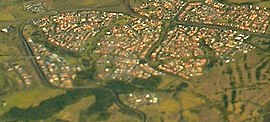 Aerial view from the east | |||||||||||||||
 Shell Cove | |||||||||||||||
| Coordinates | 34°35.4′S 150°51.7′E / 34.5900°S 150.8617°ECoordinates: 34°35.4′S 150°51.7′E / 34.5900°S 150.8617°E | ||||||||||||||
| Population | 5,624 (2016 census)[1] | ||||||||||||||
| Postcode(s) | 2529 | ||||||||||||||
| LGA(s) | City of Shellharbour | ||||||||||||||
| Region | Illawarra | ||||||||||||||
| County | Camden | ||||||||||||||
| Parish | Terragong | ||||||||||||||
| State electorate(s) | Shellharbour | ||||||||||||||
| Federal division(s) | Gilmore | ||||||||||||||
| |||||||||||||||

Shell Cove is a seaside suburb in the Shellharbour area located just south of Wollongong, New South Wales, Australia. Shell Cove adjoins Bass Point and Killalea State Park and includes a variety of facilities and amenities such as: parks and bush reserves, The Links Golf Course, Shell Cove Primary School & pre-schools, Family Health Medical Centre and a general store.
Heritage listings[]
Shell Cove has a number of heritage-listed sites, including:
- Boollwarroo Parade: Bass Point Reserve[2]
References[]
- ^ Australian Bureau of Statistics (27 June 2017). "Shell Cove (State Suburb)". 2016 Census QuickStats. Retrieved 14 July 2017.

- ^ "Bass Point Reserve". New South Wales State Heritage Register. Office of Environment and Heritage. H01896. Retrieved 18 May 2018.
This Shellharbour geography article is a stub. You can help Wikipedia by . |
Categories:
- Suburbs of Wollongong
- City of Shellharbour
- Illawarra region geography stubs