Sikka Regency
Sikka Regency
Kabupaten Sikka | |
|---|---|
Regency | |
 Beach of Maumere | |
 Coat of arms | |
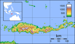
 Location within East Nusa Tenggara | |
 Sikka Regency | |
| Coordinates: 8°29′18″S 122°58′26″E / 8.48833°S 122.974°ECoordinates: 8°29′18″S 122°58′26″E / 8.48833°S 122.974°E | |
| Country | |
| Region | Lesser Sunda Islands |
| Province | |
| Capital | Maumere |
| Government | |
| • Regent | Ansar Rera |
| • Vice Regent | Paolus Nong Susar |
| Area | |
| • Total | 668.69 sq mi (1,731.91 km2) |
| Population (2020 Census) | |
| • Total | 321,953 |
| • Density | 480/sq mi (190/km2) |
| [1] | |
| Area code | (+62) 382 |
| Website | sikkakab |


Sikka is a regency within East Nusa Tenggara province, Indonesia, on the island of Flores.[2] It covers an area of 1,731.91 km² and had a population of 300,301 at the 2010 Census.[3] The capital is the town of Maumere, which comprises the districts of Alok Barat, Alok and Alok Timur (although the last two also include a number of islands to the north of Flores).
Administrative districts[]
The regency is divided into twenty-one districts (kecamatan), tabulated below with their areas and their populations at the 2010 Census[4] and the 2020 Census.[5] The table also includes the number of villages (rural desa and urban kelurahan) in each district, and its post code.
| Name | Area in km2 |
Pop'n Census 2010 |
Pop'n Census 2020 |
No. of villages |
Post codes |
|---|---|---|---|---|---|
| Paga | 82.85 | 15,598 | 16,399 | 8 | 86153 |
| Mego | 111.26 | 11,873 | 12,939 | 10 | 86113 |
| Tana Wawo | 79.78 | 8,695 | 8,926 | 6 | 86154 |
| Lela | 31.33 | 11,645 | 11,596 | 9 | 86161 |
| Bola | 56.83 | 10,785 | 10,797 | 6 | 86171 |
| Doreng | 30.41 | 11,191 | 12,002 | 7 | 86170 |
| Mapitara | 81.02 | 6,304 | 6,672 | 4 | 86172 |
| Talibura | 260.11 | 20,454 | 22,424 | 12 | 86183 |
| Waigete | 217.65 | 22,181 | 24,931 | 6 | 86184 |
| Waiblama | 144.36 | 7,042 | 8,074 | 9 | 86185 |
| Kewapante | 24.14 | 13,453 | 14,775 | 8 | 86182 |
| Hewokloang | 17.58 | 8,243 | 8,998 | 7 | 86181 |
| Kangae | 38.43 | 16,389 | 18,055 | 9 | 86180 |
| Palu'e (a) | 41.00 | 9,553 | 9,497 | 8 | 86110 |
| Koting | 23.56 | 6,360 | 6,526 | 6 | 86116 |
| Nelle | 14.65 | 5,792 | 6,147 | 5 | 86119 |
| Nita | 141.07 | 21,223 | 22,748 | 12 | 86151 |
| Magepanda | 166.15 | 11,508 | 12,727 | 5 | 86152 |
| Alok (b) (Central Alok) |
14.64 | 33,064 | 32,629 | 7 | 86112 -86118 |
| Alok Barat (West Alok) |
62.75 | 16,808 | 22,294 | 4 | 86114 -86115 |
| Alok Timur (c) (East Alok) |
92.34 | 32,167 | 32,797 | 10 | 86111 -86115 |
| Totals | 1,731.91 | 300,328 | 321,953 | 160 |
Note: (a) Palu'e is an island district, situated off the north coast of Flores. (b) includes the offshore islands of Pulau Pemana Besar and Pulau Pemana Kecil. (c) includes the offshore islands of Pulau Besar, Pulau Pangabatan, Pulau Mermaan, Pulau Damhila and Pulau Babi.
See also[]
References[]
| show Regencies and cities of East Nusa Tenggara |
|---|

| show Authority control |
|---|
This East Nusa Tenggara location article is a stub. You can help Wikipedia by . |
- Flores Island (Indonesia)
- East Nusa Tenggara geography stubs