Silt, Colorado
Silt, Colorado | |
|---|---|
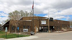 Silt Town Hall. | |
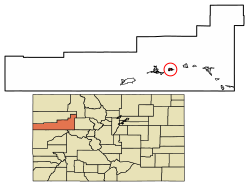 Location of Silt in Garfield County, Colorado. | |
| Coordinates: 39°32′47″N 107°39′7″W / 39.54639°N 107.65194°WCoordinates: 39°32′47″N 107°39′7″W / 39.54639°N 107.65194°W | |
| Country | |
| State | |
| County[1] | Garfield County |
| Incorporated | May, 1915[2] |
| Government | |
| • Type | Statutory Town[1] |
| Area | |
| • Total | 1.73 sq mi (4.47 km2) |
| • Land | 1.66 sq mi (4.29 km2) |
| • Water | 0.07 sq mi (0.18 km2) |
| Elevation | 5,456 ft (1,663 m) |
| Population (2010) | |
| • Total | 2,930 |
| • Estimate (2019)[6] | 3,190 |
| • Density | 1,927.49/sq mi (744.05/km2) |
| Time zone | UTC-7 (Mountain (MST)) |
| • Summer (DST) | UTC-6 (MDT) |
| ZIP code[5] | 81652 |
| Area code(s) | 970 |
| FIPS code | 08-70195 |
| GNIS feature ID | 0204657 |
| Website | www |

Silt is a Statutory Town in Garfield County, Colorado, United States. The population was 2,930 at the 2010 census,[7] up from 1,740 at the 2000 census. A post office called "Silt" has been in operation since 1898.[8] The community was named for the silt deposits at the original town site.[9]
Geography[]
Silt is located at 39°32′47″N 107°39′7″W / 39.54639°N 107.65194°W (39.546316, -107.652072),[10] on the north side of the Colorado River about 175 miles (282 km) west of Denver. Interstate 70 passes through the town as it follows the river, with access from Exit 97. Glenwood Springs, the county seat, is 19 miles (31 km) to the east, and Rifle is 7 miles (11 km) to the west. U.S. Route 6 is Main Street in Silt, and provides a local route parallel to I-70.
According to the United States Census Bureau, the town has a total area of 1.5 square miles (3.8 km2), of which 0.023 square miles (0.06 km2), or 1.46%, is water.[7]
History[]
Climate[]
This climatic region is typified by large seasonal temperature differences, with warm to hot (and often humid) summers and cold (sometimes severely cold) winters. According to the Köppen Climate Classification system, Silt has a humid continental climate, abbreviated "Dfb" on climate maps.[11]
| hideClimate data for Silt, Colorado | |||||||||||||
|---|---|---|---|---|---|---|---|---|---|---|---|---|---|
| Month | Jan | Feb | Mar | Apr | May | Jun | Jul | Aug | Sep | Oct | Nov | Dec | Year |
| Average high °C (°F) | 3 (37) |
7 (44) |
12 (54) |
18 (64) |
23 (74) |
29 (84) |
32 (90) |
31 (88) |
26 (79) |
19 (67) |
11 (51) |
4 (39) |
18 (64) |
| Average low °C (°F) | −13 (9) |
−8 (17) |
−4 (24) |
−1 (31) |
4 (39) |
7 (45) |
11 (52) |
10 (50) |
5 (41) |
−1 (31) |
−6 (21) |
−11 (12) |
−1 (31) |
| Average precipitation mm (inches) | 23 (0.9) |
20 (0.8) |
23 (0.9) |
25 (1) |
25 (1) |
18 (0.7) |
25 (1) |
28 (1.1) |
28 (1.1) |
30 (1.2) |
23 (0.9) |
23 (0.9) |
290 (11.6) |
| Source: Weatherbase [12] | |||||||||||||
Demographics[]
| Historical population | |||
|---|---|---|---|
| Census | Pop. | %± | |
| 1920 | 165 | — | |
| 1930 | 264 | 60.0% | |
| 1940 | 359 | 36.0% | |
| 1950 | 361 | 0.6% | |
| 1960 | 384 | 6.4% | |
| 1970 | 434 | 13.0% | |
| 1980 | 923 | 112.7% | |
| 1990 | 1,095 | 18.6% | |
| 2000 | 1,740 | 58.9% | |
| 2010 | 2,930 | 68.4% | |
| 2019 (est.) | 3,190 | [6] | 8.9% |
| U.S. Decennial Census[13] | |||
As of the census[14] of 2000, there were 1,740 people, 648 households, and 452 families residing in the town. The population density was 616.6 people per square mile (238.2/km2). There were 668 housing units at an average density of 236.7 per square mile (91.5/km2). The racial makeup of the town was 89.60% White, 0.17% African American, 1.32% Native American, 7.41% from other races, and 1.49% from two or more races. Hispanic or Latino of any race were 14.20% of the population.
There were 648 households, out of which 41.0% had children under the age of 18 living with them, 58.3% were married couples living together, 7.1% had a female householder with no husband present, and 30.2% were non-families. 23.9% of all households were made up of individuals, and 5.9% had someone living alone who was 65 years of age or older. The average household size was 2.69 and the average family size was 3.21.
In the town, the population was spread out, with 30.5% under the age of 18, 7.8% from 18 to 24, 37.6% from 25 to 44, 18.2% from 45 to 64, and 5.9% who were 65 years of age or older. The median age was 31 years. For every 100 females, there were 108.9 males. For every 100 females age 18 and over, there were 104.4 males.
The median income for a household in the town was $44,632, and the median income for a family was $51,736. Males had a median income of $37,566 versus $25,417 for females. The per capita income for the town was $17,723. About 5.0% of families and 7.8% of the population were below the poverty line, including 5.1% of those under age 18 and 17.1% of those age 65 or over.
Education[]
It is within Garfield Re-2 School District.[15]
See also[]
- Colorado
- Outline of Colorado
- Bibliography of Colorado
- Geography of Colorado
- History of Colorado
- Colorado statistical areas
- Glenwood Springs, CO Micropolitan Statistical Area
- List of counties in Colorado
- List of places in Colorado
- Protected areas of Colorado
References[]
- ^ Jump up to: a b "Active Colorado Municipalities". State of Colorado, Department of Local Affairs. Archived from the original on 2009-12-12. Retrieved 2007-09-01.
- ^ "Colorado Municipal Incorporations". State of Colorado, Department of Personnel & Administration, Colorado State Archives. 2004-12-01. Retrieved 2007-09-02.
- ^ "2019 U.S. Gazetteer Files". United States Census Bureau. Retrieved July 1, 2020.
- ^ "US Board on Geographic Names". United States Geological Survey. 2007-10-25. Retrieved 2008-01-31.
- ^ "ZIP Code Lookup" (JavaScript/HTML). United States Postal Service. Retrieved 2008-01-02.
- ^ Jump up to: a b "Population and Housing Unit Estimates". United States Census Bureau. May 24, 2020. Retrieved May 27, 2020.
- ^ Jump up to: a b "Geographic Identifiers: 2010 Demographic Profile Data (G001): Silt town, Colorado". American Factfinder. U.S. Census Bureau. Retrieved November 16, 2016.[dead link]
- ^ "Post offices". Jim Forte Postal History. Retrieved 9 July 2016.
- ^ Dawson, John Frank. Place Names in Colorado: Why 700 communities were so named, 150 of Spanish or Indian origin. Denver, CO: J. Frank Dawson Publishing Co. p. 46.
- ^ "US Gazetteer files: 2010, 2000, and 1990". United States Census Bureau. 2011-02-12. Retrieved 2011-04-23.
- ^ Climate Summary for Silt, Colorado
- ^ "Weatherbase.com". Weatherbase. 2013. Retrieved on August 7, 2013.
- ^ "Census of Population and Housing". Census.gov. Retrieved June 4, 2015.
- ^ "U.S. Census website". United States Census Bureau. Retrieved 2008-01-31.
- ^ "About Garfield Re-2". Garfield Re-2 School District. Retrieved 2020-05-15.
External links[]
| hide Municipalities and communities of Garfield County, Colorado, United States | ||
|---|---|---|
| Cities |  | |
| Towns | ||
| CDPs | ||
| Unincorporated communities | ||
| ||
- Towns in Garfield County, Colorado
- Towns in Colorado
- Populated places established in 1915
- 1915 establishments in Colorado