Skelmersdale
| Skelmersdale | |
|---|---|
| Town | |
 The Concourse shopping centre, Skelmersdale | |
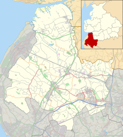 Skelmersdale Shown within West Lancashire | |
| Population | 38,813 |
| OS grid reference | SD487062 |
| • London | 180 mi (290 km) SE |
| District | |
| Shire county | |
| Region | |
| Country | England |
| Sovereign state | United Kingdom |
| Post town | SKELMERSDALE |
| Postcode district | WN8 |
| Dialling code | 01695 |
| Police | Lancashire |
| Fire | Lancashire |
| Ambulance | North West |
| UK Parliament | |


Skelmersdale /ˈskɛlmərzˌdeɪl/ is a town in Lancashire, England, on the River Tawd, 6 miles (10 km) west of Wigan, 13 miles (21 km) northeast of Liverpool and 15 miles (24 km) southwest of Preston. In 2006, it had a population of 38,813.[1] The town is known locally as Skem /ˈskɛm/.
While the first record of the town is in the Domesday Book of 1086, much of the town, including the current town centre, was developed as a second wave new town in the 1960s. The town's initial development as a coal town coincided with the Industrial Revolution in the 19th century; the town lies on the Lancashire Coalfield.
Geography[]
Skelmersdale is situated in a small valley on the River Tawd. The town was designed to accommodate both nature and compact housing estates. Even in the town centre there is an unusually large amount of forestation. The Beacon Country Park lies to the east of Skelmersdale, where the Beacon Point lies, along with a golf club. Furthermore, the Tawd Valley Park runs through the centre of the town, which West Lancashire Borough Council is currently working to improve.[2]
The town borders the village of Upholland to the east, West Lancashire's administrative centre Ormskirk to the north-west, and Saint Helens to the south. Furthermore, the town lies on the periphery of Wigan and Greater Manchester. The M58 runs through Skelmersdale, to Liverpool.
The New Town is the larger eastern part of the town which was built primarily in the 1960s as a second wave new town, and the 'Old Town' is the much smaller and older part of the town in the south west; Skelmersdale was mentioned in the Domesday Book of 1086. The town is further divided into seven wards: Skelmersdale North, Skelmersdale South, Birch Green, Ashurst, Digmoor, Moorside and Tanhouse.
History[]
Toponymy[]
Skelmersdale means "Skjaldmarr's valley", from the Old Norse personal name Skjaldmarr + probably Old Norse dalr (or Old English dæl) "dale, valley". The name was recorded as Skalmeresedel in 1136.
It is locally known as "Skem",[3] with a further distinction being made between "Old Skem" (the area which was a small mining town prior to 1961) and the broader swathe of development on the east side of the town.
Early history[]
Until the creation of Skelmersdale Urban District Council at the end of the 19th century, the town was part of the Parish of Ormskirk in the West Derby hundred, an ancient subdivision of Lancashire, covering the southwest of the county.
In the mid-14th century, the manor of Skelmersdale was held by William Dacre, 2nd Baron Dacre.[4]
Modern history[]
In 1858, Blague Gate railway station in Skelmersdale was opened on the new Ormskirk to Rainford line. It was renamed to Skelmersdale railway station in 1874, before closing in 1956 and its demolition shortly after 1968.
Skelmersdale's population in 1851 was only 760, but 50 years later it had increased to 5,699. It was a busy coal mining town.[5] Sadly, there were over 100 fatalities in Skelmersdale collieries from 1851 to 1900, according to the Reports of the Inspectors of Coal Mines, and an unknown number of serious injuries. In 1880 there were 14 Skelmersdale collieries—most of them closed in the 1920s and '30s.

The miners, many of whom were Welsh immigrants, brought with them their own brand of Nonconformist Christianity. By the start of the 20th century there were at least six dissenting chapels in the town: two Wesleyan (Berry Street, closed in the 1920s, and Liverpool Road, closed 1969), an independent Methodist, a Primitive Methodist, a Congregational and a Welsh Chapel (closed in 1963).
Today, there is little to remind people that the town was part of the once great Lancashire Coalfield, although a Skelmersdale Heritage Society was re-established in 2019.
There were also numerous brickworks in the area, and in the early-20th century Victoria County History, Skelmersdale was described as "a particularly bare, unpleasing district" owing to its coal mines and brickworks.[6]
New town[]
In 1961 Skelmersdale was designated a new town, designed to house overspill population from the north Merseyside conurbation. The town was the first in the second wave of designations.
Skelmersdale endured mixed economic fortunes during the last three decades of the 20th century. With the economic downturn in the late 1970s, large industrial employers left the town en masse, resulting in an increase in crime, drug abuse and poverty. Today, West Lancashire has a crime rate below the national average. 2006 saw a regeneration drive for the town coordinated through English Partnerships and the Northwest Regional Development Agency and publicly headed by the designer Wayne Hemingway.[7] Among the proposals was a new central focus for the entertainment and commerce for the town in the evening.[3]
In 2012, a £20m vision to create a regenerated town centre for Skelmersdale was revealed. It is expected to create as many as 500 permanent jobs, and current projections seem to satisfy that target.[citation needed] Although Skelmersdale faces a looming employment crisis, the regeneration of the town centre is a step towards recovery, and up to 100 extra jobs would be generated during the scheme's construction phase alone.[8]
Proposals included a new food store as well as a number of bars, shops and restaurants, and a five-screen cinema. A new promenade would be fronted by these establishments to overlook the Tawd Valley Park, and a new civic square would also be created between the Concourse Shopping Centre and the town library. Regeneration specialists St Modwen have been working on the proposals with West Lancashire Council and the Homes and Communities Agency.[9]
In January 2020, work began on a new Lidl supermarket and a B&M store,[10] and work began on a new two-screen cinema operated by US company Star Cinemas in May 2020, which opened in May 2021 under the name Ultra Star Cinema.[11] In June 2020, Lancashire County Council acquired the site of the former Glenburn Sports College, and approved £2 million of funding to demolish the site and prepare the location for development as a railway station.[12] There are also plans to move forward with a new high street linking the Concourse Shopping Centre with West Lancashire College's campus.
Transport[]
Road[]

Skelmersdale has been designed to work on a roundabout system and there is only one set of traffic lights in the town. For ease of access, there is a subway network allowing pedestrians to move through the town without needing to cross potentially hazardous roads. However, the subway system was called into question in 2020 by West Lancashire MP Rosie Cooper and others with regard to its safety and sustainability, as they are not regularly maintained by the county council.[13]
The M58 motorway runs along the south of Skelmersdale from the nearby M6 motorway to the Switch Island interchange at Liverpool. The A570 and the A577 both provide connections.
The New Town areas of Skelmersdale have a road-naming system where residential streets rarely feature words such as "Road" and "Street" and single-name roads are common, e.g. Abbeywood, Fairburn, Brierfield, Thornwood. "Road", "Street", "Lane" and "Drive" do appear in road names, but only in the parts of the town that pre-date the New Town development. The road names in New Town areas are also arranged in a loosely alphabetical format with large areas being defined by a single letter, for example, Larkhill, Leeswood, Ledburn and Lindens all connect to Ashley Road in the Ashurst area.
Roads in the industrial estates and the main roads in the town such as Gillibrands Road follow the usual naming conventions, although the industrial estates do feature street names beginning with the same letter. For example, Pikelaw Place, Penketh Place, Pinfold Place and Priorswood Place are all part of the Pimbo Industrial Estate.
Bus[]

In September 2011, the company providing most of Skelmersdale's bus services, Arriva North West, closed its depot in Skelmersdale, which employed 129 people. The depot was first constructed for Ribble Motor Services in the 1970s, and the premises were sold. Skelmersdale is now served by buses from Arriva depots in St Helens, Bootle and Southport.
Rail[]
Since the closure of Skelmersdale railway station in 1956, the town has become the second most populous town in the North West, after Leigh, without a railway station.[14] The nearest railway station is Upholland railway station on the Wigan Wallgate to Kirkby branch line (historically part of the Liverpool and Bury Railway line).[15] The Skelmersdale Branch previously connected Skelmersdale to Ormskirk and Rainford Junction.
In 2009, Network Rail proposed to extend the existing quarter-hourly Liverpool Central to Kirkby service, to terminate at a new station in the centre of Skelmersdale. Rainford will then become an interchange station for services to and from Wigan Wallgate.[16] In 2009, the Association of Train Operating Companies published a report, Connecting Communities, which also recommended the opening of a new rail link to Skelmersdale.[17] This time the recommendation was via the Skelmersdale Branch from Ormskirk. In February 2017, Lancashire County Council identified the site of the former Glenburn Sports College / Westbank Campus site as the preferred location for a railway station for the town. Despite the Glenburn Sports College being owned by the council, the Westbank Campus site is owned by Newcastle College and requires purchase by the council in order for the station to be built.[18] In 2017, Merseytravel and Lancashire County Council committed £5 million into a study to investigate the possibility of re-opening the station. Combined with the creation of a new station at Headbolt Lane in Kirkby, it is believed that the scheme could cost around £300 million to develop.[19]
In 2020, Lancashire County Council acquired the site of the former Glenburn Sports College, and approved £2 million to demolish the buildings on the site and prepare the area for the construction of a railway station.[20]
Education and Culture[]
Skelmersdale has a number of primary schools, and had two high schools: Our Lady Queen of Peace Catholic Engineering College and Lathom High School. Glenburn Sports College closed on 31 August 2016 following an unsuccessful campaign backed by local MP Rosie Cooper to prevent the closure.[21]
West Lancashire College has a campus in the centre of the town. The college merged with Newcastle College in 2007[22] and was graded as 'outstanding' in a recent Ofsted inspection.[23] In 2021, Professor Brian Cox launched the college's 'School of Science', a £1.3 million facility with the intention of increasing the number of students who study Science, technology, engineering and mathematics.[24]
There is a Transcendental Meditation movement community within Skelmersdale, called "European Sidhaland".[25] It has a Maharishi School which, as of 2019, performed 'well above average' according to Ofsted.[26] In 2011, it was one of 24 schools that applied for and received government funding as a flagship free school.[27]
Skelmersdale is also home to a large public library with facilities including free internet access and an extensive local history section.[28]
The town is host to a number of cultural and social organisations, such as the Artz Centre which provides opportunities in creative fields,[29] and The Birchwood Centre which aims to reduce social isolation and homelessness.[30]
The town featured in TV series Utopia (British TV series) and features in the musical Blood Brothers.[31]
Social issues[]
According to urban planning consultancy Space Syntax, Skelmersdale's fragmented streets have made its centre relatively inaccessible and this has resulted in segregated land use.[32] According to a 2017 Lancashire County Council report, Skelmersdale has one of the highest percentages of children living in poverty in Lancashire at 27%, and the highest accident and emergency attendance rate in Lancashire for 0-4 and 5-19 year olds.[33] Furthermore, Skelmersdale's poverty levels are above the national average.[34]
However, Skelmersdale's crime rates are below the Lancashire average at 66 crimes per 1,000 people, and was the 10th safest medium-sized town in Lancashire in 2020. Skelmersdale was the worst medium-sized town in Lancashire in 2020 for drugs.[35]
Economy[]
Although consisting predominantly of housing estates, Skelmersdale's industry includes the Co-operative Bank which employs 650 people,[36] distribution centres for Asda,[37] P&G,[38] Victorian Plumbing,[39][40] a Walkers snack food factory,[41] [42] and many others. Skelmersdale houses the corporate base and a distribution centre for Matalan, the discount clothing and homewares store.[43] Frederick's Dairies, who make ice cream for Cadbury, is located in Skelmersdale.[44]
Town centre[]
Skelmersdale's town centre is made up of the Concourse Shopping Centre,[45] (colloquially known as "the Connie") as well as an Asda supermarket, a library, a swimming pool and gym named after former Minister of Health Aneurin Bevan, another gym, West Lancashire College's main campus, a car garage and a new development including a Lidl supermarket and a B&M store.
The Concourse is home to a number of national chain stores such as Poundland, Home Bargains and Argos, as well as a McDonald's restaurant and KFC, both of which are located in the nearby car park. In early 2020, a Domino's Pizza chain was opened on the ground floor. The Concourse used to have an artwork by Alan Boyson, in the shape of a pyramid. This was built as a tribute to the former Skelmersdale development council which caused a lot of complaints from the residents due to the then council's handling of their duties, i.e. people thought they didn't deserve it. The pyramid was located in front of the entrance opposite the ecumenical centre until the early to mid-1980s but was removed for safety reasons.[46]
There are also smaller shopping parades in Skelmersdale which include Sandy Lane Shopping Centre, Digmoor Parade and Ashurst Shopping Centre.
Politics[]
Skelmersdale is in the West Lancashire parliamentary constituency, and has been represented by Rosie Cooper, a Labour Party MP, since the 2005 United Kingdom general election. Furthermore, as of June 2021, Skelmersdale is represented by three Labour Party councillors across three wards on Lancashire County Council and fifteen of sixteen borough councillors for wards in Skelmersdale on West Lancashire Borough Council are members of the Labour Party, with one independent councillor. Until the 2021 United Kingdom local elections, Skelmersdale had only elected Labour Party councillors for over fifty years.[47]
Skelmersdale Independent Party, established in February 2019, is active in the town and advocates for the establishment of a Skelmersdale Town Council.[48] While the party has contested multiple seats on West Lancashire Borough Council, it has been unsuccessful in gaining seats.
Sports[]
The town's football team, Skelmersdale United F.C., plays in the Premier Division of the North West Counties Football League and was a FA Vase winner in 1971. One of its former players, Steve Heighway, went on to play for Liverpool. Former Everton midfielder Leon Osman, who takes his son to Dalton St Michael's Primary School in nearby Dalton, played for the club in his youth. Former Cardiff City player Craig Noone also once played for the club. Skelmersdale Football Club is currently located at JMO Sports Park in the town.
The town is host to an archery club, the Bowmen of Skelmersdale[49] whose collective members hold 19 county records and 14 world records held by three members of the same family, (Melissa-Jane, Harriet and Gary Daniel), 6 of which were claimed at the National Flight Championships on 19 August 2006 held at RAF Church Fenton.[50] Furthermore, Skelmersdale Cricket Club was established in 1891.[51]
Cadet Forces[]
Skelmersdale has units of the Air Training Corps, Army Cadet Force and Sea Cadet Corps. These units take part in the local community life and are routinely seen attending the Remembrance Sunday parade in the old town.

Air Training Corps[]
1439 (Skelmersdale) Squadron, Air Cadets, formed at Upholland Grammar School in 1941 as the 'Beacon Squadron' and provided airmanship training for young men and those about to join the RAF in time for the Battle of Britain. The squadron continues to provide airmanship training to young men and women in addition to other activities. They are based on Daniels Lane.
Army Cadet Force[]
The Army Cadets are part of 'S' Company of the Lancashire Force. They are based on Daniels Lane.
Sea Cadets Corps[]
The Sea Cadets has a unit in Skelmersdale that trains cadets aged from 10 to 17 years. The unit is located on Tawd Road.
Notable people[]
- Footballer Leon Osman was born in Wigan, but raised in Skelmersdale. He attended Up Holland High School and Winstanley College.
- Matt Woods, a footballer, was born in Skelmersdale. He played for multiple clubs, but most notably Everton F.C. and Blackburn Rovers F.C.
- John Anderton, professional footballer born in Skelmersdale.
- Thomas Aspinwall, trade unionist born in Bickerstaffe but lived in Skelmersdale.
- Stephen James Bennett, musician and writer
- John Littlewood, chess player, born in Sheffield, resided in Skelmersdale.
- Harry Swainston, football player at the turn of the 20th century with Burnley
Twin towns[]
West Lancashire is twinned with Erkrath (Germany) and Cergy-Pontoise (France).
See also[]
- Listed buildings in Skelmersdale
- West Lancashire
- Lancashire County Council
- West Lancashire College
- Lathom High School
References[]
- ^ ""Great Britain" World Gazetteer". Archived from the original on 9 February 2013.
- ^ "Development Plans". tawd.net. Tawd Valley Park. Retrieved 20 July 2021.
- ^ Jump up to: a b David Ward (18 January 2006). "Back to the drawing board". The Guardian. Retrieved 12 May 2008.
- ^ Edward Baines, William Robert Whatton, Brooke Herford, James Croston, The History of the County Palatine and Duchy of Lancaster, vol. 5 (J. Heywood, 1893), p. 2
- ^ Pevsner, Nikolaus, Sir (2002) North Lancashire Yale University Press, New Haven ISBN 0-300-09617-8 p. 226;
- ^ "Townships: Skelmersdale". A History of the County of Lancaster Volume 3. Victoria County History. 1907. pp. 282–284. Retrieved 2 January 2010.
- ^ "'It's your town, let's work together to make its future as exiting and as successful as possible.'". Skelmersdale Vision. Archived from the original on 29 May 2005.
- ^ "New £20m Vision for Skelmersdale". Insider Media Ltd. 26 March 2012.
- ^ "Skelmersdale regeneration". West Lancashire Borough Council.
- ^ "Building work starts on new Skelmersdale town centre development". West Lancashire Borough Council.
- ^ "Cinema for Skelmersdale after 38-year wait". Place North West.
- ^ "Train station plan moves forward - purchase former college site approved". Wigan Today.
- ^ James, Henry. "Council lobbied by MP to tackle problem of subway flooding in town". Champion Newspapers. The Champion. Retrieved 31 January 2021.
- ^ Network Rail (November 2008) Merseyside Route Utilisation Strategy (RUS) Draft for Consultation, Page 93
- ^ "Disused Stations: Skelmersdale Station".
- ^ "Network Rail Merseyside RUS Draft". networkrail.co.uk.
- ^ "Transport Briefing".
- ^ "Details - Lancashire County Council". Lancashire.gov.uk. Retrieved 23 February 2017.
- ^ Alistair Houghton (18 September 2017). "Skelmersdale rail link moves step closer as £5m funding revealed". Liverpool Echo. Retrieved 19 September 2017.
- ^ Wigan Today. "Train station plan moves forward, purchase former college site approved".
- ^ "Half-empty Glenburn Sports College in Skelmersdale to close". BBC. 20 May 2015.
- ^ "Skelmersdale College (Dissolution) Order 2007". Office of Public Sector Information. 1 August 2007. Retrieved 27 August 2008.
- ^ Ofsted (25 July 2008). "Full college inspection report". Archived from the original on 28 June 2008. Retrieved 27 August 2008.
- ^ "Professor Brian Cox CBE officially opens The School of Science". West Lancashire College. West Lancashire College. Retrieved 20 July 2021.
- ^ "Maharishi European Sidhaland". Maharishi European Sidhaland. Archived from the original on 13 March 2010. Retrieved 5 May 2010.
- ^ "Maharishi Free School". gov.uk. HM Government. Retrieved 20 July 2021.
- ^ Byrne, Michael (1 September 2011). "Maharishi School in Skelmersdale hits back over Free School status criticisms".
- ^ "Welcome to the Library and Information Service web site". Lancashire County Council. Archived from the original on 12 June 2011. Retrieved 26 February 2008.
- ^ "ABOUT US". Artz Centre. Artz Centre. Retrieved 20 July 2021.
- ^ "The Birchwood Centre". The Birchwood Centre. The Birchwood Centre. Retrieved 20 July 2021.
- ^ Russell, Willy (May 2001). Blood Brothers (New ed.). Methuen Drama. p. 128. ISBN 978-0413767707.
- ^ "Inclusive growth and place layout" (PDF). Space Syntax. Retrieved 27 June 2020.
- ^ "Lancashire County Council Children & Young People's Public Health Commissioning—Child Health Profiles 2017" (PDF). Lancashire County Council. Lancashire County Council. Retrieved 20 July 2021.
- ^ Collins, Simon; Tucker, Angela; Abbas, Farha (March 2015). "The Seven Wards: A Focus on Skelmersdale" (PDF). West Lancashire Clinical Commissioning Group. Retrieved 20 July 2021.
- ^ "Crime and Safety in Skelmersdale, Lancashire". CrimeRate. CrimeRate. Retrieved 20 July 2021.
- ^ James, Henry. "IT'S 'BUSINESS AS USUAL' AT CO-OP BANK'S SKEM SITE". Champion. Champion News. Retrieved 20 July 2021.
- ^ "Asda Wal-Mart UK logistics and distribution centres". The Tracing Paper. 1 February 2009. Archived from the original on 1 August 2010. Retrieved 2 October 2010.
- ^ "Proctor & Gamble Celebrates Investment in Skelmersdale" (Press release). Northwest Regional Development Agency. 11 October 2004. Archived from the original on 8 July 2011. Retrieved 2 October 2010.
- ^ "Skelmersdale, Here We Come! | Victorian Plumbing Bathroom Blog". www.victorianplumbing.co.uk. Retrieved 15 September 2016.
- ^ "Champ CyberNews :: Your story". www.champnews.com.
- ^ Lorraine Heller (5 October 2005). "Walkers to open new snack factory in UK". Bakery & Snacks. Decision News Media. Retrieved 2 October 2010.
- ^ Philip Ghayour (11 May 2018). "Skelmersdale litter pickers out in force ⋆ Business Lancashire".
- ^ Martin Wainwright (14 October 2004). "Industrial retreat opens way for a 21st century city". The Guardian. UK: Guardian News and Media. Retrieved 2 October 2010.
- ^ "New Cadbury ice cream range for winter". Talking Retail. Metropolis International Group. 4 December 2007. Archived from the original on 26 July 2011. Retrieved 2 October 2010.
- ^ "Concourse Shopping Centre".
- ^ "Alan Boyson – Sculptor of Skelmersdale New Town's Pyramid". Modernism North West. 9 February 2012. Archived from the original on 8 November 2016. Retrieved 7 November 2016.
- ^ Lopez, Jamie. "Community campaigner first to break Labour's Skelmersdale dominance in decades". LancsLive. Lancashire Live. Retrieved 20 July 2021.
- ^ "Skelmersdale Independent Party". The Electoral Commission. The Electoral Commission. Retrieved 14 June 2021.
- ^ "Bowmen of Skelmersdale Archery Sports Club - North-West Lancashire".
- ^ "LAA Flight Records". Lancashire Archery Association. Retrieved 11 February 2020.
- ^ "Skelmersdale Cricket Club". play-cricket.com. Skelmersdale Cricket Club. Retrieved 20 July 2021.
Further reading[]
- Wilson, L. Hugh (1964) Skelmersdale new town planning proposals: report on basic plan prepared for the Skelmersdale Development Corporation by L. Hugh Wilson, Hugh Wilson & Lewis Womersley Chartered Architects & Town Planners, with a foreword by A.J. Kentish Barnes, Chairman of the Skelmersdale Development Corporation, Skelmersdale Development Corporation;
- Riley, Frank (1986) People in Need of a Future: A Survey of the Long-term Unemployed in Skelmersdale Ecumenical Centre, Northway, Skelmersdale;
- Howe, Don and Frank Riley (1982) Skem – The Broken Promise: Unemployment in Skelmersdale New Town Liverpool Industrial Ecumenical Mission;
External links[]
| Wikimedia Commons has media related to Skelmersdale. |
- Skelmersdale Heritage Society website
- Potential Rail Improvements in North Western England – Evidence presented to the Transport Select Committee, 2002–03
- Skem News
- Ormskirk & Skelmersdale Advertiser
- Champion Newspapers
| show Authority control |
|---|
- Skelmersdale
- Towns in Lancashire
- New towns in England
- New towns started in the 1960s
- Unparished areas in Lancashire
- Geography of the Borough of West Lancashire