South Ribble
Coordinates: 53°41′49″N 2°41′24″W / 53.697°N 2.690°W

Borough of South Ribble | |
|---|---|
Borough | |
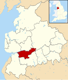 Shown within the ceremonial county of Lancashire | |
| Sovereign state | United Kingdom |
| Constituent country | England |
| Region | North West England |
| Ceremonial county | Lancashire |
| Founded | 1974 |
| Admin. HQ | Leyland |
| Government | |
| • Type | South Ribble Borough Council |
| • Leadership: | Leader & Cabinet |
| • Executive: | Labour |
| • MPs: | Katherine Fletcher, Nigel Evans |
| Area | |
| • Total | 43.6 sq mi (113.0 km2) |
| Area rank | 201st |
| Population (mid-2019 est.) | |
| • Total | 110,788 |
| • Rank | Ranked 215th |
| • Density | 2,500/sq mi (980/km2) |
| Time zone | UTC+0 (Greenwich Mean Time) |
| • Summer (DST) | UTC+1 (British Summer Time) |
| ONS code | 30UN (ONS) E07000126 (GSS) |
| Ethnicity | 97.1% White 1.5% S. Asian[1] |
| Website | southribble.gov.uk |
South Ribble is a non-metropolitan district and borough of Lancashire, England. Its council is based in Leyland. The population, at the 2011 Census, was 109,057.[1] In May 2007, the council was officially declared "Excellent" by the Audit Commission, of the best five district councils in the country.
Overview[]
On 4 October 2007, a team from South Ribble won the LGC Challenge, defeating over 40 other authorities, including larger metropolitan and unitary councils.
South Ribble Borough Council is working in partnership with Chorley Borough Council (a neighbouring authority) on Finance, Procurement, Audit and other centralised functions.
Other notable population areas within South Ribble are Penwortham, Longton, Hutton (headquarters of the Lancashire Police), Walton-le-Dale, Bamber Bridge, Lostock Hall, Moss Side, and part of Buckshaw Village.
The district was formed on 1 April 1974 under the Local Government Act 1972, from Leyland and Walton-le-Dale urban districts, along with part of Preston Rural District.
The Parliamentary Constituency of South Ribble includes the West Lancashire communities of Rufford, Tarleton, Hesketh Bank and Meols.
In February 2017 the district was named as the 'UK's best place to live' for people in their twenties on Channel 4's programme of the same name.
Council affiliation[]
South Ribble Council elections are at South Ribble Borough Council elections
In the 2007 local elections, South Ribble witnessed a landslide Conservative victory, gaining 24 seats to hold 44 of 55 on the borough council.[2]
After the 2015 local elections, the political make up was Conservative (29 members), Labour (19 members) and Liberal Democrat (2 members).
In the 2019 local elections the Conservatives lost their majority and Labour took control after an agreement with the Liberal Democrats. The current make up of the council is Conservatives (23 members), Labour (22 members), Liberal Democrat (5 members).
Parishes[]

The former urban district areas of Leyland, Lostock Hall, Bamber Bridge and Walton-le-Dale are unparished areas. The rest of the district is divided into the following civil parishes:

Twin Town[]
South Ribble is twinned with:[3]
 Schleswig-Flensburg, Germany
Freedom of the Borough[]
The following people and military units have received the Freedom of the Borough of South Ribble.
This list is incomplete; you can help by . (March 2021) |
Individuals[]
- Anthony Kelly JP: September 2010.[4]
Military Units[]
- The King's Royal Hussars: 1992.[5]
Footnotes[]
- ^ Jump up to: a b UK Census (2011). "Local Area Report – South Ribble Local Authority (E07000126)". Nomis. Office for National Statistics. Retrieved 26 March 2021.
- ^ "South Ribble". BBC News. Retrieved 17 May 2007.
- ^ South Ribble Borough Council, Town Twinning retrieved 21 January 2019
- ^ https://www.blogpreston.co.uk/2021/02/tributes-pour-in-for-former-south-ribble-mayor-and-council-leader-tony-kelly/[bare URL]
- ^ [1][dead link]
External links[]
- South Ribble Borough Council
- South Ribble Neighbourhood Watch Association
- Leyland Lancashire - A Community website

| show Authority control |
|---|
- South Ribble
- Non-metropolitan districts of Lancashire