Slobidskyi District
Slobidskyi District
Слобідський район | |
|---|---|
Urban district | |
| Country | |
| Oblast | Kharkiv Oblast |
| Area | |
| • Total | 24.3 km2 (9.4 sq mi) |
| Population | |
| • Total | 146,850 |
| Time zone | UTC+2 (EET) |
| • Summer (DST) | UTC+3 (EEST) |
|
Slobidskyi District (Ukrainian: Слобідський район) is urban district of the city of Kharkiv, Ukraine, named after historical eastern region of Ukraine, Sloboda Ukraine.
The district was created in 1940 as Kominternivskyi after the Kharkiv Locomotive Factory of Komintern (today Malyshev Factory. In May 2016 it was renamed to its current name to comply with decommunization laws.[1]
Places[]
- Chervonyi Promin
- Artema
- Hertzena
- Kachanivka
- Horbani
- Novi Domy
Gallery[]

Metalist Stadium

References[]
- ^ (in Ukrainian) Another 48 streets and 5 districts "decommunized" in Kharkiv, Ukrayinska Pravda (3 February 2015)
(in Russian) Three districts renamed in Kharkiv, SQ (3 February 2015)
(in Ukrainian) In Kharkiv, five metro stations and fifty streets have been communicated, Korrespondent.net, 18 May 2016)
External links[]
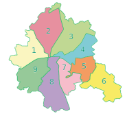
| Districts | ||
|---|---|---|
| City neighborhoods |
| |
| ||
| Raions | ||
|---|---|---|
| Hromadas |
| |
| Cities | ||
| Urban-type settlements |
| |
Coordinates: 49°56′N 36°16′E / 49.933°N 36.267°E

This article about a location in Kharkiv Oblast is a stub. You can help Wikipedia by . |
Categories:
- Slobidskyi District
- Urban districts of Kharkiv
- Kharkiv Oblast geography stubs