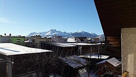
Slovenská Ves
Slovenská Ves | |
|---|---|
Village | |
 View on the main street | |
 Slovenská Ves Location in Slovakia | |
| Coordinates: 49°13′30″N 20°25′30″E / 49.22500°N 20.42500°ECoordinates: 49°13′30″N 20°25′30″E / 49.22500°N 20.42500°E | |
| Country | Slovakia |
| Region | Prešov |
| District | Kežmarok |
| First mentioned | 1311 |
| Area | |
| • Total | 22.440104 km2 (8.664173 sq mi) |
| Elevation | 647 m (2,123 ft) |
| Population (2010) | |
| • Total | 1,862 |
| • Density | 83/km2 (210/sq mi) |
| Time zone | UTC+1 (CET) |
| • Summer (DST) | UTC+2 (CEST) |
| Postal code | 059 02 |
| Area code(s) | 052 |
| Website | http://slovenskaves.info |
Slovenská Ves is a village and municipality in Kežmarok District in the Prešov Region of north Slovakia.
Geography[]


The municipality lies at an altitude of 650 metres and covers an area of 22.4 km2. It has a population of 1862 inhabitants.[1] It is located under the largest mountain in middle Europe called the Tatras, surrounded by lush forests, with a lot of natural wells, rich in mushrooms and berries, being as a living space for wild animals as a bear, deer or fox.
History[]
In historical records, the village was first mentioned in 1311. It had been also known under the name Windschendorf.[2]
The main employment of the village population since its establishment was agricultural manufacture. The main crops were and still are wheat and potatoes. Because of large meadows on mountain roots, a sheep breeding was the next favorite activity.
Economy and infrastructure[]


In the village there are several sport clubs, like table tennis, or football. In Slovenská Ves there is also a ski lift and a gym hall. Gothic Roman Catholic church and a classistic manor house are the most important cultural attractions for sightseeing.
Near the village is located a Jewish cemetery which was being built before the second world war. It was restored few years ago and now serves as a worth memory for the next generations.
The area of the village location is called Spiš which isn't very densely populated. This is a big advantage for people enjoying free space and fresh air. The closest bigger city (population ↑15k) is 12 km far away, the village is a crossroad to the Tatras and to Poland.
References[]
- ^ "Statistical Office of the Slovak Republic" (PDF). Tab. 1 Obyvateľstvo trvalo bývajúce v obciach SR podľa veku a pohlavia, SODB 2011. Retrieved 11.8.2012.
{{cite web}}: Check date values in:|accessdate=(help) - ^ "E-obce.sk Slovensko". Slovenská Ves, Základné údaje. Retrieved 11.8.2012.
{{cite web}}: Check date values in:|accessdate=(help)
External links[]
- http://www.slovenskaves.sk Official homepage (in Slovak)
- Article about church in Slovenská Ves (in Slovak)
- Video about the village
- Weather in Slovenská Ves (in Slovak)
- Villages and municipalities in Kežmarok District
- Prešov Region geography stubs
