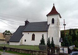
Vojňany
Vojňany | |
|---|---|
Municipality | |
 | |
 Vojňany Location in Slovakia | |
| Coordinates: 49°15′00″N 20°26′30″E / 49.25000°N 20.44167°ECoordinates: 49°15′00″N 20°26′30″E / 49.25000°N 20.44167°E | |
| Country | Slovakia |
| Region | Prešov |
| District | Kežmarok |
| Area | |
| • Total | 5.794543 km2 (2.237286 sq mi) |
| Elevation | 666 m (2,185 ft) |
| Population (2010-12-31) | |
| • Total | 281 |
| • Density | 48/km2 (130/sq mi) |
| Time zone | UTC+1 (CET) |
| • Summer (DST) | UTC+2 (CEST) |
| Postal code | 059 02 |
| Area code(s) | 421-53 |
| Car plate | KK |
| Website | http://vojnany.ocu.sk |

Vojňany is a village and municipality in the Kežmarok District, Prešov Region of north Slovakia.[1]
History[]
In historical records the village was first mentioned in 1235. The historical name of the village in German is Kreig.
Geography[]
The municipality lies at an altitude of 666 metres and covers an area of 5.795 km². It has a population of about 280 people.
External links[]
References[]
- ^ "Statistical Office of the Slovak Republic" (PDF). Výsledky SODB 2011. Štatistický úrad SR. Retrieved 9 August 2012.
| Authority control |
|---|
This Prešov Region geography article is a stub. You can help Wikipedia by . |
Categories:
- Villages and municipalities in Kežmarok District
- Prešov Region geography stubs