Somali Region
Somali Region
Dawlad Deegaanka Soomaalida Soomaali Galbeed | |
|---|---|
 | |
 Flag  Seal | |
| Nickname(s): DDS | |
 Map of Ethiopia showing Somali Region | |
| Country | Ethiopia |
| Capital | Jijiga |
| Government | |
| • | Mustafa Muhummed Omer |
| • Vice Interim President | Ibrahim Osman |
| Area | |
| • Total | 279,252 km2 (107,820 sq mi) |
| • Land | 279,252 km2 (107,820 sq mi) |
| Area rank | 2nd |
| Population (2018) | |
| • Total | 12.5 million |
| Demonym(s) | Somali |
| Time zone | UTC+3 (EAT) |
| Area code(s) | +251 |
| ISO 3166 code | ET-SO |
| HDI (2017) | 0.409[1] low · 10th |
The Somali Region (Somali: Dawlad Deegaanka Soomaalida,[2] Amharic: ሱማሌ ክልል, Arabic: المنطقة الصومالية), also known as Soomaali Galbeed (Somali West)[3] is a regional state in eastern Ethiopia. Its territory is the largest after Oromia Region.[4] The regional state borders the Ethiopian states of Afar and Oromia and the chartered city Dire Dawa (Dire Dhawa) to the west, as well as Djibouti and Somalia to north the east and south; and Kenya to the southwest.[5]
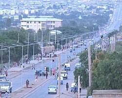
Jijiga is the capital of the Somali Region. The capital was formerly Gode, until Jijiga became the capital in 1995 on account of political considerations.[6]
The Somali regional government is composed of the executive branch, led by the President; the legislative branch, which comprises the State Council; and the judicial branch, which is led by the State Supreme Court.
Overview

The Somali Region formed a large part of the pre-1995 province of Hararghe. The population is predominantly Somali, and there have been attempts to incorporate the area into a Greater Somalia. In the 1970s, Somalia, supported by the United States, invaded Ethiopia, igniting the Ogaden War, which Somalia lost due to timely military intervention from the Soviet Union and its ally Cuba. Despite this defeat, local groups still tried either to become part of Somalia or independent.[citation needed]
The 2007 Abole oil field raid, in which 72 Chinese and Ethiopian oilfield workers were killed, has led to a series of military reprisals against the rebel group ONLF Ogaden National Liberation Front.[citation needed]
Until its first-ever district elections in February 2004, Zonal and woreda administrators and village chairmen were appointed by the Regional government. Senior politicians at the Regional level nominated their clients to the local government positions. In the 2004 local elections, each woreda elected a council including a spokesman, vice-spokesman, administrator, and vice-administrator. These councils have the responsibility of managing budgets and development activities within their respective districts.[7]
Demographics


Based on the 2007 Census conducted by the Central Statistical Agency of Ethiopia (CSA), the Somali Region has a total population of 7,445,219, consisting of 3,472,490 men and 3,972,729 women; urban inhabitants number 1,489,044 or 20% of the population, a further 5,956,175 or 80% were pastoralists and farmers. With an estimated area of 327,068 square kilometers, this region has an estimated density of 20.9 people per square kilometer. For the entire region 1, 685,986 households were counted, which results in an average for the Region of 6.8 persons to a household, with urban households having on average 6 and rural households 6.5 people. Ethnic groups include Somalis (99.2%), Amhara (0.06%), Oromo (0.46%), foreign-born Somalis (0.20%) and Gurages (0.08%). The population was projected to be 11,748,998 in 2017.[8]
There are 8 refugee camps and 1 transit center, housing 212,967 refugees from Somalia, located in Somali Region.[5]
In the previous census, conducted in 1994, the region's population was reported to be 5,439,860, of which 2,875,996 were males and 2,563,864 were females. The urban residents of the Somali Region numbered 492,710 households, with an average of 6.6 persons per household; a high sex ratio of 120 males to 100 females was reported.[9] The ethnic groups included Somalis (96.23%), Oromo (2.25%), Amhara (0.69%), and Gurages (0.14%). Somali was the working language and is predominantly spoken within the Region, spoken by 95.9% of the inhabitants. Other major languages included Oromo (2.24%), Amharic (0.92%), and Gurage (0.033%). 98.7% of the population were Muslim, 0.9% Orthodox Christian, and 0.3% are followers of other religions.[10]
According to the CSA, as of 2004, 38.98% of the total population had access to safe drinking water, of whom 21.32% were rural inhabitants and 77.21% were urban.[11] Values for other reported common indicators of the standard of living for Somali as of 2005 include the following: 71.8% of the inhabitants fall into the lowest wealth quintile; adult literacy for men is 22% and for women 9.8%; and the Regional infant mortality rate is 57 infant deaths per 1,000 live births, which is less than the nationwide average of 77; at least half of these deaths occurred in the infants’ first month of life.[12]
| Year | Ethiopia population |
Somali Region population |
% of Ethiopia | Source |
|---|---|---|---|---|
| 2007 | 73,918,505 | 7,445,219 | 6.21% | [1] |
| 2012 | 84,320,987 | 9,148,989 | 6.51% | [2] |
| 2013 | 86,613,986 | 10,318,000 | 6.99% | [3] |
The region is home to almost all major Somali clan families. The Issa and Gadabuursi subclans of the Dir primarily inhabit the northern Sitti zone and the Awbare woreda in Fafan zone.[13][14][15]
The Habr Awal, Garhajis, Habr Je'lo and Arap clans of the Isaaq clan family inhabit the northern part of the region bordering Somaliland, with the Habr Awal making up the majority in Harshin woreda as well as making up a significant portion of the population of the Kebribeyah woreda, as well as the lucrative border town of Tog Wajaale. The Garhajis and Habr Je'lo make up the majority of Awaare and Misrak Gashamo woredas in Jarar zone with a significant presence in the Danot woreda.[13]
Subclans of the Hawiye inhabit the western and southern areas of the region, with the Degodia being the majority in Liben and also having a large presence in Afder, Dollo, Jarar and Jijiga and other zones. Karanle and Sheekhaal are present in the western areas bordering the Oromia region and the Hawadle and Habar Gidir subclans are present in the Shabelle zone. The closely related Samaale subclan of Garre are also present in the Liben zone.[13]
Various subclans of the Darod clan family primarily inhabit the central and eastern parts of the region, with the Ogaden and Jidwaq inhabiting the interior as well as the major towns of Jijiga, Gode, Kebridehar. The Harti as well as the Leelkase clans inhabit the Dollo zone where they make up the majority while the Marehan clan inhabit the Shilavo woreda and the Liben zone.[13]
Languages
Somali was spoken by 99.92% of the inhabitants. Other minority languages included Oromo (0.7%), and Amharic (0.1%).
Religion
Sunni Islam accounts for 99.4% of the population, 0.50% Orthodox Christian, and 0.10% are followers of all other religions.[16]
Agriculture

The CSA of Ethiopia estimated in 2005 that farmers in the Somali Region had a total of 1, 459,720 cattle (representing 10.19%% of Ethiopia's total cattle), 1,463,000 sheep (20.66%), 1,650,970 goats (50.02%), 1,291,550 donkey (30.66%), 5,3165,260 camels (96.2%), 154,670 poultry of all species (0.5%), and 5,330 beehives (0.12%). For nomadic inhabitants, the CSA provided two sets of estimates, one based on aerial surveys and the other on more conventional methodology:[17]
| Livestock | Aerial survey (conducted 5-23 Nov. 2003) |
Conventional survey (conducted 11 Dec. 2003) |
|---|---|---|
| Cattle | 670,280 | 130,610 |
| Sheep | 6,410,800 | 250,110 |
| Goats | 5,525,460 | 177,580 |
| Camels | 1,041,870 | 64,510 |
| Donkeys | 42,640 | 14,290 |
| Mules | 430 | 160 |
| Horses | 50 | - |
Transportation
Ground travel
West from Addis Ababa, Awash 572 km via Harar and Jijiga to Degehabur
Air travel
Somali Regional State has 3 international airport and 2 commercial airports. The international airports are Jijiga Airport, Gode Airport, and Kabri Dar Airport, The 2 commercial airports are Dolo Airport, and Shilavo Airport.
Government
Executive branch
The executive branch is headed by the President of Somali Regional State. The current President is Mustafa Muhummed Omer (Cagjar), elected in 22 August 2018.[18] A Vice President of Somali Region succeeds the president in the event of any removal from office, and performs any duties assigned by the president. The current vice president is . The other offices in the executive branch cabinet are the Regional Health Bureau, Educational Bureau, and 18 other officials.[19]
List of presidents of Somali Region
Judicial branch
There are three levels of the Somali region judiciary. The lowest level is the court of common pleas: each woreda maintains its own constitutionally mandated court of common pleas, which maintain jurisdiction over all justiciable matters. The intermediate-level court system is the district court system. Four courts of appeals exist, each retaining jurisdiction over appeals from common pleas, municipal, and county courts in an administrative zone. A case heard in this system is decided by a three-judge panel, and each judge is elected.
The highest-ranking court, the Somali Supreme Court, is Somali's "court of last resort". A Seven-justice panel composes the court, which, by its own discretion, hears appeals from the courts of appeals, and retains original jurisdiction over limited matters. The chief judge is called the Chief of Soamli Supreme Court .[25]
Legislative branch
The State Council, which is the highest administrative body of the state, is made up of 269 members.[26]
National politics
Somali is represented by
- 6 representatives in The House of Federation (upper chamber) and
- 24 representatives in The House of Peoples' Representatives (lower chamber)
Administrative zones

Like other Regions in Ethiopia, Somali Region is subdivided into eleven administrative zones and Six Special administrative zones:[27]
- Afder Zone
- Dollo Zone (formerly Warder)
- Erer Zone
- Fafan Zone (formerly Jigjiga)
- Jarar Zone (formerly Degehabur)
- Korahe Zone
- Liben Zone
- Nogob Zone (formerly Fiq)
- Shabelle Zone (formerly Godey)
- Sitti Zone (formerly Shinile)
- Degehabur Special Zone (special zone)
- Gode Special Zone (special zone)
- Harawo Special Zone (special zone)
- Kebri Beyah Special Zone (special zone)
- (special zone)
The zones are themselves subdivided into districts.
See also
- Ethiopia
- List of airports in Ethiopia
- Afar-Somali clashes
References
- ^ "Sub-national HDI - Area Database - Global Data Lab". hdi.globaldatalab.org. Retrieved 2018-09-13.
- ^ "Country Facts | Somalia". www.un.int. Retrieved 2020-02-05.
- ^ "Itoobiya oo laga xusay guushi Karamardha ee 1977-kii". BBC News Somali (in Somali). 2020-03-06. Retrieved 2021-02-21.
- ^ "Ethiopia Regions, Cities, and Population". www.ethiovisit.com. Retrieved 2021-05-09.
- ^ Jump up to: a b "Registered Somali Refugee Population". The UN Refugee Agency. July 31, 2014.
- ^ "April 1994 Monthly Situation Report" United Nations Emergencies Unit for Ethiopia (accessed 29 May 2008)
- ^ Tobias Hagmann, Mohamud H. Khalif: "State and Politics in Ethiopia's Somali region since 1991", Bildhaan: the International Journal of Somali Studies Archived 2011-08-31 at the Wayback Machine, 6 (2006), p. 33
- ^ Population Projection of Ethiopia for All Regions At Wereda Level from 2014 – 2017. Federal Democratic Republic of Ethiopia Central Statistical Agency. Retrieved 4 June 2018.
- ^ The 1994 National Census was delayed in the Somali Region until 1997. The Census did not cover all parts of the Region, namely rural kebeles in the following Zones: Shinile, Fiq, Gode, and Afder. The 1994 Population and Housing Census of Ethiopia: Results for Somali Region, vol.1 Archived 2008-12-07 at the Wayback Machine, Chapter 2 "Population size and characteristics"
- ^ FDRE States: Basic Information - Somalia Archived 2005-05-22 at the Wayback Machine, Population (accessed 12 March 2006)
- ^ "Households by sources of drinking water, safe water sources" Archived 2008-11-18 at the Wayback Machine CSA Selected Basic Welfare Indicators (accessed 28 January 2009)
- ^ Macro International Inc. "2008. Ethiopia Atlas of Key Demographic and Health Indicators, 2005." (Calverton: Macro International, 2008), pp. 2, 3, 10 (accessed 28 January 2009)
- ^ Jump up to: a b c d "Changing Pastoralism in Region 5". www.africa.upenn.edu. Retrieved 2021-04-22.
- ^ Sociology Ethnology Bulletin of Addis Ababa University "Sociology Ethnology Bulletin" Check
|url=value (help). 1994.Different aid groups were also set up to help communities cope in the predominantly Gadabursi district of Aw Bare.
- ^ (PDF). 2018–2019. p. 8 Theoretical and Practical Conflict Rehabilitation in the Somali Region of Ethiopia https://www.scribd.com/document/408504136/Theoretical-and-Practical-Conflict-Rehabilitation-in-the-Somali-Region-of-Ethiopia Theoretical and Practical Conflict Rehabilitation in the Somali Region of Ethiopia Check
|url=value (help).The Gadabursi, who dominate the adjacent Awbare district north of Jijiga and bordering with the Awdal Region of Somaliland, have opened the already existing camps of Derwanache and Teferi Ber to these two communities.
Missing or empty|title=(help) - ^ " Census 2007 Tables: Somali Region", Tables 2.1, 2.5, 3.1, 3.2, 3.4
- ^ "CSA 2005 National Statistics" Archived 2008-11-18 at the Wayback Machine, Tables D.4 - D.7.
- ^ Ben, Cahoon. "Ethiopia Administrative Divisions". World Statesman. Retrieved 24 February 2018.
- ^ "Amhara Region Announces Appointment of 22 Cabinet Members". Ethiopian News Agency. 23 November 2016. Archived from the original on 2018-03-05. Retrieved 24 February 2018.
- ^ Tobias Hagmann, Mohamud H. Khalif, "State and Politics in Ethiopia's Somali region since 1991" Archived 2011-08-31 at the Wayback Machine, Bildhaan: the International Journal of Somali Studies, 6 (2006), p. 29
- ^ Asnake Kefale Adegehe, Federalism and ethnic conflict in Ethiopia: a comparative study of the Somali and Benishangul-Gumuz regions Department of Political Science, Faculty of Social and Behavioural Sciences, Leiden University, Doctoral thesis (2009), p. 138
- ^ "Ahmed Shide named chairman of the Somali region ruling party". 12 August 2018.
- ^ Dirir Mohamoud (Ethiopia) Archived 28 April 2009 at the Wayback Machine AfDevInfo website (accessed 14 May 2009)
- ^ Exclusive: Third day EPRDF EC discussing “Prosperity Party” Regulation. Find the draft copy obtained by AS
- ^ "MOU Signing ceremony With Federal and Regional Supreme Courts of Ethiopia to Facilitate Support for Clearance of Backlog Files". Justice For All-PF Ethiopia. 14 August 2015. Archived from the original on 5 November 2017. Retrieved 8 July 2017.
- ^ Lansford, Tom (2015). Political Handbook of the World 2015. Washington, D.C., United States: CQ Press. pp. 492. ISBN 978-1483371559.
- ^ "Ethiopia: Somali Region Administrative map (as of 05 Jan 2015)". OCHA. 5 January 2015. Retrieved 5 November 2017.
Further reading
- Tobias Hagmann, "Beyond clannishness and colonialism: understanding political disorder in Ethiopia's Somali Region, 1991- 2004", Journal of Modern African Studies, 43 (2005), 509–536.
- Abdi Ismail Samatar (2004): "Ethiopian Federalism: Autonomy versus Control in the Somali Region". Third World Quarterly, Vol. 25/6
- John Markakis (1996): "The Somali in Ethiopia". Review of African Political Economy, Vol. 23, No. 70, pp. 567–570
- John Markakis (1994): "Briefing: Somalia in the New Political Order of Ethiopia". Review of African Political Economy, Vol. 21, No. 59 pp. 71–79
External links
- Map of Somali Region at UN-OCHA[permanent dead link]
- Map of Somali Region at DPPA of Ethiopia (PDF file)
- List of Ogaden-Somali Members of Ethiopian Parliament
- Official Website of Ogaden-Somali region of Ethiopia
- "Ethiopia: Rains pound Somali region as death toll rises" - UN IRIN
- "Floods plague Horn of Africa, wash away refugee shelters" - UN News
| show Zones of the Somali Region |
|---|
| show Woredas of the Somali Region |
|---|
Coordinates: 7°26′19″N 44°17′49″E / 7.4387305°N 44.2968750°E

- Somali Region
- 1994 establishments in Ethiopia
- Regions of Ethiopia
- Somali-speaking countries and territories
- States and territories established in 1992