Sudipen
Sudipen | |
|---|---|
| Municipality of Sudipen | |
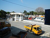
 Downtown area | |
 Flag  Seal | |
 Map of La Union with Sudipen highlighted | |
OpenStreetMap  | |
 Sudipen Location within the Philippines | |
| Coordinates: 16°54′N 120°28′E / 16.9°N 120.47°ECoordinates: 16°54′N 120°28′E / 16.9°N 120.47°E | |
| Country | Philippines |
| Region | Ilocos Region |
| Province | La Union |
| District | 1st district |
| Barangays | 17 (see Barangays) |
| Government | |
| • Type | Sangguniang Bayan |
| • Mayor | Wendy Joy D. Buquing |
| • Vice Mayor | Melvin G. Macusi |
| • Representative | Pablo C. Ortega |
| • Municipal Council | Members |
| • Electorate | 13,933 voters (2019) |
| Area | |
| • Total | 97.59 km2 (37.68 sq mi) |
| Elevation | 70 m (230 ft) |
| Highest elevation | 443 m (1,453 ft) |
| Lowest elevation | 0 m (0 ft) |
| Population (2020 census) [3] | |
| • Total | 17,187 |
| • Density | 180/km2 (460/sq mi) |
| • Households | 3,758 |
| Economy | |
| • Income class | 4th municipal income class |
| • Poverty incidence | 9.66% (2015)[4] |
| • Revenue | ₱95,824,274.10 (2020) |
| • Assets | ₱367,643,774.58 (2020) |
| • Expenditure | ₱134,202,778.69 (2020) |
| • Liabilities | ₱50,421,080.72 (2020) |
| Service provider | |
| • Electricity | La Union Electric Cooperative (LUELCO) |
| Time zone | UTC+8 (PST) |
| ZIP code | 2520 |
| PSGC | |
| IDD : area code | +63 (0)72 |
| Native languages | Kankanaey Ilocano Tagalog |
| Website | www |

Sudipen (Southern Ilocano pronunciation: [sudipɯn]), officially the Municipality of Sudipen (Ilocano: Ili ti Sudipen; Pangasinan: Baley na Sudipen, Filipino: Bayan ng Sudipen), is a 4th class municipality in the province of La Union, Philippines. According to the 2020 census, it has a population of 17,187 people. [3]
Geography[]
Sudipen is located 312 kilometres (194 mi) north-north-west of the Philippine capital, Manila, and 43 kilometres (27 mi) away from the provincial capital of San Fernando, La Union. It is bounded on the west by the municipalities of Bangar and Balaoan; on the east and north by the Amburayan River and the province of Ilocos Sur; and in the south by Santol.
Sudipen has a total land area of 97 square kilometers, making it the fifth largest municipality by land area in the province. [5] Barangay Bulalaan is the largest barangay with a land area of 8,988 hectares (22,210 acres), while Barangay Poblacion is the smallest with only 82 hectares (200 acres).
Climate[]
| Climate data for Sudipen, La Union | |||||||||||||
|---|---|---|---|---|---|---|---|---|---|---|---|---|---|
| Month | Jan | Feb | Mar | Apr | May | Jun | Jul | Aug | Sep | Oct | Nov | Dec | Year |
| Average high °C (°F) | 30 (86) |
31 (88) |
33 (91) |
33 (91) |
32 (90) |
31 (88) |
30 (86) |
30 (86) |
30 (86) |
31 (88) |
31 (88) |
31 (88) |
31 (88) |
| Average low °C (°F) | 20 (68) |
21 (70) |
23 (73) |
25 (77) |
26 (79) |
25 (77) |
25 (77) |
25 (77) |
25 (77) |
23 (73) |
22 (72) |
21 (70) |
23 (74) |
| Average precipitation mm (inches) | 27 (1.1) |
31 (1.2) |
40 (1.6) |
71 (2.8) |
207 (8.1) |
237 (9.3) |
286 (11.3) |
261 (10.3) |
261 (10.3) |
254 (10.0) |
88 (3.5) |
46 (1.8) |
1,809 (71.3) |
| Average rainy days | 9.4 | 9.3 | 12.7 | 17.0 | 25.4 | 26.8 | 27.4 | 26.1 | 25.0 | 21.0 | 15.5 | 10.6 | 226.2 |
| Source: Meteoblue [6] | |||||||||||||
Barangays[]
Sudipen is politically subdivided into 17 barangays. [5]
- Bigbiga
- Bulalaan
- Castro
- Duplas
- Ilocano
- Ipet
- Maliclico
- Namaltugan
- Old Central ('Nagpanaoan)
- Poblacion
- Porporiket
- San Francisco Norte
- San Francisco Sur
- San Jose
- Sengngat
- Turod
- Up-uplas
Demographics[]
| Year | Pop. | ±% p.a. |
|---|---|---|
| 1918 | 3,569 | — |
| 1939 | 6,039 | +2.54% |
| 1948 | 6,922 | +1.53% |
| 1960 | 7,926 | +1.13% |
| 1970 | 9,785 | +2.13% |
| 1975 | 10,430 | +1.29% |
| 1980 | 10,796 | +0.69% |
| 1990 | 13,043 | +1.91% |
| 1995 | 14,075 | +1.44% |
| 2000 | 15,099 | +1.52% |
| 2007 | 15,949 | +0.76% |
| 2010 | 16,531 | +1.31% |
| 2015 | 17,056 | +0.60% |
| 2020 | 17,187 | +0.15% |
| Source: Philippine Statistics Authority [7] [8] [9][10] | ||
In the 2020 census, the population of Sudipen was 17,187 people, [3] with a density of 180 inhabitants per square kilometre or 470 inhabitants per square mile.
Economy[]
| Poverty Incidence of Sudipen | |
| Source: Philippine Statistics Authority[11][12][13][14][15][16] | |
Local government[]
- Mayor: Wendy Joy D. Buquing
- Vice Mayor: Melvin G. Macusi
- Sangguniang Bayan Members (Municipal Councilors):
- Tita D. Mostoles
- Edwin M. Belisoa, Jr.
- Joebet L. Dee
- Demy L. Danguecan
- Thelma R. Peña
- Bery A. Yadao
- Marcelina P. Leonen
- Yna P. Castro
- Edwin O. Oribio – President of the Liga ng mga Barangay
- Michael A. Amoyen – SK Federation President
- Noli C. Cong-o – Indigenous Peoples Mandatory Representative
Gallery[]

Municipal hall
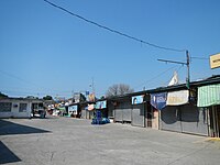
Town center
Sudipen Farmers Public Market

Sudipen Central School

Sudipen terminal


References[]
- ^ Municipality of Sudipen | (DILG)
- ^ "2015 Census of Population, Report No. 3 – Population, Land Area, and Population Density" (PDF). Philippine Statistics Authority. Quezon City, Philippines. August 2016. ISSN 0117-1453. Archived (PDF) from the original on 25 May 2021. Retrieved 16 July 2021.
- ^ a b c Census of Population (2020). "Region I (Ilocos Region)". Total Population by Province, City, Municipality and Barangay. PSA. Retrieved 8 July 2021.
- ^ https://psa.gov.ph/sites/default/files/City%20and%20Municipal-level%20Small%20Area%20Poverty%20Estimates_%202009%2C%202012%20and%202015_0.xlsx; publication date: 10 July 2019; publisher: Philippine Statistics Authority.
- ^ a b "Province: La Union". PSGC Interactive. Quezon City, Philippines: Philippine Statistics Authority. Retrieved 12 November 2016.
- ^ "Sudipen: Average Temperatures and Rainfall". Meteoblue. Retrieved 26 April 2020.
- ^ Census of Population (2015). "Region I (Ilocos Region)". Total Population by Province, City, Municipality and Barangay. PSA. Retrieved 20 June 2016.
- ^ Census of Population and Housing (2010). "Region I (Ilocos Region)". Total Population by Province, City, Municipality and Barangay. NSO. Retrieved 29 June 2016.
- ^ Censuses of Population (1903–2007). "Region I (Ilocos Region)". Table 1. Population Enumerated in Various Censuses by Province/Highly Urbanized City: 1903 to 2007. NSO.
- ^ "Province of La Union". Municipality Population Data. Local Water Utilities Administration Research Division. Retrieved 17 December 2016.
- ^ "Poverty incidence (PI):". Philippine Statistics Authority. Retrieved 28 December 2020.
- ^ https://psa.gov.ph/sites/default/files/NSCB_LocalPovertyPhilippines_0.pdf; publication date: 29 November 2005; publisher: Philippine Statistics Authority.
- ^ https://psa.gov.ph/sites/default/files/2003%20SAE%20of%20poverty%20%28Full%20Report%29_1.pdf; publication date: 23 March 2009; publisher: Philippine Statistics Authority.
- ^ https://psa.gov.ph/sites/default/files/2006%20and%202009%20City%20and%20Municipal%20Level%20Poverty%20Estimates_0_1.pdf; publication date: 3 August 2012; publisher: Philippine Statistics Authority.
- ^ https://psa.gov.ph/sites/default/files/2012%20Municipal%20and%20City%20Level%20Poverty%20Estima7tes%20Publication%20%281%29.pdf; publication date: 31 May 2016; publisher: Philippine Statistics Authority.
- ^ https://psa.gov.ph/sites/default/files/City%20and%20Municipal-level%20Small%20Area%20Poverty%20Estimates_%202009%2C%202012%20and%202015_0.xlsx; publication date: 10 July 2019; publisher: Philippine Statistics Authority.
External links[]
| Wikimedia Commons has media related to Sudipen. |
- Sudipen Profile at PhilAtlas.com
- Philippine Standard Geographic Code
- Philippine Census Information
- Local Governance Performance Management System
Places adjacent to Sudipen | |
|---|---|
San Fernando (capital) | |
| Municipalities | |
| Component city | |
| Barangays | |
- Municipalities of La Union