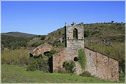
Suellacabras
This article does not cite any sources. (December 2009) |
Suellacabras | |
|---|---|
 | |
 Suellacabras Location in Spain. | |
| Coordinates: 41°51′09″N 2°13′24″W / 41.85250°N 2.22333°WCoordinates: 41°51′09″N 2°13′24″W / 41.85250°N 2.22333°W | |
| Country | |
| Autonomous community | |
| Province | |
| Municipality | Suellacabras |
| Area | |
| • Total | 39.19 km2 (15.13 sq mi) |
| Elevation | 1,196 m (3,924 ft) |
| Population (2018)[1] | |
| • Total | 25 |
| • Density | 0.64/km2 (1.7/sq mi) |
| Time zone | UTC+1 (CET) |
| • Summer (DST) | UTC+2 (CEST) |
| Website | Official website |
Suellacabras is a small Spanish town and municipality, located in the province of Soria, part of the autonomous community of Castile and León.
It is located in the mountain range known as .
The most important attraction is the church of San Caprasio.
In the municipality is included the village El Espino, with the romanesque church of San Benito and two hermitages: Virgen del Espinar and San Román (gothic, ruins).
References[]
- ^ Municipal Register of Spain 2018. National Statistics Institute.
Categories:
- Municipalities in the Province of Soria
- Province of Soria geography stubs


