Tagoloan River
| Tagoloan River | |
|---|---|
 Tagoloan River mouth | |
| Location | |
| Country | |
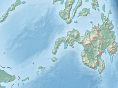
| Region | Northern Mindanao |
| Province | |
| Physical characteristics | |
| Source | |
| • location | Malaybalay City, Bukidnon |
| • elevation | 2,041 ft (622 m) |
| Mouth | Macajalar Bay |
• location | Tagoloan, Misamis Oriental |
• coordinates | 8°33′20″N 124°44′37″E / 8.55565°N 124.74359°ECoordinates: 8°33′20″N 124°44′37″E / 8.55565°N 124.74359°E |
• elevation | 0 m (0 ft) |
| Length | 106 km (66 mi) |
| Basin size | 1,704 km2 (658 sq mi) |
| Discharge | |
| • location | Macajalar Bay |
| Basin features | |
| Tributaries | |
| • left | |
| • right | |


The Tagoloan River is the 13th largest river system in the Philippines in terms of watershed size, as classified by the National Water Resources Board.[1][2] It has an estimated drainage area of 1,704 square kilometres (658 sq mi) covering the provinces of Bukidnon and Misamis Oriental. It has a length of 106 kilometres (66 mi) from its source in Malaybalay City in Bukidnon province.[3]
References[]
- ^ Velasco, Luis Rey; Liborio Cabanilla (January 2003). "Assessment of Physical Resource Capability in Philippine Agriculture" (PDF). Philippine APEC Study Center Network. Archived from the original (PDF) on 2007-11-17. Retrieved 2008-09-19.
- ^ Suminguit, Vel J.; Erlinda Burton. "§ A Study on Ancestral Domain Recognition and Management Within and Around the Mt. Kitanglad Range National Park" (PDF). ICRAF Southeast Asia. Retrieved 2008-09-19.
- ^ Sumbalan, Antonio T. "The Bukidnon Experience on Natural Resource Management Decentralization". Archived from the original on 2011-07-19. Retrieved 2008-09-19.
Categories:
- Rivers of the Philippines
- Landforms of Misamis Oriental
- Landforms of Bukidnon
- Asia river stubs
- Philippines geography stubs