Tanah Bumbu Regency
Tanah Bumbu Regency
Kabupaten Tanah Bumbu | |
|---|---|
 Coat of arms | |
| Motto(s): Bersujud (Kneeling to God) | |
 | |
| Country | Indonesia |
| Province | South Kalimantan |
| Capital | Batulicin |
| Established | 8 April 2003 |
| Area | |
| • Total | 4,890.30 km2 (1,888.16 sq mi) |
| Population (2019) | |
| • Total | 360,187 |
| • Density | 74/km2 (190/sq mi) |
| [1] | |
| Time zone | UTC+8 (WITA) |
| Area code(s) | 0518 |
| Website | tanahbumbukab.go.id |
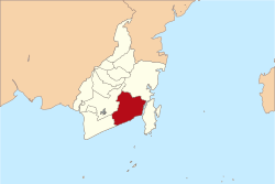
Tanah Bumbu is one of the regencies in the Indonesian province of South Kalimantan. It covers an area of 4,890.3 km2 and had a population of 267,929 at the 2010 Census; the latest official estimate (as at 2019) is 360,187. The regency's capital is Batulicin.
Administrative Districts[]
Tanah Bumbu Regency is divided into ten districts (kecamatan), listed below with their areas and their 2010 Census populations,[2] together with the latest (as at 2019) official estimates.[3] The table includes the number of administrative villages (totalling 144 rural desa and 5 urban kelurahan) in each district, and its post code.
| Name | Area in km2 |
Pop'n Census 2010 |
Pop'n Estimate 2019 |
No. of vill. |
Post code |
|---|---|---|---|---|---|
| Kusan Hilir (Lower Kusan) |
289.01 | 42,829 | 56,029 | 35 | 72273 |
| Sungai Loban (Loban River) |
383.91 | 18,867 | 24,765 | 17 | 72274 |
| Satui | 877.87 | 49,252 | 68,526 | 16 | 72276 |
| Angsana | 195.95 | 16,347 | 21,529 | 9 | 72275 |
| Kusan Hulu (Upper Kusan) |
1,503.24 | 18,910 | 24,368 | 21 | 72270 |
| Kuranji | 114.64 | 7,558 | 10,025 | 7 | 72272 -72274 |
| Batulicin(a) (town) | 135.16 | 13,430 | 18,140 | 9 | 72211 -72273 |
| Karang Bintang | 201.40 | 15,814 | 21,048 | 11 | 72210 |
| Simpang Empat (b) (c) | 293.48 | 67,909 | 93,542 | 12 | 72211 -72213 |
| Mantewe | 895.64 | 16,933 | 22,215 | 12 | 72211 |
| Totals | 4,890.30 | 267,929 | 360,187 | 149 |
Notes: (a) includes the three offshore islands of Suwangi, Anak Suwangi and Sungai Dua.
(b) not to be confused with the district of the same name in Banjar Regency.
(c) includes the three offshore islands of Burung, Hantu and Tampakan.
References[]
Regencies and cities of South Kalimantan | ||
|---|---|---|
Capital: Banjarmasin | ||
| Regencies | ||
| Cities | ||
Coordinates: 3°27′15″S 115°42′13″E / 3.4541°S 115.7037°E

This South Kalimantan location article is a stub. You can help Wikipedia by . |
- Regencies of South Kalimantan
- Kalimantan geography stubs