Tatebayashi, Gunma
Tatebayashi
館林市 | |
|---|---|
 Tatebayashi city hall | |
 Flag  Emblem | |
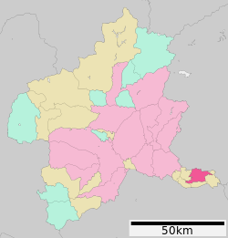 Location of Tatebayashi in Gunma Prefecture | |
 Tatebayashi | |
| Coordinates: 36°14′41.4″N 139°32′31.6″E / 36.244833°N 139.542111°ECoordinates: 36°14′41.4″N 139°32′31.6″E / 36.244833°N 139.542111°E | |
| Country | Japan |
| Region | Kantō |
| Prefecture | Gunma |
| Government | |
| • Mayor | Kazuo Yasuraoka (since April 2007) |
| Area | |
| • Total | 60.97 km2 (23.54 sq mi) |
| Population (September 2020) | |
| • Total | 75,442 |
| • Density | 1,200/km2 (3,200/sq mi) |
| Time zone | UTC+9 (Japan Standard Time) |
| – Tree | Pinus thunbergii |
| – Flower | Rhododendron obtusum |
| – Bird | Anas poecilorhyncha |
| Phone number | 0276-72-4111 |
| Address | 1-1 Shiromachi, Tatebayashi-shi, Gunma-ken 374-8501 |
| Website | Official website |


Tatebayashi (館林市, Tatebayashi-shi) is a city located in Gunma Prefecture, Japan. As of 1 September 2020, the city had an estimated population of 75,442 in 33,589 households,[1] and a population density of 1200 persons per km². The total area of the city is 60.97 square kilometres (23.54 sq mi). Tatebayashi is famous for Azalea Hill Park and Bunbuku Chagama of temple.
Geography[]
Tatebayashi is located in the extreme southeastern portion of Gunma Prefecture in the Kantō Plains, bordered by Tochigi Prefecture to the north. The Tone River and Watarase Rivers sandwich the city to the north and south.
Surrounding municipalities[]
Climate[]
Tatebayashi has a Humid continental climate (Köppen Cfa) characterized by warm summers and cold winters with heavy snowfall. The average annual temperature in Tatebayashi is 14.5 °C. The average annual rainfall is 1287 mm with September as the wettest month. The temperatures are highest on average in August, at around 26.7 °C, and lowest in January, at around 3.3 °C.[2]
| hideClimate data for Tatebayashi City | |||||||||||||
|---|---|---|---|---|---|---|---|---|---|---|---|---|---|
| Month | Jan | Feb | Mar | Apr | May | Jun | Jul | Aug | Sep | Oct | Nov | Dec | Year |
| Record high °C (°F) | 18.4 (65.1) |
24.0 (75.2) |
27.1 (80.8) |
33.2 (91.8) |
35.4 (95.7) |
39.3 (102.7) |
39.9 (103.8) |
40.3 (104.5) |
39.3 (102.7) |
33.9 (93.0) |
24.9 (76.8) |
25.2 (77.4) |
40.3 (104.5) |
| Average high °C (°F) | 9.3 (48.7) |
10.1 (50.2) |
13.7 (56.7) |
19.9 (67.8) |
24.1 (75.4) |
26.7 (80.1) |
30.4 (86.7) |
32.3 (90.1) |
27.7 (81.9) |
22.0 (71.6) |
16.5 (61.7) |
11.7 (53.1) |
20.4 (68.7) |
| Daily mean °C (°F) | 3.7 (38.7) |
4.5 (40.1) |
7.9 (46.2) |
13.6 (56.5) |
18.3 (64.9) |
21.8 (71.2) |
25.4 (77.7) |
26.9 (80.4) |
22.9 (73.2) |
17.0 (62.6) |
11.0 (51.8) |
6.0 (42.8) |
14.9 (58.8) |
| Average low °C (°F) | −1.1 (30.0) |
−0.4 (31.3) |
2.8 (37.0) |
8.3 (46.9) |
13.4 (56.1) |
17.8 (64.0) |
21.7 (71.1) |
23.1 (73.6) |
19.4 (66.9) |
12.9 (55.2) |
6.3 (43.3) |
1.1 (34.0) |
10.5 (50.9) |
| Record low °C (°F) | −8.8 (16.2) |
−7.0 (19.4) |
−4.7 (23.5) |
−1.0 (30.2) |
3.6 (38.5) |
11.0 (51.8) |
14.6 (58.3) |
15.9 (60.6) |
10.2 (50.4) |
2.8 (37.0) |
−2.0 (28.4) |
−5.9 (21.4) |
−8.8 (16.2) |
| Average precipitation mm (inches) | 32.7 (1.29) |
36.7 (1.44) |
71.9 (2.83) |
88.4 (3.48) |
114.7 (4.52) |
140.0 (5.51) |
143.3 (5.64) |
166.3 (6.55) |
171.8 (6.76) |
129.3 (5.09) |
57.2 (2.25) |
32.4 (1.28) |
1,184.6 (46.64) |
| Average precipitation days (≥ 1.0 mm) | 3.9 | 4.9 | 8.9 | 9.5 | 10.6 | 12.5 | 13.2 | 9.5 | 12.3 | 9.2 | 6.2 | 3.2 | 104.0 |
| Mean monthly sunshine hours | 204.6 | 186.8 | 185.8 | 191.1 | 182.3 | 130.8 | 144.3 | 173.7 | 125.6 | 142.8 | 168.2 | 198.1 | 2,035 |
| Source: Japan Meteorological Agency (Averages:1981-2010, Peaks:1978-present)[3][4] | |||||||||||||
Demographics[]
Per Japanese census data,[5] the population of Tatebayashi has increased steadily over the past 100 years. There is a small community of around 200 Rohingya from Myanmar living in Tatebayashi.[6][7]
| Year | Pop. | ±% |
|---|---|---|
| 1920 | 37,242 | — |
| 1930 | 41,629 | +11.8% |
| 1940 | 42,411 | +1.9% |
| 1950 | 55,510 | +30.9% |
| 1960 | 55,684 | +0.3% |
| 1970 | 61,130 | +9.8% |
| 1980 | 70,245 | +14.9% |
| 1990 | 76,221 | +8.5% |
| 2000 | 79,371 | +4.1% |
| 2010 | 78,580 | −1.0% |
History[]
Tatebayashi is located within traditional Kōzuke Province and has been settled since prehistoric times and there is a continuous record of habitation from the Japanese Paleolithic period 20,000 years ago. During the Edo period, the area of present-day Tatebayashi was a castle town and administrative center of Tatebayashi Domain, a feudal domain under the Tokugawa shogunate.
Tatebayashi Town was created within Ōra District, Gunma Prefecture on April 1, 1889 with the creation of the modern municipalities system after the Meiji Restoration. On April 1, 1954 the town of Tatebayashi and the villages of Satoya, Ōshima, Akabane, Rokugō, Minoya, Tatara, and Watarase merged to form the city Tatebayashi.
Government[]
Tatebayashi has a mayor-council form of government with a directly elected mayor and a unicameral city council of 18 members. Tatebayashi contributes two members to the Gunma Prefectural Assembly. In terms of national politics, the city is part of of the lower house of the Diet of Japan.
Economy[]
This section needs expansion. You can help by . (April 2015) |
Tatebayashi is a regional commercial center and transportation hub. Food processing dominates the manufacturing sector of the local economy.
Education[]
Tatebayashi has 11 public elementary schools and five public middle schools operated by the city government, and two public high schools operated by the Gunma Prefectural Board of Education. There is also one private high school.
University[]
Transportation[]
Railway[]
 Tōbu Railway Isesaki Line
- Tōbu Railway Sano Line
- Tōbu Railway Koizumi Line
Highway[]
 Tōhoku Expressway – Tatebayashi Interchange
 National Route 122
 National Route 354
Local attractions[]
- Site of Tatebayashi Castle
- Tsutsujigaoka Park, a National Place of Scenic Beauty
- Jō-numa marsh
- Tatara-numa marsh
- Moriniji Temple
Sister-city relations[]
 – Maroochy Shire Council, Australia, since July 1996[8]
 – Kunshan, China, friendship city since 2004[9]
Notable people[]
- Katai Tayama, novelist
- Kenjiro Shoda, mathematician
- Chiaki Mukai, astronaut and doctor[10]
References[]
- ^ "Tatebayashi City official statistics" (in Japanese). Japan.
- ^ Tatebayashi climate data
- ^ "平年値(年・月ごとの値)". Japan Meteorological Agency. Retrieved November 1, 2018.
- ^ "観測史上1~10位の値(年間を通じての値)". Japan Meteorological Agency. Retrieved November 1, 2018.
- ^ Tatebayashi population statistics
- ^ Shintomi, Tetsuo Student films documentary about Rohingya in Gunma Prefecture February 2, 2016 Japan Times Retrieved June 23, 2016
- ^ Bleak prospects for Rohingya refugee in Japan September 3, 2013 Yomiuri Shimbun Retrieved June 23, 2016
- ^ "Sister Cities and International Partnerships". business.sunshinecoast.qld.gov.au. Sunshine Coast Regional Council. May 6, 2015.
- ^ "Kunshan China". The People's Government of Kunshan. Archived from the original on April 29, 2015. Retrieved May 7, 2015.
- ^ "Biographical Data: CHIAKI MUKAI (M.D., PH.D.) JAXA ASTRONAUT (PAYLOAD SPECIALIST)". jsc.nasa.gov. National Aeronautics and Space Administration. October 2013.
External links[]
![]() Media related to Tatebayashi, Gunma at Wikimedia Commons
Media related to Tatebayashi, Gunma at Wikimedia Commons
- Official Website (in Japanese)
 Tatebayashi, Gunma travel guide from Wikivoyage
| show Authority control |
|---|
- Cities in Gunma Prefecture
- Tatebayashi, Gunma