Tinjan
Tinjan | |
|---|---|
Municipality | |
 | |
 Flag | |
 Tinjan Location of Tinjan in Croatia | |
| Coordinates: 45°13′02″N 13°50′20″E / 45.21722°N 13.83889°ECoordinates: 45°13′02″N 13°50′20″E / 45.21722°N 13.83889°E | |
| Country | Croatia |
| County | Istria |
| Population (2011)[1] | |
| • Total | 1,684 |
| Time zone | UTC+1 (CET) |
| • Summer (DST) | UTC+2 (CEST) |
| Website | tinjan.hr |

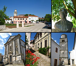
Tinjan (Italian: Antignana) is a village and municipality in Istria, Croatia. The total population is 1,684 (2011 census), distributed in the following settlements:[1]
- , population 100
- , population 187
- , population 268
- Kringa, population 315
- , population 77
- , population 210
- Tinjan, population 417
- , population 110
Tinjan is located is 50 km north of Pula and 10 km southwest of Pazin, in the Draga valley. The Coat of Arms of Tinjan is azure on a base vert a tower argent behind walls of the same. This is based on the historical pattern.
References[]
- ^ Jump up to: a b "Population by Age and Sex, by Settlements, 2011 Census: Tinjan". Census of Population, Households and Dwellings 2011. Zagreb: Croatian Bureau of Statistics. December 2012.
External links[]
| Wikimedia Commons has media related to Tinjan. |
| show Subdivisions of Istria County |
|---|

| show Authority control |
|---|
This Istria County geography article is a stub. You can help Wikipedia by . |
Categories:
- Municipalities of Croatia
- Populated places in Istria County
- Istria County geography stubs