Tippecanoe, Indiana
Tippecanoe | |
|---|---|
 Tippecanoe | |
| Coordinates: 41°12′32″N 86°06′54″W / 41.20889°N 86.11500°WCoordinates: 41°12′32″N 86°06′54″W / 41.20889°N 86.11500°W | |
| Country | United States |
| State | Indiana |
| County | Marshall |
| Township | Tippecanoe |
| Named for | Tippecanoe River |
| Elevation | 781 ft (238 m) |
| Time zone | UTC-5 (Eastern) |
| • Summer (DST) | UTC-4 (Eastern Daylight) |
| ZIP code | 46570 |
| FIPS code | 18-75860[2] |
| GNIS feature ID | 449738 |


Tippecanoe is an unincorporated community in Tippecanoe Township, Marshall County, Indiana, United States.
History[]
Tippecanoe was settled beginning in 1882. The original town was located 1 mile to the north and was platted as Tippecanoe Town in 1850, named for the Tippecanoe River to the south. After the railroad was built 1 mile south, the town was relocated. The original Tippecanoe Town was renamed Old Tip Town.[3]
Benack's Village was located 1.4 mile (2.3 km) ENE from Tippecanoe, across the Tippecanoe River in what is now Potawatomi Wildlife Park.
Geography[]
Tippecanoe is located at 41°12′32″N 86°06′54″W / 41.20889°N 86.11500°W. It is named for the Tippecanoe River, which runs on the north side of town. Indiana Highway 331 passes through the town.
Notable residents[]
- Donald V. Fites - Former President & CEO of Caterpillar Inc.
- Paul & Joyce Hensley - Founders of Hensley Fabricating & Equipment Co., Inc.
Gallery[]

Cemetery sign
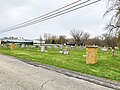
Original Tippecanoe, Indiana Cemetery

Mural Commissioned by Paul Hensley in 2013


References[]
- ^ "US Board on Geographic Names". United States Geological Survey. October 25, 2007. Retrieved January 31, 2008.
- ^ "US Census website". US Census Bureau. Retrieved January 31, 2008.
- ^ Baker, Ronald L. (October 1995). From Needmore to Prosperity: Hoosier Place Names in Folklore and History. Indiana University Press. p. 324. ISBN 978-0-253-32866-3.
This village was laid out on January 8, 1882...
Municipalities and communities of Marshall County, Indiana, United States | ||
|---|---|---|
| City | ||
| Towns | ||
| Townships | ||
| CDP | ||
| Unincorporated communities | ||
| Footnotes | ‡This populated place also has portions in an adjacent county or counties | |
| ||
This Marshall County, Indiana location article is a stub. You can help Wikipedia by . |
- Unincorporated communities in Marshall County, Indiana
- Unincorporated communities in Indiana
- Michiana Region, Indiana geography stubs