Tippecanoe Township, Marshall County, Indiana
Tippecanoe Township | |
|---|---|
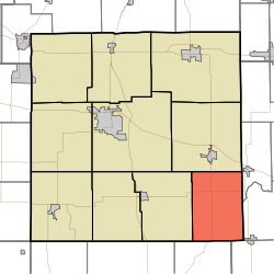 Location in Marshall County | |
| Coordinates: 41°13′07″N 86°06′15″W / 41.21861°N 86.10417°WCoordinates: 41°13′07″N 86°06′15″W / 41.21861°N 86.10417°W | |
| Country | |
| State | |
| County | Marshall |
| Government | |
| • Type | Indiana township |
| • Trustee | Matthew Pitney[1] |
| Area | |
| • Total | 35.8 sq mi (93 km2) |
| • Land | 35.75 sq mi (92.6 km2) |
| • Water | 0.05 sq mi (0.1 km2) 0.14% |
| Elevation | 781 ft (238 m) |
| Population (2010) | |
| • Total | 1,313 |
| • Density | 36.7/sq mi (14.2/km2) |
| ZIP codes | 46504, 46539, 46570 |
| GNIS feature ID | 0453896 |

Tippecanoe Township is one of ten townships in Marshall County, Indiana, United States. As of the 2010 census, its population was 1,313 and it contained 542 housing units.[2]
History[]
Tippecanoe Township was organized in 1842. It was named from its principal stream, the Tippecanoe River.[3]
The Erwin House, Gaskill-Erwin Farm, and Tippecanoe Twp. District No. 3 Schoolhouse and Cemetery are listed on the National Register of Historic Places.[4][5][6]
Geography[]
According to the 2010 census, the township has a total area of 35.8 square miles (93 km2), of which 35.75 square miles (92.6 km2) (or 99.86%) is land and 0.05 square miles (0.13 km2) (or 0.14%) is water.[2]
Unincorporated towns[]
- Old Tip Town at 41°13′25″N 86°06′55″W / 41.223655°N 86.115277°W
- at 41°14′43″N 86°05′05″W / 41.245322°N 86.084721°W
- Tippecanoe at 41°12′32″N 86°06′54″W / 41.208933°N 86.114999°W
(This list is based on USGS data and may include former settlements.)
Cemeteries[]
The township contains two cemeteries: Tippecanoe Cemetery, and Summit Chapel Cemetery.
Major highways[]
School districts[]
- Triton School Corporation
- Argos School District
Political districts[]
- Indiana's 2nd congressional district
- State House District 23
- State Senate District 9
References[]
- "Tippecanoe Township, Marshall County, Indiana". Geographic Names Information System. United States Geological Survey. Retrieved 2009-09-29.
- United States Census Bureau 2008 TIGER/Line Shapefiles
- IndianaMap
- ^ https://indianatownshipassoc.org/indiana-townships/
- ^ a b "Population, Housing Units, Area, and Density: 2010 - County -- County Subdivision and Place -- 2010 Census Summary File 1". United States Census. Archived from the original on 2020-02-12. Retrieved 2013-05-10.
- ^ McDonald, Daniel (1908). A Twentieth Century History of Marshall County, Indiana, Volume 1. Lewis Publishing Company. pp. 86–87.
- ^ "National Register Information System". National Register of Historic Places. National Park Service. July 9, 2010.
- ^ "National Register of Historic Places Listings". Weekly List of Actions Taken on Properties: 3/16/15 through 3/20/15. National Park Service. 2015-03-27.
- ^ "National Register of Historic Places Listings". Weekly List of Actions Taken on Properties: 3/14/16 through 3/18/16. National Park Service. 2016-03-25.
External links[]
- Indiana Township Association
- United Township Association of Indiana
- City-Data.com page for Tippecanoe Township
Places adjacent to Tippecanoe Township, Marshall County, Indiana | |
|---|---|
Municipalities and communities of Marshall County, Indiana, United States | ||
|---|---|---|
| City | ||
| Towns | ||
| Townships | ||
| CDP | ||
| Unincorporated communities | ||
| Footnotes | ‡This populated place also has portions in an adjacent county or counties | |
| ||
- Townships in Marshall County, Indiana
- Townships in Indiana