Bremen, Indiana
Town of Bremen, Indiana | |
|---|---|
 Bremen, Indiana from the air | |
| Nickname(s): B-Town | |
| Motto(s): "A Good Town" | |
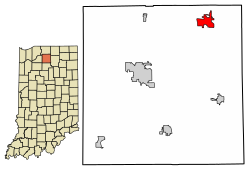 Location of Bremen in Marshall County, Indiana. | |
| Coordinates: 41°26′50″N 86°08′58″W / 41.44722°N 86.14944°WCoordinates: 41°26′50″N 86°08′58″W / 41.44722°N 86.14944°W | |
| Country | United States |
| State | Indiana |
| County | Marshall |
| Township | German |
| Area | |
| • Total | 2.84 sq mi (7.35 km2) |
| • Land | 2.83 sq mi (7.34 km2) |
| • Water | 0.00 sq mi (0.01 km2) |
| Elevation | 853 ft (260 m) |
| Population | |
| • Total | 4,588 |
| • Estimate (2019)[2] | 4,474 |
| • Density | 1,578.69/sq mi (609.58/km2) |
| Demonym(s) | Bremenite |
| Time zone | UTC−5 (EST) |
| • Summer (DST) | UTC−4 (EDT) |
| ZIP code | 46506 |
| Area code | 574 |
| FIPS code[4][5] | 18-07318 |
| GNIS ID[4][5] | 431479 |
| Website | www |

Bremen (/ˈbriːmən/ BREE-mən) is a town in German Township, Marshall County, Indiana, United States. The population was 4,588 at the 2010 census.
History[]
Bremen was platted and laid out in 1851. A large portion of the early settlers being natives of Germany caused the name Bremen to be selected.[6]
The Bremen Water Tower and Dietrich-Bowen House are listed on the National Register of Historic Places.[7][8]
Geography[]
Bremen is located at 41°26′50″N 86°08′58″W / 41.447109°N 86.149342°W.[9] It is at an elevation of 854 feet.
According to the 2010 census, Bremen has a total area of 2.72 square miles (7.04 km2), all land.[10]
Demographics[]
| Historical population | |||
|---|---|---|---|
| Census | Pop. | %± | |
| 1880 | 1,028 | — | |
| 1890 | 1,076 | 4.7% | |
| 1900 | 1,671 | 55.3% | |
| 1910 | 2,008 | 20.2% | |
| 1920 | 2,084 | 3.8% | |
| 1930 | 2,105 | 1.0% | |
| 1940 | 2,179 | 3.5% | |
| 1950 | 2,664 | 22.3% | |
| 1960 | 3,026 | 13.6% | |
| 1970 | 3,487 | 15.2% | |
| 1980 | 3,565 | 2.2% | |
| 1990 | 4,725 | 32.5% | |
| 2000 | 4,486 | −5.1% | |
| 2010 | 4,588 | 2.3% | |
| 2019 (est.) | 4,474 | [2] | −2.5% |
| U.S. Decennial Census[11] | |||
2010 census[]
As of the 2010 census,[1] there were 4,588 people, 1,736 households, and 1,155 families living in the town. The population density was 1,686.8 inhabitants per square mile (651.3/km2). There were 1,922 housing units at an average density of 706.6 per square mile (272.8/km2). The racial makeup of the town was 86.5% White, 0.4% African American, 0.2% Native American, 0.3% Asian, 11.1% from other races, and 1.5% from two or more races. Hispanic or Latino of any race were 18.0% of the population.
There were 1,736 households, of which 36.7% had children under the age of 18 living with them, 50.5% were married couples living together, 10.8% had a female householder with no husband present, 5.2% had a male householder with no wife present, and 33.5% were non-families. 30.1% of all households were made up of individuals, and 15.7% had someone living alone who was 65 years of age or older. The average household size was 2.58 and the average family size was 3.20.
The median age in the town was 36.6 years. 27.6% of residents were under the age of 18; 8.3% were between the ages of 18 and 24; 25% were from 25 to 44; 23.2% were from 45 to 64; and 16% were 65 years of age or older. The gender makeup of the town was 47.8% male and 52.2% female.
2000 census[]
As of the 2000 census,[12] there were 4,486 people, 1,689 households, and 1,177 families living in the town. The population density was 1,967.8 people per square mile (759.7/km2). There were 1,791 housing units at an average density of 785.6 per square mile (303.3/km2). The racial makeup of the town was 91.42% White, 0.16% African American, 0.38% Native American, 0.31% Asian, 0.04% Pacific Islander, 6.53% from other races, and 1.16% from two or more races. Hispanic or Latino of any race were 12.02% of the population.
There were 1,689 households, out of which 34.5% had children under the age of 18 living with them, 56.0% were married couples living together, 9.9% had a female householder with no husband present, and 30.3% were non-families. 26.9% of all households were made up of individuals, and 13.3% had someone living alone who was 65 years of age or older. The average household size was 2.59 and the average family size was 3.14.

In the town, the population was spread out, with 27.3% under the age of 18, 9.2% from 18 to 24, 27.4% from 25 to 44, 20.2% from 45 to 64, and 15.9% who were 65 years of age or older. The median age was 35 years. For every 100 females, there were 92.9 males. For every 100 females age 18 and over, there were 88.9 males.
The median income for a household in the town was $40,185, and the median income for a family was $47,768. Males had a median income of $32,443 versus $21,902 for females. The per capita income for the town was $17,073. About 4.2% of families and 6.5% of the population were below the poverty line, including 7.4% of those under age 18 and 5.3% of those age 65 or over.
Commerce[]
Bremen supports light and heavy industry in the form of fiberglass and custom cabinet manufacturing, RV and van painting, and roller bearing manufacture. Much of its industry supports the large RV manufacturing in the area, especially in nearby Nappanee and Elkhart.

Education[]
The town has a lending library, the Bremen Public Library.[13]
Notable people[]
- Otis Bowen, MD, Indiana 44th Governor (1973-1981) and Secretary of Health and Human Services under President Ronald Reagan (1985-1989).
- Brad Stine, conservative Christian Comedian and Actor

References[]
- ^ Jump up to: a b "U.S. Census website". United States Census Bureau. Retrieved 2012-12-11.
- ^ Jump up to: a b "Population and Housing Unit Estimates". United States Census Bureau. May 24, 2020. Retrieved May 27, 2020.
- ^ "2019 U.S. Gazetteer Files". United States Census Bureau. Retrieved July 16, 2020.
- ^ Jump up to: a b c "Feature ID 431479". Geographic Names Information System. United States Geological Survey. Retrieved June 30, 2014.
- ^ Jump up to: a b "FIPS55 Data: Indiana". FIPS55 Data. United States Geological Survey. February 23, 2006. Archived from the original on June 18, 2006. Retrieved June 30, 2014.
- ^ McDonald, Daniel (1908). A Twentieth Century History of Marshall County, Indiana, Volume 1. Lewis Publishing Company. p. 124.
- ^ "National Register Information System". National Register of Historic Places. National Park Service. July 9, 2010.
- ^ "National Register of Historic Places Listings". Weekly List of Actions Taken on Properties: 1/07/13 through 1/11/13. National Park Service. 2013-01-18.
- ^ "US Gazetteer files: 2010, 2000, and 1990". United States Census Bureau. 2011-02-12. Retrieved 2011-04-23.
- ^ "G001 - Geographic Identifiers - 2010 Census Summary File 1". United States Census Bureau. Archived from the original on 2020-02-13. Retrieved 2015-07-13.
- ^ "Census of Population and Housing". Census.gov. Retrieved June 4, 2015.
- ^ "U.S. Census website". United States Census Bureau. Retrieved 2008-01-31.
- ^ "Indiana public library directory" (PDF). Indiana State Library. Retrieved 10 March 2018.
External links[]
| show Municipalities and communities of Marshall County, Indiana, United States |
|---|
| show Authority control |
|---|
- Towns in Marshall County, Indiana
- Towns in Indiana
- Populated places established in 1851
- 1851 establishments in Indiana