Towanda, Kansas
Towanda, Kansas | |
|---|---|
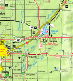
 Location within Butler County and Kansas | |
 | |
| Coordinates: 37°47′45″N 96°59′58″W / 37.79583°N 96.99944°WCoordinates: 37°47′45″N 96°59′58″W / 37.79583°N 96.99944°W | |
| Country | United States |
| State | Kansas |
| County | Butler |
| Founded | 1870 |
| Incorporated | 1905 |
| Named for | "big village" |
| Government | |
| • Type | Council-Mayor |
| • Mayor | Jennifer Shaults[1] |
| Area | |
| • Total | 0.92 sq mi (2.38 km2) |
| • Land | 0.91 sq mi (2.37 km2) |
| • Water | 0.01 sq mi (0.01 km2) |
| Elevation | 1,293 ft (394 m) |
| Population | |
| • Total | 1,450 |
| • Estimate (2019)[4] | 1,454 |
| • Density | 1,590.81/sq mi (613.95/km2) |
| Time zone | UTC-6 (CST) |
| • Summer (DST) | UTC-5 (CDT) |
| ZIP code | 67144 |
| Area code | 316 |
| FIPS code | 20-71125 [5] |
| GNIS ID | 474579 [6] |
| Website | cityoftowanda.com |

Towanda is a city in Butler County, Kansas, United States. As of the 2010 census, the city population was 1,450.[7]
History[]
Towanda was established in 1870[8][9] and incorporated in 1905.[10] Towanda is an Osage-language name meaning "big village".
The town was severely damaged by a cyclone in 1892.[11]
21st century[]
In 2010, the Keystone-Cushing Pipeline (Phase II) was constructed a few blocks west of Towanda (immediately west of SW River Valley Rd), running north to south through Butler County.[12][13] With much controversy over tax exemption and environmental concerns (if a leak ever occurs).[citation needed]
Geography[]
Towanda is located at 37°47′45″N 96°59′58″W / 37.79583°N 96.99944°W (37.795921, -96.999380),[14] along the Whitewater River. According to the United States Census Bureau, the city has a total area of 1.06 square miles (2.75 km2), all of it land.[15]
Demographics[]
| Historical population | |||
|---|---|---|---|
| Census | Pop. | %± | |
| 1880 | 53 | — | |
| 1890 | 156 | 194.3% | |
| 1910 | 275 | — | |
| 1920 | 718 | 161.1% | |
| 1930 | 424 | −40.9% | |
| 1940 | 374 | −11.8% | |
| 1950 | 417 | 11.5% | |
| 1960 | 1,031 | 147.2% | |
| 1970 | 1,190 | 15.4% | |
| 1980 | 1,332 | 11.9% | |
| 1990 | 1,289 | −3.2% | |
| 2000 | 1,338 | 3.8% | |
| 2010 | 1,450 | 8.4% | |
| 2019 (est.) | 1,454 | [4] | 0.3% |
| U.S. Decennial Census | |||
2010 census[]
As of the census[3] of 2010, there were 1,450 people, 524 households, and 397 families living in the city. The population density was 1,367.9 inhabitants per square mile (528.1/km2). There were 577 housing units at an average density of 544.3 per square mile (210.2/km2). The racial makeup of the city was 95.3% White, 0.3% African American, 1.1% Native American, 0.5% Asian, 0.4% Pacific Islander, 0.5% from other races, and 1.9% from two or more races. Hispanic or Latino of any race were 2.7% of the population.
There were 524 households, of which 39.9% had children under the age of 18 living with them, 59.9% were married couples living together, 9.4% had a female householder with no husband present, 6.5% had a male householder with no wife present, and 24.2% were non-families. 20.4% of all households were made up of individuals, and 7.2% had someone living alone who was 65 years of age or older. The average household size was 2.77 and the average family size was 3.15.
The median age in the city was 34.5 years. 30% of residents were under the age of 18; 8.9% were between the ages of 18 and 24; 24.4% were from 25 to 44; 25.1% were from 45 to 64; and 11.7% were 65 years of age or older. The gender makeup of the city was 50.0% male and 50.0% female.
2000 census[]
As of the census[5] of 2000, there were 1,338 people, 492 households, and 383 families living in the city. The population density was 1,804.8 people per square mile (698.1/km2). There were 537 housing units at an average density of 724.3 per square mile (280.2/km2). The racial makeup of the city was 96.79% White, 0.37% African American, 0.37% Native American, 0.22% Asian, 0.22% from other races, and 2.02% from two or more races. Hispanic or Latino of any race were 0.75% of the population.
There were 492 households, out of which 39.2% had children under the age of 18 living with them, 66.1% were married couples living together, 8.3% had a female householder with no husband present, and 22.0% were non-families. 20.7% of all households were made up of individuals, and 8.1% had someone living alone who was 65 years of age or older. The average household size was 2.72 and the average family size was 3.14.
In the city, the population was spread out, with 29.3% under the age of 18, 9.2% from 18 to 24, 29.0% from 25 to 44, 20.5% from 45 to 64, and 12.0% who were 65 years of age or older. The median age was 34 years. For every 100 females, there were 96.2 males. For every 100 females age 18 and over, there were 92.7 males.
The median income for a household in the city was $41,875, and the median income for a family was $47,188. Males had a median income of $32,250 versus $24,167 for females. The per capita income for the city was $17,815. About 5.1% of families and 6.5% of the population were below the poverty line, including 9.0% of those under age 18 and 5.0% of those ages 65 or over.
Education[]
The community is served by Circle USD 375 public school district.
Circle High School, located in Towanda, has one of the top graphic arts departments in the state. They are the top computer art school recognized at the Scholastics Art and Writing Awards, since 2005.[citation needed] The Circle High School mascot is the Thunderbirds.
Notable people[]
- Garner E. Shriver, U.S. Representative from Kansas
- Jordan Phillips, defensive lineman for the Arizona Cardinals
See also[]
References[]
- ^ "Directory of Kansas Public Officials - Towanda". League of Kansas Municipalities. Archived from the original on 27 May 2015. Retrieved 27 May 2015.
- ^ "2019 U.S. Gazetteer Files". United States Census Bureau. Retrieved July 24, 2020.
- ^ Jump up to: a b "U.S. Census website". United States Census Bureau. Retrieved 2012-07-06.
- ^ Jump up to: a b "Population and Housing Unit Estimates". United States Census Bureau. May 24, 2020. Retrieved May 27, 2020.
- ^ Jump up to: a b "U.S. Census website". United States Census Bureau. Retrieved 2008-01-31.
- ^ "US Board on Geographic Names". United States Geological Survey. 2007-10-25. Retrieved 2008-01-31.
- ^ "2010 City Population and Housing Occupancy Status". U.S. Census Bureau. Retrieved March 6, 2011.[dead link]
- ^ Kansas State Historical Society (1916). Biennial Report of the Board of Directors of the Kansas State Historical Society. Kansas State Printing Plant. pp. 152.
- ^ "History of Towanda Township". Towanda Area Historical Museum. Retrieved 7 Nov 2019.
- ^ "City of Towanda, Kansas". City of Towanda Official Website. Retrieved 7 Nov 2019.
- ^ Mooney, Vol. P. (1916). History of Butler County Kansas. Standard Publishing Company. pp. 224.
- ^ Keystone Pipeline - Marion County Commission calls out Legislative Leadership on Pipeline Deal; April 18, 2010. Archived October 22, 2011, at the Wayback Machine
- ^ Keystone Pipeline - TransCanada inspecting pipeline; December 10, 2010.
- ^ "US Gazetteer files: 2010, 2000, and 1990". United States Census Bureau. 2011-02-12. Retrieved 2011-04-23.
- ^ "US Gazetteer files 2010". United States Census Bureau. Archived from the original on 2012-07-02. Retrieved 2012-07-06.
Further reading[]
External links[]
| Wikimedia Commons has media related to Towanda, Kansas. |
| hide Municipalities and communities of Butler County, Kansas, United States | ||
|---|---|---|
| Cities |  | |
| Unincorporated communities | ||
| Ghost towns | ||
| Townships | ||
| Footnotes | †This populated place is designated a Census-Designated Place (CDP) by the United States Census Bureau. ‡This populated place also has portions in an adjacent county or counties. | |
| ||
| show Authority control |
|---|
- Cities in Kansas
- Cities in Butler County, Kansas
- Wichita, KS Metropolitan Statistical Area
- 1870 establishments in Kansas
- Populated places established in 1870