U.S. Route 89 in Arizona
 | ||||
|---|---|---|---|---|
 US 89 highlighted in red; US 89T in blue | ||||
| Route information | ||||
| Maintained by ADOT, City of Flagstaff | ||||
| Length | 136.49 mi[1] (219.66 km) | |||
| Major junctions | ||||
| South end | ||||
| North end | ||||
| Location | ||||
| Counties | Coconino | |||
| Highway system | ||||
| ||||

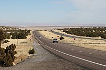
U.S. Route 89 (US 89) in the U.S. state of Arizona is a U.S. Highway that begins in Flagstaff and heads north to the Utah border northwest of Page.
Route description[]
This section does not cite any sources. (March 2015) |
U.S. 89 begins at Flagstaff, Arizona. The highway proceeds north passing near Grand Canyon National Park and through the Navajo Nation. Near the Utah state line the highway splits into U.S. 89 and U.S. Route 89A. The Alternate is the original highway; what is now the main highway was constructed in the 1960s to serve the Glen Canyon Dam. The two highways rejoin in Kanab, Utah.
The main branch passes over the Colorado River just south of the Glen Canyon Dam and Lake Powell near Page then enters Utah. The Alternate branch crosses the Colorado River at Navajo Bridge and proceeds to the North Rim of the Grand Canyon before entering Utah.
History[]
Prior to 1992,[2] the southern terminus of US 89 was at Nogales, Arizona. US 89 ran concurrently with Interstate 19 (I-19) until Green Valley. The route was taken (in a northerly direction) through Tucson via 6th Avenue, Congress Street and Granada Avenue. The route was carried out of Tucson via State Route 77 (SR 77). Further north it was carried via the Pinal Pioneer Parkway northwest out of Oracle Junction on SR 79. In Maricopa County, it ran concurrently with existing US 60 along Main Street in Mesa, Apache Boulevard and Mill Avenue in Tempe, then along Van Buren Street in Phoenix to Grand Avenue,[3] then to Wickenburg. Departing Wickenburg, it followed US 93 and SR 89 to Prescott. Departing Prescott, the route followed present-day SR 89 to Ash Fork, then ran east concurrently with I-40 to Flagstaff.
In Flagstaff, US 89 ran along old Route 66, Milton Road and Santa Fe Avenue. The highway crossed the Little Colorado River at Cameron on the Cameron Suspension Bridge until 1959, when the bridge was retired and replaced by a parallel span.[4]
On February 20, 2013,[5] the main alignment of US 89 was closed in both directions approximately 25 miles (40 km) south of Page due to a landslide that caused the roadway to buckle and subside. Traffic was re-routed via 45 miles (72 km) of secondary and tertiary roads on the Navajo Reservation. Alternate routes through Las Vegas, Nevada, or Hurricane, Utah, and Marble Canyon (US 89A) were also suggested.[6] US 89T (see below) opened in August 2013 as a bypass of the closed section, utilizing Navajo Route 20 as an alignment.
U.S. 89 reopened in March 2015 after a $25 million repair project.[5]
Major intersections[]
The entire route is in Coconino County.
| Location | mi[1] | km | Destinations | Notes | |
|---|---|---|---|---|---|
| Flagstaff | 418.37 | 673.30 | National southern terminus; former interchange, now at-grade T-intersection; highway continues west as I-40 BL/US 180 (former US 89 south) | ||
| Cameron | 465.21 | 748.68 | Roundabout; eastern terminus of SR 64 | ||
| | 480.80 | 773.77 | Western terminus of US 160 | ||
| Bitter Springs | 524.01 | 843.31 | Southern terminus of US 89A; former US 89 north | ||
| Page | 546.20 | 879.02 | Western terminus of SR 98 | ||
| Glen Canyon NRA | 556.84 | 896.15 | Continuation into Utah | ||
| 1.000 mi = 1.609 km; 1.000 km = 0.621 mi | |||||
U.S. Route 89T[]
U.S. Route 89T | |
|---|---|
| Location | –Page |
| Length | 46.17 mi[7] (74.30 km) |
| Existed | 2013–2015 |
Navajo Route 20 | |
|---|---|
| Location | –Page |
| Length | 43.57 mi[7] (70.12 km) |
U.S. Route 89T (US 89T or US 89X) was the designation for Navajo Route 20 (N20), a road running mostly parallel to US 89 in Arizona. Added to the Arizona state highway system in 2013, US 89T served as a temporary detour for a closed section of US 89. The route was 46.17 miles (74.30 kilometres) long.[7]
The need for US 89T arose in February 2013, when a geological event caused a 150-foot (46 m)[8] stretch of US 89 to buckle 25 miles (40 km) south of Page. The loss of this stretch of road forced detours for traffic entering the Page area from the south. The Navajo Nation declared a state of emergency.[9] Motorists were rerouted on a 115-mile (185 km) detour via US 160 and SR 98 or a 90-mile (145 km) detour on N20, which had a 28-mile (45 km) unpaved stretch. As a result, commute times into Page increased, and merchants in Page and the surrounding area lost significant business.
The Arizona Department of Transportation (ADOT) added the road to the state highway system as US 89T and quickly moved to get money ($35 million from the Federal Highway Administration's emergency relief project fund) and equipment to pave the road. As the Navajo had wanted to pave N20 for decades, and some design and environmental clearances had already been obtained, it took just 79 days to pave N20 in a project that might have otherwise taken more than a year.[10][11] In addition to pavement, right-of-way and fencing to separate the road from the local livestock population were required.[12] The improved road opened to traffic on August 29, 2013. Plans called for the road to be used for three years before the road reverted to Bureau of Indian Affairs jurisdiction.[13]
Initially, the route lacked proper fencing, cattle guards, and pavement markings to support safe travel at higher speeds. As a result, US 89T was open to local traffic only at night, and posted speed limits as low as 25 miles per hour (40 km/h).[10] As of October 15, US 89T restrictions were lifted following the installation of upgraded control features.[14]
With the reopening of mainline US 89 in March 2015, the US 89T designation was retired and ownership of the route returned to the Navajo Nation in April 2015. The route from The Gap to SR 98 is currently designated only as N20.[15]
- Major intersections
The entire route was in Coconino County.
| Location | mi[7] | km | Destinations | Notes | |
|---|---|---|---|---|---|
| 0.000 | 0.000 | Southern terminus of US 89T; current southern terminus of N20; southern end of N20 concurrency | |||
| | 7.872 | 12.669 | Southern terminus of N21 | ||
| Page | 43.570 | 70.119 | Northern terminus of N20; northern end of N20 concurrency; southern end of SR 98 concurrency | ||
| 46.174 | 74.310 | Northern terminus of US 89T; northern end of SR 98 concurrency | |||
1.000 mi = 1.609 km; 1.000 km = 0.621 mi
| |||||
See also[]
References[]
- ^ a b Arizona Department of Transportation. "2008 ADOT Highway Log" (PDF). Retrieved April 9, 2008.
- ^ "Report of the Special Committee on U.S. Route Numbering to the Executive Committee" (PDF). American Association of State Highway and Transportation Officials. June 15, 1992.
- ^ "Web site of the US Route 89 Appreciation Society". Retrieved October 9, 2014.
- ^ Fraser, Clayton B. (October 31, 2004). "Cameron Suspension Bridge" (PDF). Historic Bridge Inventory. Arizona Department of Transportation. pp. 308–311. Archived from the original (PDF) on September 21, 2013. Retrieved July 19, 2012.
- ^ a b "U.S. 89 to open March". Navajo-Hopi Observer. March 17, 2015. Retrieved March 18, 2015.
- ^ Stocks, Deborah (February 20, 2013). "US 89 south of Page buckles, collapses". Phoenix, AZ: KNXV-TV. Retrieved February 25, 2013.
- ^ a b c d Arizona Department of Transportation. "2013 ADOT Highway Log" (PDF). Retrieved September 21, 2019.
- ^ Hwang, Kristen (February 25, 2013). "U.S. Highway 89A near Page remains open despite road collapse". The Arizona Republic. Retrieved August 28, 2013.
- ^ Kane, Jenny (February 25, 2013). "Navajo Nation to declare emergency after road collapse". The Daily News. Farmington, NM. Retrieved August 28, 2013.
- ^ a b Dungan, Ron (August 30, 2013). "Road less traveled eases trek near Page". Arizona Republic. Retrieved August 30, 2013.
- ^ . April 17, 2015 https://www.youtube.com/watch?v=UKY3scPIMd8. Retrieved May 21, 2015. Missing or empty
|title=(help) - ^ De Welles, Angela (August 16, 2013). "Work on N20 isn't finished yet". ADOTBlog. Arizona Department of Transportation. Retrieved August 28, 2013.
- ^ "NDOT: Navajo Route 20 to open Aug. 29". Lake Powell Chronicle. August 27, 2013. Retrieved August 28, 2013.
- ^ "Newly completed US 89 bypass fully open with no restrictions". Arizona Department of Transportation. October 15, 2013. Retrieved April 27, 2014.
- ^ "US Highway 89 south of Page reopens after 2013 landslide". News Article. St. George News. March 29, 2015. Retrieved March 30, 2015.
Further reading[]
- Pry, Mark E.; Andersen, Fred (2011). "From Border to Border: U.S. Route 89" (PDF). Arizona Transportation History. Phoenix: Arizona Department of Transportation Research Center. pp. 95–97. Final Report 660.
External links[]
| ( • help)
|
- US 89 Landslide at ADOT
- U.S. Highways in Arizona
- U.S. Route 89
- Transportation in Coconino County, Arizona
