Veľký Biel
Veľký Biel | |
|---|---|
Village | |
 | |
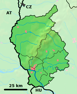
 Veľký Biel Location of Veľký Biel in the Bratislava Region | |
| Coordinates: 48°12′50″N 17°21′35″E / 48.21389°N 17.35972°ECoordinates: 48°12′50″N 17°21′35″E / 48.21389°N 17.35972°E | |
| Country | Slovakia |
| Region | Bratislava |
| District | Senec |
| First mentioned | 1209 |
| Government | |
| • Mayor | Anton Danter |
| Area | |
| • Total | 10.16 km2 (3.92 sq mi) |
| Elevation | 131 m (430 ft) |
| Population (2017-12-31) | |
| • Total | 2,567 |
| • Density | 250/km2 (650/sq mi) |
| Time zone | UTC+1 (CET) |
| • Summer (DST) | UTC+2 (CEST) |
| Postal code | 900 24 |
| Area code(s) | +421-2 |
| Car plate | SC |
| Website | www.velkybiel.eu |

Veľký Biel(Slovak: Veľký Biel, Hungarian: Magyarbél) is a village and municipality in western Slovakia in Senec District in the Bratislava Region.
Etymology[]
The name comes from Slavic beľ (bělь): whiteness, "glistening place" - mud, swam (compare i.e. with Old Polish biel or Russian biľ /dialect/).[1] 1294 Beel, 1335 Magyarbel (hu: "Hungarian Bel"), now Veľký Biel. 1323 Minor Beel, 1335 Nemethbel (hu: "German Bel"), now Malý Biel - a part of Veľký Bieľ.[1]
History[]
In historical records the village was first mentioned in 1209.
Geography[]
The municipality lies at an altitude of 131 metres and covers an area of 10.161 km². It has a population of 2303 people.[citation needed]
References[]
- ^ Jump up to: a b Krajčovič, Rudolf (2007). "Z lexiky stredovekej slovenčiny s výkladmi názvov obcí a miest (2ľ)" (PDF). Kultúra slova (in Slovak). Martin: Vydavateľstvo Matice slovenskej (2): 88.
External links/Sources[]
![]() Media related to Veľký Biel at Wikimedia Commons
Media related to Veľký Biel at Wikimedia Commons
- Official page
- https://web.archive.org/web/20070513023228/http://www.statistics.sk/mosmis/eng/run.html
Categories:
- Villages and municipalities in Senec District
- Bratislava Region geography stubs

