Vitry-en-Perthois
Vitry-en-Perthois | |
|---|---|
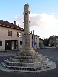 The calvary in Vitry-en-Perthois | |
 Coat of arms | |
show Location of Vitry-en-Perthois | |
 Vitry-en-Perthois | |
| Coordinates: 48°44′54″N 4°37′32″E / 48.7482°N 4.6256°ECoordinates: 48°44′54″N 4°37′32″E / 48.7482°N 4.6256°E | |
| Country | France |
| Region | Grand Est |
| Department | Marne |
| Arrondissement | Vitry-le-François |
| Canton | Sermaize-les-Bains |
| Intercommunality | |
| Government | |
| • Mayor (2020–2026) | Hugues Gérardin[1] |
| Area 1 | 17.49 km2 (6.75 sq mi) |
| Population (Jan. 2018)[2] | 828 |
| • Density | 47/km2 (120/sq mi) |
| Time zone | UTC+01:00 (CET) |
| • Summer (DST) | UTC+02:00 (CEST) |
| INSEE/Postal code | 51647 /51300 |
| 1 French Land Register data, which excludes lakes, ponds, glaciers > 1 km2 (0.386 sq mi or 247 acres) and river estuaries. | |


Vitry-en-Perthois is a commune in the Marne department in north-eastern France.
History[]
Vitry-en-Perthois was called Vitry-le-Brûlé (Vitry the burnt) after being burnt two times; in 1142 by the armies of Louis VII of France and in 1544 by the armies of Charles V.
Geography[]
The Chée flows into the Saulx in the northern part of the commune.
The Saulx forms part of the commune's eastern border, then flows westward through the commune and crosses the village.
See also[]
References[]
- ^ "Répertoire national des élus: les maires". data.gouv.fr, Plateforme ouverte des données publiques françaises (in French). 2 December 2020.
- ^ "Populations légales 2018". INSEE. 28 December 2020.
| Wikimedia Commons has media related to Vitry-en-Perthois. |
| show Authority control |
|---|
This Marne geographical article is a stub. You can help Wikipedia by . |
Categories:
- Communes of Marne (department)
- Marne (department) geography stubs