Waldheim, Saskatchewan
Waldheim | |
|---|---|
 Central Avenue and Main Street | |
Nickname(s):
| |
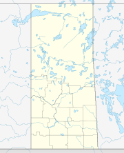 Town of Waldheim in Saskatchewan | |
| Coordinates: 52°39′N 106°37′W / 52.650°N 106.617°WCoordinates: 52°39′N 106°37′W / 52.650°N 106.617°W | |
| Country | Canada |
| Provinces and territories of Canada | Saskatchewan |
| Rural Municipalities (R.M.) | Laird No. 404 |
| Hamlet and Post office Founded in the NWT | 1900-06-01 |
| Village | 1908 |
| Town | 1967 |
| Government | |
| • Mayor | John Bollinger |
| • Federal Electoral District | Carlton Trail-Eagle Creek |
| • M.P. | Kelly Block |
| • Provincial Constituency | Biggar-Sask Valley |
| • M.L.A. | Randy Weekes |
| Area | |
| • Total | 1.97 km2 (0.76 sq mi) |
| Population (2011) | |
| • Total | 1,035 |
| • Density | 525.5/km2 (1,361/sq mi) |
| Time zone | UTC−6 (CST) |
| Website | waldheim |
| [1][2][3][4] | |

Waldheim is a town of 1,035 residents in the rural municipality of Laird No. 404, in the Canadian province of Saskatchewan, located 57 km north of Saskatoon. Waldheim is located on Highway 312 in central Saskatchewan, the "Heart of the Old North-West". Fort Carlton, Batoche, Battle of Fish Creek, and Seager Wheeler's Maple Grove Farm are all near Waldheim.
History[]
Mennonites from Manitoba and South Dakota arrived here to settle and farm in 1893. The Canadian Northern Railway arrived in 1908.[5]
Particularly in the 1870s, Mennonites of Dutch-German origins residing in colonies in the Black Sea region of present-day Ukraine became alarmed at the rising nationalism in the Russian Empire. Along with land shortages in these growing colonies, pressure toward Russification of minorities was threatening Mennonite values in education. Similarly, the promise made by Catherine the Great to exempt them from military service was quite clearly being challenged and rewritten by the then current Russian government. Canada was seeking farming immigrants, and about 7,000 Mennonites chose to immigrate to Manitoba where the government of Canada set aside two reserves for their resettlement. In the early 1890s, some of these families decided to move on to District of Saskatchewan, thereby establishing a trend that would see considerable Mennonite immigration to the Saskatchewan Valley area before the turn of the century. Many came from Manitoba, but others arrived directly from colonies in Russia, from the Danzig region of Prussia and from Kansas, Nebraska, and Minnesota where they had settled in the 1870s.
Thriving Mennonite farming communities were quickly established in the Saskatchewan Valley area in the vicinities of Aberdeen, Laird, Waldheim, Langham, Dalmeny, and Rosthern particularly. Churches were established, land was broken and cropped and roads were built.
Demographics[]
| hideCanada census – Waldheim, Saskatchewan community profile | |||
|---|---|---|---|
| 2011 | 2006 | ||
| Population: | 1,035 (19.2% from 2006) | 868 (-2.4% from 2001) | |
| Land area: | 1.97 km2 (0.76 sq mi) | 1.97 km2 (0.76 sq mi) | |
| Population density: | 525.5/km2 (1,361/sq mi) | 440.7/km2 (1,141/sq mi) | |
| Median age: | 38.8 (M: 38.8, F: 38.8) | ||
| Total private dwellings: | 369 | 342 | |
| Median household income: | $46,900 | ||
| References: 2011[6] 2006[7] earlier[8] | |||
- Latitude 52°39′ N
- Longitude 106°37′ W
- Dominion Land Survey Section16, Township 42, Range 5 West of the 3rd Meridian
- Time zone (CST) UTC−6
Sports[]
Fort Carlton Hockey League serves a large area in the vicinity of Waldheim, such as Rosthern, Warman, Dalmeny, Shellbrook, Bruno, Martensville, Aberdeen, Blaine Lake, and Cudworth.[9] Sask Valley Minor Hockey League offers level of hockey for Novice, Atoms, Pee Wee, Bantams and Midget.[10]
Recreation[]
Waldheim features a green space in its downtown area: Sam Wendland Heritage Park. This park was created in 2000, and was dedicated to Sam Wendland for his many years of serving as mayor. The Waldheim Pineridge Golf and Country Club is a neighbour to the recreational facility (containing an arena and a curling rink). Westview Jubilee Seniors Centre offers events and services to Waldheim's senior population.

in the former Waldheim railway station
Attractions[]
- Valley Regional Park offers a 9-hole grass green golf course as well as camping facilities.
- Valley - Waldheim regional park[11]
- Valley - Rosthern regional park[12]
- Martins Lake regional park[13]
Provincial parks in the area of Waldheim are:
Camps and retreats near Waldheim are:
- Shekinah Retreat Centre
- Redberry Bible Camp
- Camp Kadesh
See also[]
References[]
- ^ National Archives, Archivia Net. "Post Offices and Postmasters". Retrieved 2007-05-26.
- ^ Government of Saskatchewan, MRD Home. "Municipal Directory System". Retrieved 2007-05-26.
- ^ Canadian Textiles Institute. (2005). "CTI Determine your provincial constituency". Retrieved 2007-05-26.
- ^ Commissioner of Canada Elections, Chief Electoral Officer of Canada (2005). "Elections Canada On-line". Retrieved 2007-04-24.
- ^ Sally Chernoby, Town of Waldheim. "Town of Waldheim - history". Retrieved 2007-05-27.
- ^ "2011 Community Profiles". 2011 Canadian Census. Statistics Canada. July 5, 2013. Retrieved 2012-05-14.
- ^ "2006 Community Profiles". 2006 Canadian Census. Statistics Canada. March 30, 2011. Retrieved 2011-03-06.
- ^ "2001 Community Profiles". 2001 Canadian Census. Statistics Canada. February 17, 2012.
- ^ "Fort Carlton Hockey League". Retrieved 2007-05-27.
- ^ "Sask Valley Minor Hockey League". Retrieved 2007-05-27.
- ^ "Valley - Waldheim regional park". Archived from the original on 2007-01-28. Retrieved 2007-05-27.
- ^ "Valley - Rosthern regional park". Archived from the original on 2007-01-28. Retrieved 2007-05-27.
- ^ "Martins Lake regional park". Archived from the original on 2007-01-29. Retrieved 2007-05-27.
External links[]
 Media related to Waldheim, Saskatchewan at Wikimedia Commons
 Canada portal
- Official website
| show Places adjacent to Waldheim, Saskatchewan |
|---|
| show |
|---|
| show Authority control |
|---|
- Towns in Saskatchewan
- Laird No. 404, Saskatchewan
- Russian Mennonite diaspora in Canada